Ukrainian Air Force reports jet-powered Geran-3 drone near Rudnytsia, Vinnytsia Oblast, heading northwest
What happened
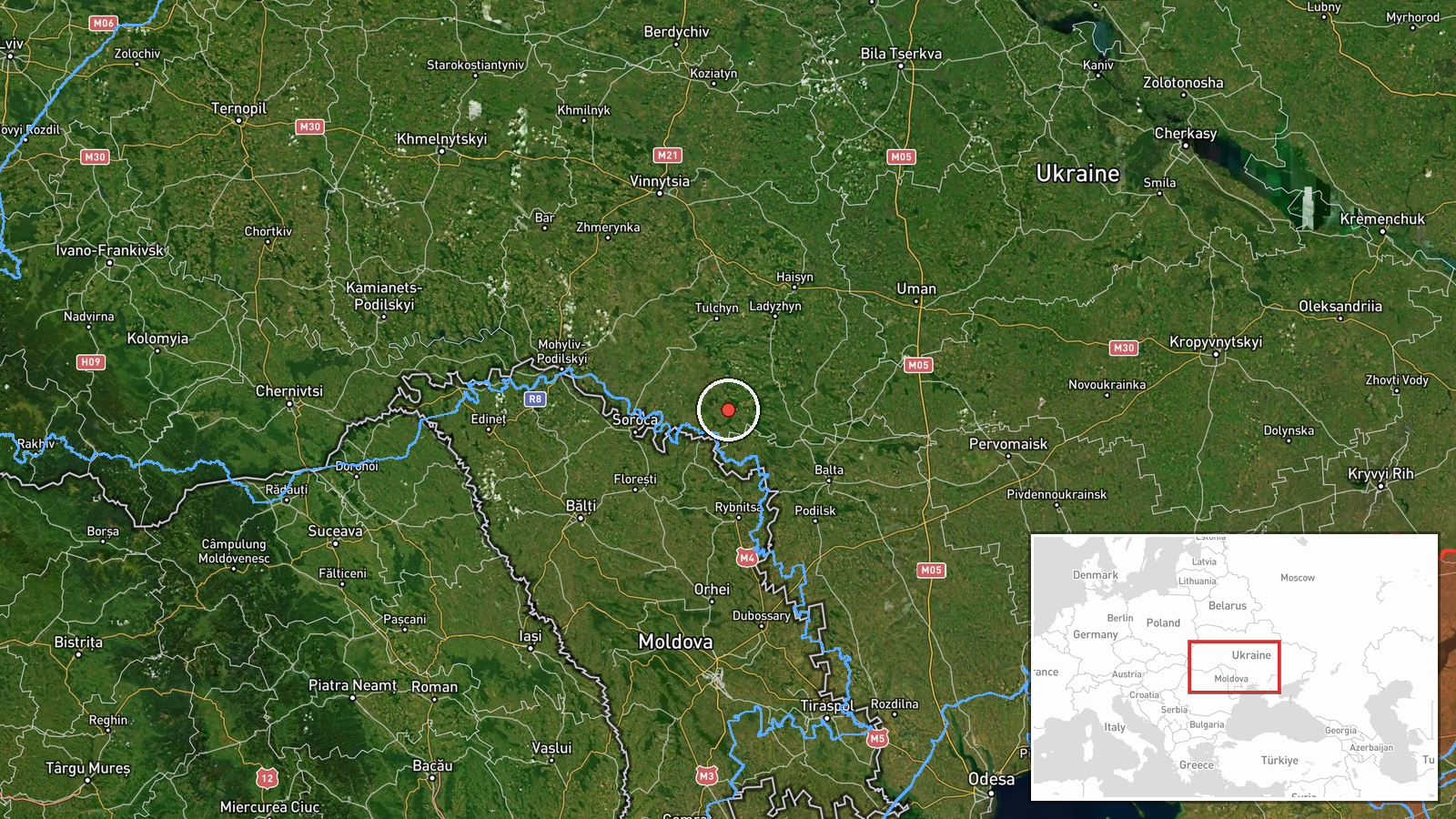
On 21 October 2026 at about 07:20 UTC, the official Ukrainian Air Force Telegram channel (@kpszsu) reported a single jet-powered Shahed-type drone, identified as a Geran-3, operating in the Rudnytsia area of Vinnytsia Oblast. The original Ukrainian wording describes a jet-type unmanned aerial vehicle in the Rudnytsia area on a northwestern course. The report gives no impact, casualty, or damage information, and it does not state the drone's origin or final destination. It is recorded as a drone transit, meaning the object was tracked moving through airspace rather than reported striking a target. The channel is the primary public feed for Ukrainian air alerts, and its updates are typically brief and tied to tracked movement.
Context and assessment
Rudnytsia sits in the eastern part of Vinnytsia Oblast, a region that Russian long-range drones have repeatedly crossed on routes toward western and central Ukraine. The related events show a clear pattern over the previous day. Between 08:43 and 14:50 UTC on 20 October, the same channel logged a series of single Geran-3 transits: one from Kirovohrad Oblast toward Hayvoron, two from Vinnytsia Oblast toward Kryzhopil, and one toward Rudnytsya. A further transit from Vinnytsia Oblast toward Berezivka was logged at 05:08 UTC on 21 October. Taken together, these reports suggest a sustained stream of individual jet-powered drones moving through the same south-central corridor over roughly 24 hours, rather than a single isolated sighting. Operationally, such a pattern may indicate waves of long-range launches transiting toward distant targets, reconnaissance or route-testing, or deliberate pressure on air-defence coverage in less densely defended areas. The public data cannot confirm which of these explanations applies.
Sources and confidence
The report comes from a single Telegram channel, the official Ukrainian Air Force account, and no independent second source appears in the provided data. The confidence score of 8.0 is high for a single-channel report because the channel is the official military air-monitoring authority and the location is specified at settlement level. It is not higher because nothing in the data independently verifies the drone's track, and the channel's wording is brief. Confidence would rise with corroboration from regional military administrations, local officials, or open-source tracking data. It would fall if the channel corrected the track or if the reported location were revised.
Location
The location is recorded at settlement level for Rudnytsia, with high location confidence, and the coordinates are approximate to the populated place rather than a specific facility. The area is rural and agricultural, with open farmland, small settlements, and river valleys typical of south-central and eastern Vinnytsia Oblast. The settlement lies near administrative boundaries with neighbouring oblasts, which is consistent with the nearby transit reports from Kirovohrad and Odesa areas.
Related events nearby
- Ukrainian air monitoring: 1 Russian jet-powered Shahed (Geran-3) drone heading toward Rudnytsya.2026-10-20 14:50 UTC · Drone Transit · Rudnytsya, Ukraine
- Ukrainian air monitoring: 1 Russian jet-powered Shahed (Geran-3) drone heading toward Kryzhopil.2026-10-20 11:12 UTC · Drone Transit · Kryzhopil, Ukraine
- Ukrainian air monitoring: 1 Russian jet-powered Shahed (Geran-3) drone from Vinnytsia Oblast toward Kryzhopil.2026-10-20 08:58 UTC · Drone Transit · Kryzhopil, Ukraine
- Ukrainian air monitoring: 1 Russian jet-powered Shahed (Geran-3) drone from Kirovohrad Oblast toward Hayvoron.2026-10-20 08:43 UTC · Drone Transit · Hayvoron, Ukraine
- Ukrainian air monitoring: 1 Russian jet-powered Shahed (Geran-3) drone from Vinnytsia Oblast toward Berezivka.2026-10-21 05:08 UTC · Drone Transit · Berezivka, Ukraine
▶ View this event on the live map

Intel Mapper aggregates open-source reports from monitored Telegram and X channels, geolocates them, cross-checks duplicates across sources and assigns a confidence score. Entries are updated as new confirmations arrive. Read how we verify events.