Single jet-powered Shahed (Geran-3) drone reported heading toward Chernihiv from the north
What happened
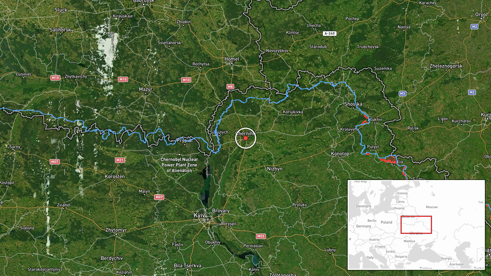
Ukrainian air monitoring reported one Russian jet-powered Shahed drone, identified in the source as a Geran-3, heading toward Chernihiv from the north. The alert was posted on Telegram at 18:03 UTC on 21 October 2026 through the channel @kpszsu. The original Ukrainian-language message, which is short and typical of air-alert updates, describes a jet-type UAV moving toward Chernihiv from the north. The post does not state whether the drone was shot down, lost, or reached its target, and it gives no damage or casualty information. The event is logged as a drone transit, meaning an observed airborne track rather than a confirmed strike.
Context and assessment
Chernihiv sits in northern Ukraine, close to the Belarusian border and roughly 140 km north-east of Kyiv. It has repeatedly appeared in air-alert reporting as a corridor and destination for Russian long-range strike systems. The related events from the same day show a sustained pattern. Shortly after 04:00 UTC, two or more Geran-3 drones were tracked passing Mykhailo-Kotsiubynske heading south. At 05:10 a Banderol mini cruise missile was reported heading toward Chernihiv, and at 05:22 two or more Geran-3 drones were reported heading toward Nosivka. Later tracks included a single drone over Mena in Chernihiv Oblast heading south at 07:21, a drone south of Chernihiv heading west at 10:04, and the present report at 18:03. Operationally, the mix of headings and the repeated passes suggest that individual drones were being routed through northern Chernihiv airspace at different times, some possibly aimed at local targets and others transiting toward other areas. Because the source gives no target or outcome information, these readings remain interpretive and should not be taken as confirmation of intent.
Sources and confidence
The report rests on a single Telegram channel, @kpszsu, which is widely recognized as an official Ukrainian Air Force monitoring feed. The source count is one and no independent outlet has cross-confirmed the track. The confidence score of 8.0 reflects the channel's established role in air-alert reporting and the internal consistency of the same-day related tracks, but it is held below the top range because the event is unverified by a second source, imagery, or local authority statements. Confidence would rise with corroboration from other monitoring outlets, regional administration statements, or reports of interception or impact near Chernihiv. It would fall if later updates revise the track, reclassify the drone, or if no follow-up reports emerge.
Location
The location is recorded at settlement level, placed on the city of Chernihiv at approximately 51.49 N, 31.29 E, with high location confidence. Chernihiv lies on the Desna River in northern Ukraine, near the Belarusian frontier. The surrounding area is largely flat, with river floodplains, forest belts, and farmland. Nearby settlements named in related events, including Mena, Nosivka, and Mykhailo-Kotsiubynske, are within Chernihiv Oblast and help frame the broader corridor of the day's tracks.
Related events nearby
- Ukrainian air monitoring: 1 Russian Banderol mini cruise missile heading toward Chernihiv.2026-10-21 05:10 UTC · Cruise Missile · Chernihiv, Ukraine
- Ukrainian air monitoring: 2+ Russian jet-powered Shahed (Geran-3) drones passing Mykhailo-Kotsiubynske, headin2026-10-21 04:18 UTC · Drone Transit · Mykhailo-Kotsiubynske, Ukraine
- Ukrainian air monitoring: 1 Russian jet-powered Shahed (Geran-3) drone passing south of Chernihiv, heading wes2026-10-21 10:04 UTC · Drone Transit · south of Chernihiv, Ukraine
- Ukrainian air monitoring: one Russian jet-powered Shahed (Geran-3) drone tracked over Mena, Chernihiv Oblast, 2026-10-21 07:21 UTC · Drone Transit · Mena, Chernihiv Oblast, Ukraine
- Ukrainian air monitoring: 2+ Russian jet-powered Shahed (Geran-3) drones heading toward Nosivka.2026-10-21 05:22 UTC · Drone Transit · Nosivka, Ukraine
▶ View this event on the live map

Intel Mapper aggregates open-source reports from monitored Telegram and X channels, geolocates them, cross-checks duplicates across sources and assigns a confidence score. Entries are updated as new confirmations arrive. Read how we verify events.