Single Russian jet-powered Shahed drone reported heading toward Kostopil, Rivne Oblast, Ukraine
What happened
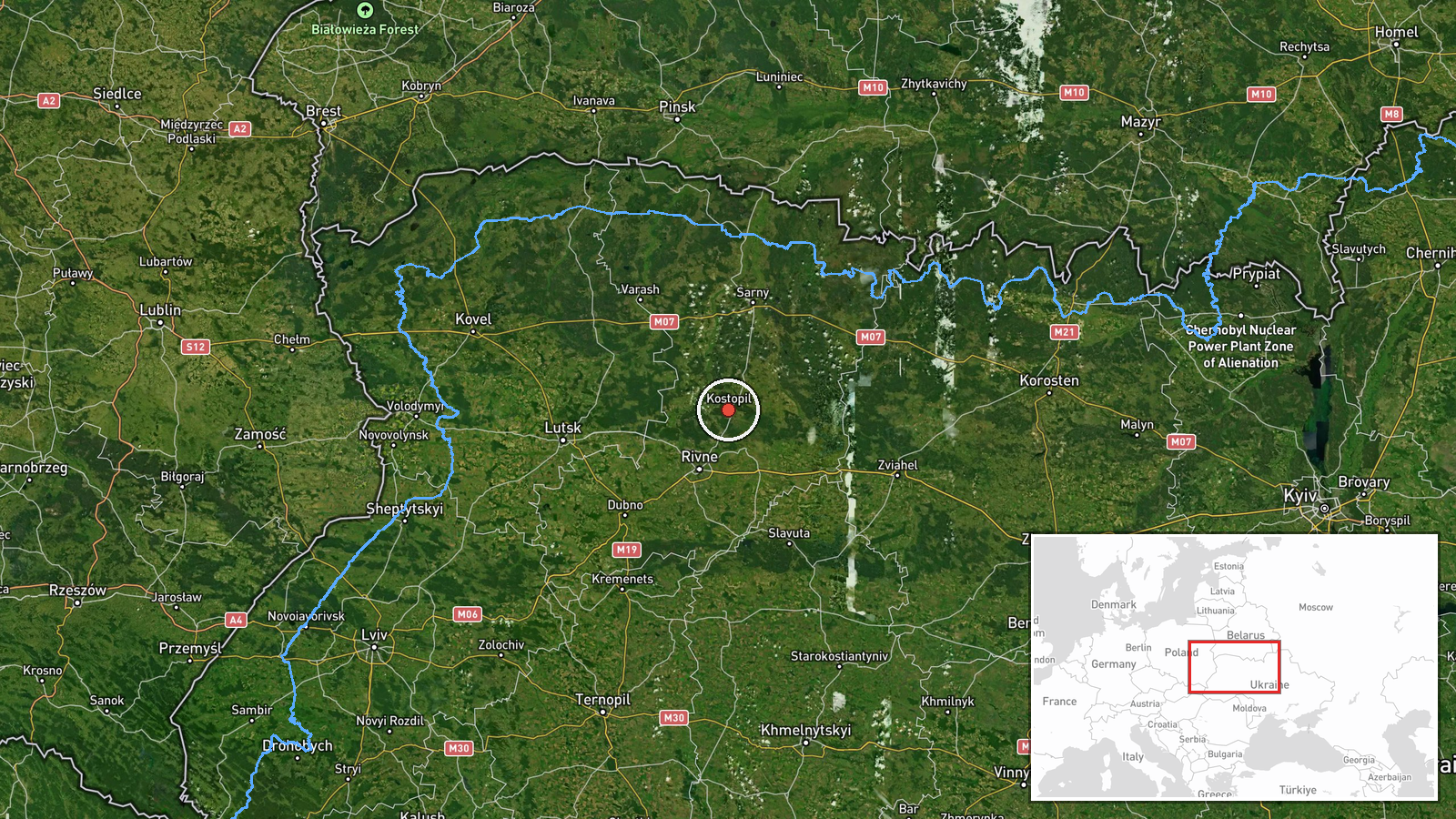
Ukrainian air monitoring channel @kpszsu reported on Telegram on 22 October 2026 at about 07:40 UTC that one Russian jet-powered Shahed (Geran-3) drone was heading toward Kostopil, in Rivne Oblast in northwestern Ukraine. The original post, written in Ukrainian, described a jet-type UAV on a course toward Kostopil and Rivne, using the phrase 'реактивний БпЛА' (jet UAV). The report describes a transit track rather than a strike, and it does not state any impact, damage, or casualties. Because the post comes from a single channel and has not been independently corroborated in this record, the details should be treated as provisional.
Context and assessment
Rivne Oblast has appeared repeatedly in air alerts over the past day. In the hours before this report, the same monitoring feed logged a sequence of Geran-3 transits: one drone toward Rivne at 15:57 UTC and again at 16:02 UTC on 21 October, one toward Rivne Oblast at 16:36, a group of two or more drones moving from northern Zhytomyr Oblast toward Rivne Oblast at 17:11, and a group of two or more passing eastern Volyn Oblast heading west at 17:20. This pattern suggests Russian drones entering Ukrainian airspace from the east and northeast and moving westward through the northwestern oblasts, with Rivne and its surroundings as a recurring corridor rather than a single fixed target. Kostopil lies on this western track, and a lone drone heading there the next morning fits a continuation of the same flow. Operationally, the sequence may reflect routine long-range drone routing, decoy or saturation movement, or attempts to stretch air defence across several oblasts. Public monitoring alone cannot tell these apart, so any reading of intent remains hedged.
Sources and confidence
The report comes from one Telegram channel, @kpszsu, which relays Ukrainian air monitoring alerts. No second outlet, official statement, or independent tracking source is recorded for this event, so cross-confirmation is absent. The confidence score of 8.0 reflects a clear, specific, and time-stamped report that matches a broader pattern of similar alerts, but it is held below the top range because it rests on one channel. Confidence would rise if regional military administrations, the Ukrainian Air Force, or wire services confirmed the track, or if later reporting noted impact or debris. It would fall if the track were revised, withdrawn, or contradicted by follow-up monitoring.
Location
The location is recorded at settlement level for Kostopil in Rivne Oblast, with coordinates of about 50.877 N, 26.448 E, and the location confidence is rated high. The report names the settlement as the heading, so the point marks the stated destination rather than a confirmed impact site. Kostopil sits in the Polissia lowlands of northwestern Ukraine, an area of forest, wetlands, and farmland near the Volyn and Zhytomyr region boundaries. The nearby Horyn River basin and dense woodland are typical low-altitude features in this part of the country.
Related events nearby
- Ukrainian air monitoring: 2+ Russian jet-powered Shahed (Geran-3) drones passing eastern Volyn Oblast, heading2026-10-21 17:20 UTC · Drone Transit · eastern Volyn Oblast, Ukraine
- Ukrainian air monitoring: 2+ Russian jet-powered Shahed (Geran-3) drones from northern Zhytomyr Oblast toward 2026-10-21 17:11 UTC · Drone Transit · Rivne Oblast, Ukraine
- Ukrainian air monitoring: 1 Russian jet-powered Shahed (Geran-3) drone heading toward Rivne Oblast.2026-10-21 16:36 UTC · Drone Transit · Rivne Oblast, Ukraine
- Ukrainian air monitoring: 1 Russian jet-powered Shahed (Geran-3) drone heading toward Rivne.2026-10-21 16:02 UTC · Drone Transit · Rivne, Ukraine
- Ukrainian air monitoring: 1 Russian jet-powered Shahed (Geran-3) drone heading toward Rivne.2026-10-21 15:57 UTC · Drone Transit · Rivne, Ukraine
▶ View this event on the live map

Intel Mapper aggregates open-source reports from monitored Telegram and X channels, geolocates them, cross-checks duplicates across sources and assigns a confidence score. Entries are updated as new confirmations arrive. Read how we verify events.