Ukrainian air monitoring reports Russian Banderol cruise missile heading toward Pryluky
What happened
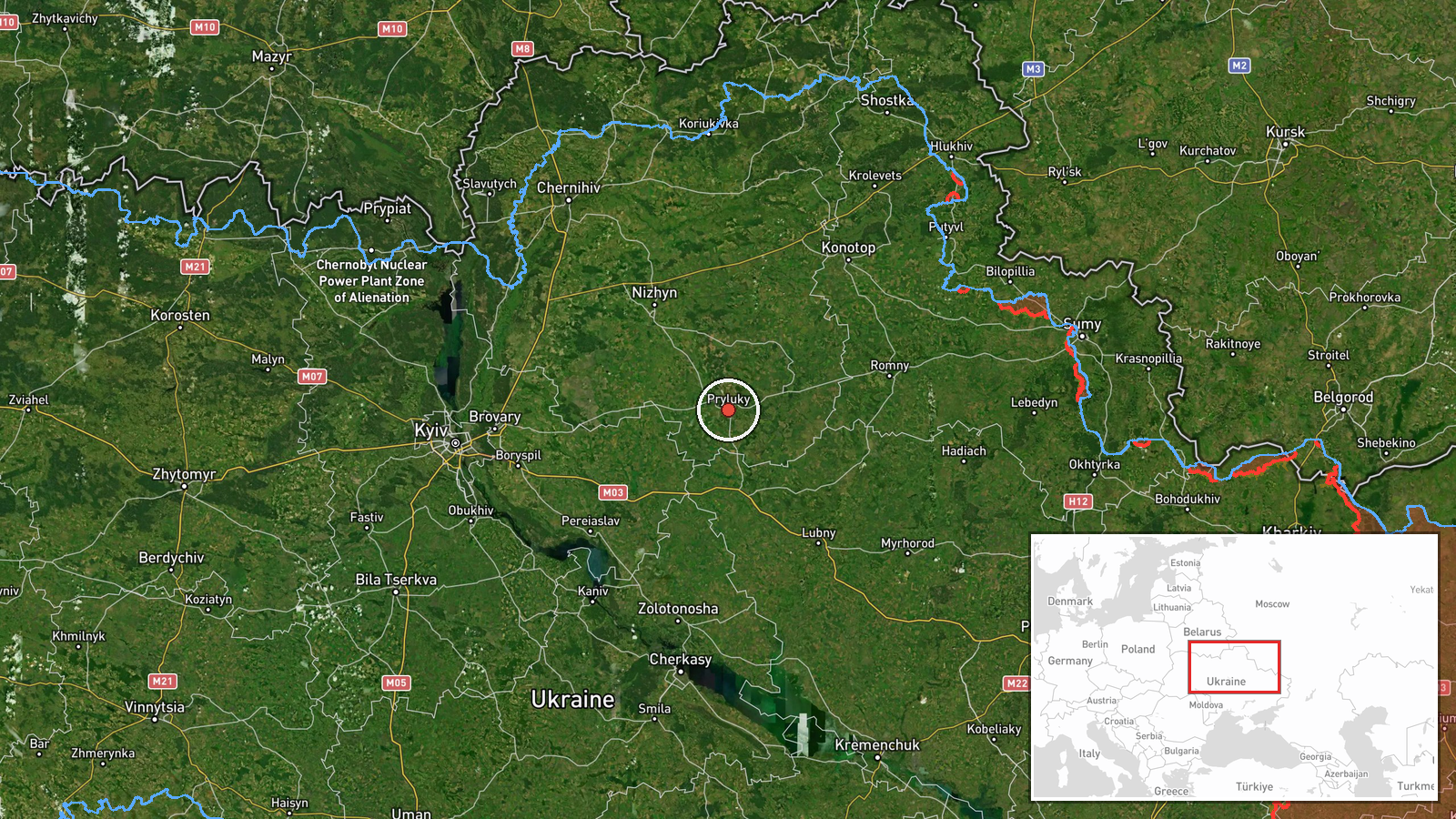
Ukrainian air monitoring channel @kpszsu reported on Telegram at 08:04 UTC on 22 October 2026 that one Russian Banderol mini cruise missile was heading toward Pryluky, a city in Chernihiv oblast in northern Ukraine. The original post is a brief emoji-led alert reading, in Ukrainian, that a Banderol is on course for Pryluky. The report does not mention impact, casualties, damage, or interception, and it does not state the missile's launch point. The event is logged as a single-source warning issued during an active flight, so it describes a reported trajectory rather than a confirmed strike. Related alerts in the preceding hours point to a sustained series of aerial threats across the same northern region.
Context and assessment
Pryluky sits in northeastern Ukraine, within the broader corridor linking Chernihiv and Poltava regions toward Kyiv and the central front. Its significance for an alert like this is likely tied to its position on routes that Russian long-range weapons have used toward infrastructure and logistics nodes in the north. The surrounding events show a cluster over roughly 36 hours: a Banderol alert toward Romny at 07:56 UTC, a Zircon or Oniks cruise missile passing Nizhyn toward Brovary the previous evening, and several jet-powered Geran-3 drones tracked near Chernihiv, Semenivka and south of Chernihiv. This density suggests a coordinated air-attack package moving through the north rather than an isolated launch. Operationally, closely spaced alerts against multiple northern towns may indicate an effort to saturate air defence coverage and draw interceptors across a wide area, though the data alone cannot confirm intent or targeting.
Sources and confidence
The event rests on one Telegram channel, @kpszsu, which is an official Ukrainian air-monitoring account, and no second outlet has been logged for this alert. Confidence is scored at 8.0 out of 10, reflecting an official source with a clear, specific report and high location certainty, offset by the single-channel basis and the absence of any post-event confirmation. Confidence would rise with independent corroboration from regional military administrations, a follow-up report of interception or impact, or matching open-source flight tracking. It would fall if the alert were retracted or if later official updates redirected the missile to a different settlement.
Location
The location is recorded at settlement level for Pryluky, Chernihiv oblast, at approximately 50.595 N, 32.384 E, and the precision is rated high. The coordinates were assigned from the named settlement in the alert text rather than a specific facility, so they indicate the town centre and not any particular target. Pryluky lies on relatively flat terrain of the Dnipro lowlands, with the Udy River and surrounding wetlands and forest belts in the region. Its position on the northern rail and road approaches gives it notable transport relevance.
Related events nearby
- Ukrainian air monitoring: 1 Russian Banderol mini cruise missile heading toward Romny.2026-10-22 07:56 UTC · Cruise Missile · Romny, Ukraine
- Ukrainian air monitoring: 1 Russian jet-powered Shahed (Geran-3) drone passing south of Chernihiv, heading wes2026-10-21 10:04 UTC · Drone Transit · south of Chernihiv, Ukraine
- Ukrainian air monitoring: 1 Russian Zircon/Oniks missile passing Nizhyn, heading toward Brovary.2026-10-21 19:10 UTC · Cruise Missile · Brovary, Ukraine
- Ukrainian air monitoring: 1 Russian jet-powered Shahed (Geran-3) drone heading toward Semenivka.2026-10-21 08:59 UTC · Drone Transit · Semenivka, Ukraine
- Ukrainian air monitoring: 1 Russian jet-powered Shahed (Geran-3) drone heading toward Chernihiv.2026-10-21 18:03 UTC · Drone Transit · Chernihiv, Ukraine
▶ View this event on the live map

Intel Mapper aggregates open-source reports from monitored Telegram and X channels, geolocates them, cross-checks duplicates across sources and assigns a confidence score. Entries are updated as new confirmations arrive. Read how we verify events.