Single jet-powered Geran-3 drone reported passing Zhashkiv toward Kyiv Oblast, per Ukrainian monitoring
What happened
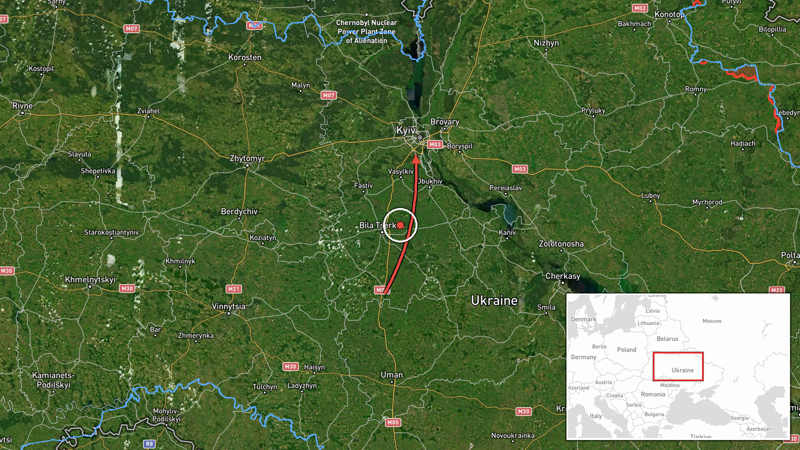
Ukrainian air monitoring reported on Telegram that one Russian jet-powered Shahed-type drone, identified as a Geran-3, was passing Zhashkiv in Cherkasy region and heading toward Kyiv Oblast. The post, from the @kpszsu channel, was dated 22 October 2026 at 17:00 UTC. The original Ukrainian wording describes a jet-type UAV passing Zhashkiv in the direction of the Kyiv region, without reporting impacts, casualties or damage. The event is recorded as a drone transit rather than a strike. The report is a single-channel alert, and its position on the map is approximate.
Context and assessment
Zhashkiv lies to the south of Kyiv, on the approach corridor that Russian long-range drones have repeatedly used toward the capital and surrounding oblast. The related events on the same day show a sustained sequence of Geran-3 transits: groups of two or more drones reported from Belarus toward Kyiv Oblast in the early morning, followed by single drones over Kyiv city, passing Chabany toward the capital, and then passing Chernihiv toward Kyiv Oblast shortly before this report. This pattern suggests an ongoing, staggered raid in which individual drones are tracked as they move through several oblasts rather than a single concentrated impact. Operationally, a lone drone reported on a southern track could be a straggler from an earlier wave, a decoy, or part of a wider flight path, but the data alone cannot establish its target. Such transit alerts are typically issued to give air defence and civil authorities warning, and they do not on their own indicate where, or whether, the drone would strike.
Sources and confidence
The event rests on one channel, Telegram @kpszsu, which is the official account of the Ukrainian Air Force-linked air monitoring feed and is generally treated as a primary source for drone tracking. No independent outlet or second channel in the data confirms this specific sighting. Confidence is scored at 8.0 out of 10, reflecting the authoritative origin and the consistency with the surrounding same-day sequence, offset by the single-source basis. The score would rise with corroboration from a second monitoring channel, regional military administration statements or a Russian-side reference, and would fall if the track were revised or retracted in later updates.
Location
The location is recorded as Kyiv Oblast with region-level precision and low location confidence, rather than as a precise point. The coordinates correspond to the broader Kyiv area, and the report itself names Zhashkiv, a town in Cherkasy region, which lies south of the oblast boundary. The map point should therefore be read as an approximate marker of the drone's direction of travel toward Kyiv. The terrain is largely flat to gently rolling Dnipro basin farmland, with the Dnipro river and its reservoirs lying to the east of the capital.
Related events nearby
- Ukrainian air monitoring: 1 Russian jet-powered Shahed (Geran-3) drone passing Chernihiv, heading toward Kyiv 2026-10-22 16:59 UTC · Drone Transit · Kyiv Oblast, Ukraine
- Ukrainian air monitoring: 1 Russian jet-powered Shahed (Geran-3) drone passing Chabany, heading toward Kyiv.2026-10-22 08:48 UTC · Drone Transit · Kyiv, Ukraine
- Ukrainian air monitoring: 1 Russian jet-powered Shahed (Geran-3) drone over Kyiv.2026-10-22 08:27 UTC · Drone Transit · Kyiv, Ukraine
- Ukrainian air monitoring: 2+ Russian jet-powered Shahed (Geran-3) drones from Belarus toward Kyiv Oblast.2026-10-22 07:48 UTC · Drone Transit · Kyiv Oblast, Ukraine
- Ukrainian air monitoring: 2+ Russian jet-powered Shahed (Geran-3) drones from Belarus toward Kyiv Oblast.2026-10-22 07:16 UTC · Drone Transit · Kyiv Oblast, Ukraine
▶ View this event on the live map

Intel Mapper aggregates open-source reports from monitored Telegram and X channels, geolocates them, cross-checks duplicates across sources and assigns a confidence score. Entries are updated as new confirmations arrive. Read how we verify events.