Air monitoring reports 2+ jet-powered Shahed drones tracked from Zhytomyr toward Rivne Oblast
What happened
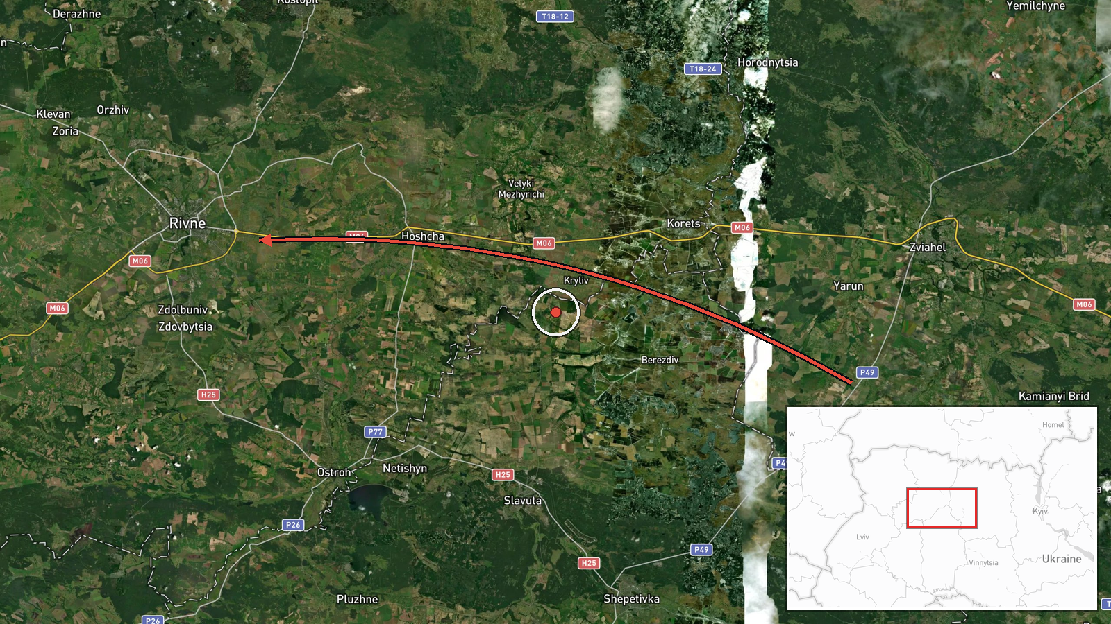
Ukrainian air monitoring, posted on Telegram by the channel @kpszsu, reported that at least two Russian jet-powered Shahed drones, described in the summary as Geran-3, were moving from Zhytomyr Oblast toward Rivne Oblast in northwestern Ukraine. The original Ukrainian post, timed at 00:20 UTC on 23 October 2026, used the phrase 'jet UAVs' and named only the direction of travel. The report did not name a specific settlement target, and it stated no casualties, damage, or interceptions. Because the cited channel is a single source, this is best read as a monitoring alert about drones in flight rather than a confirmed event on the ground.
Context and assessment
Rivne Oblast lies on the route toward the central and northern parts of the country, so drones heading there late at night could be aimed at energy, logistics, or industrial sites, though the data does not show a specific target. The related events show a steady pattern over roughly sixteen hours on 22 and 23 October. Individual jet-powered Geran-3 drones were logged toward Kostopil in the morning, toward Rivne and Zdolbuniv in the afternoon and evening, and a separate Shahed passing Zaporizhzhia was recorded heading toward Rivne just after midnight. The succession of settlement names along a northwestern corridor suggests either drones following a common track or a deliberate spread of approach paths. Several tracks converging on one region within a short window may point to a saturation-style raid, although monitoring feeds alone cannot show intent. The Zaporizhzhia track also indicates that at least one drone crossed the country from the southeast, consistent with long-range launch patterns. Transit reports of this kind are often the early phase of a larger strike wave, so the signal merits tracking, but the data does not establish what, if anything, was struck.
Sources and confidence
The event rests on one channel, the Telegram account @kpszsu, the official Ukrainian Air Force feed used for real-time air alerts. The related entries follow the same monitoring format, but the data lists no other outlet, so there is no independent cross-confirmation. The score of 8.0 reflects the official status of the channel and its consistent alert record, offset by the single-source basis and the absence of media reports or imagery. Confidence would rise with statements from regional military administrations, local reporting, or debris and impact reports, and would fall if the tracks were later revised.
Location
The location is region-level rather than settlement-level. The coordinates, 50.62 N and 26.25 E, approximate the centre of Rivne Oblast, and location confidence is low because the report gives only a heading toward the oblast, not a position. The oblast sits in northwestern Ukraine, bordering Belarus to the north, and much of it is Polissia lowland of forest, marsh, and river valleys.
Related events nearby
- Ukrainian air monitoring: 1 Russian jet-powered Shahed (Geran-3) drone heading toward Rivne Oblast.2026-10-23 00:39 UTC · Drone Transit · Rivne Oblast, Ukraine
- Ukrainian air monitoring: 1 Russian Shahed-type drone heading toward Rivne; 1 Russian Shahed-type drone passin2026-10-23 00:20 UTC · Drone Transit · Rivne, Ukraine
- Ukrainian air monitoring: 1 Russian jet-powered Shahed (Geran-3) drone heading toward Rivne.2026-10-22 09:23 UTC · Drone Transit · Rivne, Ukraine
- Ukrainian air monitoring: 1 Russian jet-powered Shahed (Geran-3) drone heading toward Zdolbuniv.2026-10-23 00:21 UTC · Drone Transit · Zdolbuniv, Ukraine
- Ukrainian air monitoring: 1 Russian jet-powered Shahed (Geran-3) drone heading toward Zdolbuniv.2026-10-22 17:52 UTC · Drone Transit · Zdolbuniv, Ukraine
▶ View this event on the live map

Intel Mapper aggregates open-source reports from monitored Telegram and X channels, geolocates them, cross-checks duplicates across sources and assigns a confidence score. Entries are updated as new confirmations arrive. Read how we verify events.