Jet-powered Geran-3 drone reported near Pishchanka, Vinnytsia Oblast, heading northwest
What happened
Ukrainian air monitoring reported one Russian jet-powered Shahed drone, identified in the summary as a Geran-3, passing the area of Pishchanka in Vinnytsia Oblast at about 06:05 UTC on 23 October 2026, on a northwest heading. The original post, published on the Telegram channel @kpszsu, calls the object a jet-type UAV (Реактивний БпЛА) and gives its course as north-western. The report does not mention impact, damage, or casualties. It is a transit notice, so it describes the drone's track rather than any detonation. Only this single channel has carried the report so far, which is why it is presented with a moderate confidence score.
Context and assessment
Pishchanka lies in the Podilia part of Vinnytsia Oblast, in the western part of the country's central-south belt, an area that long-range drones have crossed repeatedly on routes toward western and central Ukraine. The related reports show a sustained track rather than a single sighting. On 22 October, monitoring logged a Geran-3 moving from Vinnytsia Oblast toward Ladyzhyn in the morning, another over Rakhny-Lisovi in the late afternoon, and a further one heading toward Ladyzhyn at 16:58. An earlier entry placed a drone crossing Podilsk district toward Pishchanka, and the 06:11 entry on 23 October described a drone heading toward Sharhorod, further along the same general corridor. Together the sequence suggests one or more drones following a broadly northwest-trending path across the oblast. This may reflect navigation toward targets further north or west, or simply a transit route. Because these are transit alerts rather than impact reports, the pattern informs analysts about flight paths and monitoring coverage, not about intended targets. Repeated appearances of the same airframe type along one corridor are consistent with routine long-range attack traffic, though the reports alone cannot establish mission purpose.
Sources and confidence
Only one channel, the Telegram account @kpszsu, carries this report, and the related entries come from the same type of Ukrainian air monitoring feed. No independent outlet, wire service, or official statement has been matched to this specific track at the time of writing, so cross-confirmation is absent. The confidence score of 8.0 reflects a clear, timestamped primary post from an identified military-affiliated source, reduced by single-source status and the lack of corroboration. Confidence would rise with a second independent monitoring source, regional administration statements, or imagery tying the track to the area. It would fall if the originating channel revised the report or if later monitoring contradicted the heading.
Location
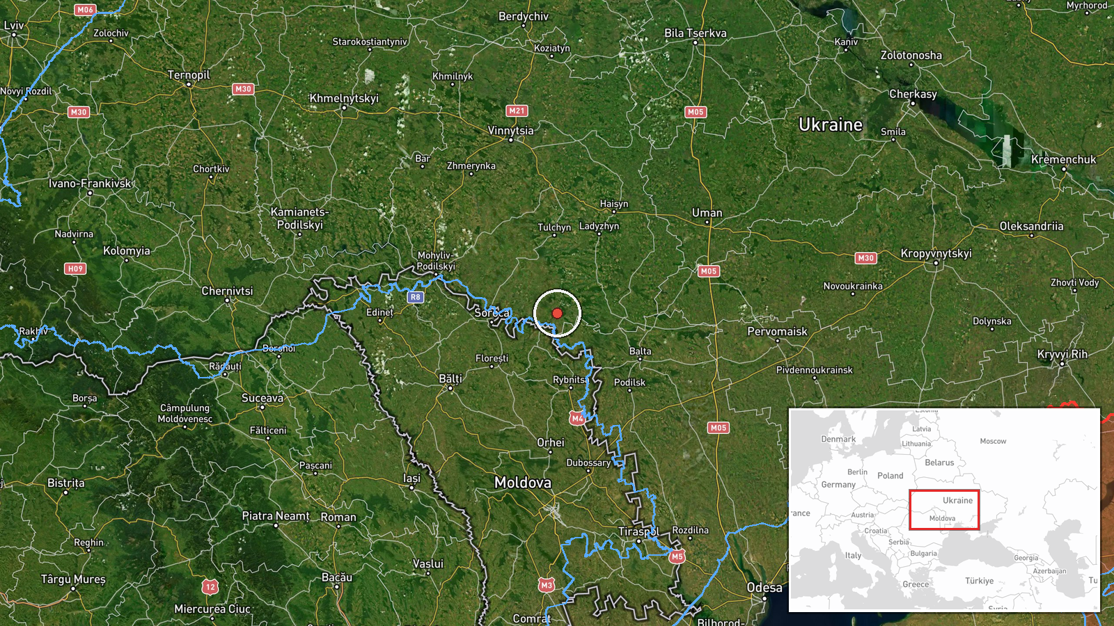
The coordinates correspond to the settlement of Pishchanka, which the feed records at settlement precision with high location confidence. The point is therefore a village-level reference, not a precise position on the drone's track, and the actual route is known only through the reported heading. Pishchanka sits in the Podilian upland of Vinnytsia Oblast, a rolling, largely agricultural landscape with river valleys and scattered woodland. It lies within the broader Southern Bug drainage area, which shapes local terrain and transport corridors.
Related events nearby
- Ukrainian air monitoring: 1 Russian jet-powered Shahed (Geran-3) drone passing Podilsk district, heading towar2026-10-22 09:18 UTC · Drone Transit · Pishchanka, Ukraine
- Ukrainian air monitoring: 1 Russian jet-powered Shahed (Geran-3) drone heading toward Ladyzhyn.2026-10-22 16:58 UTC · Drone Transit · Ladyzhyn, Ukraine
- Ukrainian air monitoring: 1 Russian jet-powered Shahed (Geran-3) drone over Rakhny-Lisovi.2026-10-22 17:00 UTC · Drone Transit · Rakhny-Lisovi, Ukraine
- Ukrainian air monitoring: 1 Russian jet-powered Shahed (Geran-3) drone heading toward Sharhorod.2026-10-23 06:11 UTC · Drone Transit · Sharhorod, Ukraine
- Ukrainian air monitoring: 1 Russian jet-powered Shahed (Geran-3) drone heading toward Vendychany.2026-10-22 09:28 UTC · Drone Transit · Vendychany, Ukraine
▶ View this event on the live map

Intel Mapper aggregates open-source reports from monitored Telegram and X channels, geolocates them, cross-checks duplicates across sources and assigns a confidence score. Entries are updated as new confirmations arrive. Read how we verify events.