Single Russian Geran-3 jet drone reported heading toward Sharhorod, Vinnytsia Oblast
What happened
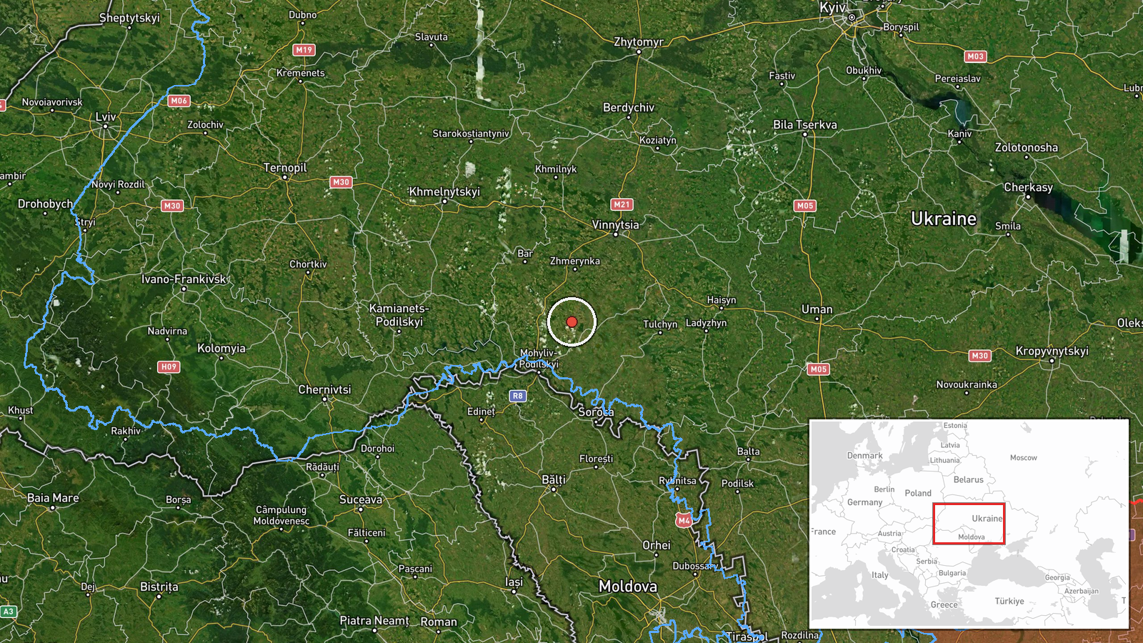
Ukrainian air monitoring reported one Russian jet-powered Shahed (Geran-3) drone on a course toward Sharhorod, a town in Vinnytsia Oblast in western Ukraine. The alert was timestamped 23 October 2026 at 06:11 UTC and was posted to Telegram by the channel @kpszsu. The original Ukrainian wording, "реактивний БпЛА курсом на Шаргород", translates roughly as a jet-powered unmanned aerial vehicle on course for Sharhorod, and it is a heading report rather than a confirmed strike. The report does not describe impact, damage, casualties, or interception. Because it describes a single airframe in transit, it is best read as a warning about an aircraft's track, not as a record of an attack on the town.
Context and assessment
Sharhorod sits in the western part of Vinnytsia Oblast, and the region lies on routes that Russian long-range drones have used to cross central and western Ukraine toward rail, energy, and logistics targets. The related events fit a broader pattern. On 22 October 2026, separate Ukrainian air monitoring alerts placed the same type of drone toward or over Vendychany, Rakhny-Lisovi, Zhmerynka (reported twice, at 16:58 and 17:02 local-timestamp UTC), and Vinnytsia itself, with the sequence spanning roughly 09:28 to 17:41. Zhmerynka is an important rail junction, which may explain repeated tracking there. The clustering of single-drone reports across several settlements over one day suggests either a sustained flight campaign or several airframes using overlapping corridors. Whether the Sharhorod drone is part of the same wave cannot be confirmed from the data. Operationally, a single drone heading toward a town may be tracking a route, reconnoitering, or being redirected by electronic warfare, and the reports do not establish which.
Sources and confidence
The report rests on one Telegram channel, @kpszsu, which is associated with Ukrainian air-force monitoring. No second independent channel, news agency, or official regional statement appears in the dataset. The confidence score of 8.0 reflects the channel's institutional role, the specificity of the aircraft type, and the precise settlement reference. It is held below the maximum because the report is single-sourced and describes only a heading, not an outcome. Confidence would rise with an official air-force statement, a regional military administration update, or independent reporting of impact or debris. It would fall if later corrections changed the target, the drone count, or the track.
Location
The location is recorded at settlement level, with high location confidence, and the coordinates correspond to the town of Sharhorod rather than a specific facility. Sharhorod lies in the Podillia region of western Vinnytsia Oblast, an area of rolling upland, river valleys, and farmland. The terrain is open enough for low-flying drones to be tracked over long distances. The precise point of any intended impact cannot be determined from the report, so the coordinates should be read as the named town.
Related events nearby
- Ukrainian air monitoring: 1 Russian jet-powered Shahed (Geran-3) drone heading toward Vendychany.2026-10-22 09:28 UTC · Drone Transit · Vendychany, Ukraine
- Ukrainian air monitoring: 1 Russian jet-powered Shahed (Geran-3) drone over Rakhny-Lisovi.2026-10-22 17:00 UTC · Drone Transit · Rakhny-Lisovi, Ukraine
- Ukrainian air monitoring: 1 Russian jet-powered Shahed (Geran-3) drone heading toward Zhmerynka.2026-10-22 17:02 UTC · Drone Transit · Zhmerynka, Ukraine
- Ukrainian air monitoring: 1 Russian jet-powered Shahed (Geran-3) drone heading toward Zhmerynka.2026-10-22 16:58 UTC · Drone Transit · Zhmerynka, Ukraine
- Ukrainian air monitoring: 1 Russian jet-powered Shahed (Geran-3) drone heading toward Vinnytsia.2026-10-22 17:41 UTC · Drone Transit · Vinnytsia, Ukraine
▶ View this event on the live map

Intel Mapper aggregates open-source reports from monitored Telegram and X channels, geolocates them, cross-checks duplicates across sources and assigns a confidence score. Entries are updated as new confirmations arrive. Read how we verify events.