Ukrainian air monitoring reports one jet-powered Geran-3 drone heading toward Zhmerynka
What happened
On 22 October 2026, at about 16:58 UTC, Ukrainian air monitoring reported a single Russian jet-powered Shahed (Geran-3) drone heading toward Zhmerynka in Vinnytsia Oblast, western-central Ukraine. The report was posted on Telegram by the channel @kpszsu, the official Ukrainian Air Force account. The original Ukrainian wording describes a jet-type UAV moving in the direction of Zhmerynka and does not mention impact, damage, or casualties. The event is logged as a drone transit, meaning a track sighting rather than a confirmed strike. Related entries in the same hours describe further drones over the oblast, including one heading toward Vinnytsia itself.
Context and assessment
Zhmerynka is a major railway junction in Vinnytsia Oblast, and rail hubs in western Ukraine have repeatedly mattered to logistics, troop movement, and the regional energy and transport network. The Geran-3 is a jet-powered variant of the Shahed design, generally considered faster and harder to intercept than the piston-engine Geran-2, so its appearance in air monitoring reports is operationally notable. The related events show a sequence over roughly thirty hours. Multiple drones were reported passing southern Vinnytsia Oblast on 21 October, followed by single-drone tracks passing Ananyiv, over Rakhny-Lisovi, toward Zhmerynka, and toward Vinnytsia city on 22 October. This pattern suggests a route of drones transiting the oblast, possibly toward targets further east or west, though the data does not establish the intended target. Because each entry is a separate sighting, the sequence may also reflect repeated launches along one corridor. Analysts would usually treat such a cluster as evidence of a sustained campaign against the region rather than an isolated incident.
Sources and confidence
The report comes from a single channel, Telegram @kpszsu, which carries official Ukrainian Air Force air-monitoring alerts. No independent outlet, second official channel, or local media report appears in the supplied data, so cross-confirmation is absent. The confidence score of 8.0 reflects the official nature of the source and the specific, time-stamped wording, but it is not higher because the claim rests on one channel and describes a track rather than an observed impact. Confidence would rise with corroboration from Ukrainian regional military administrations, a later air-monitoring update confirming the drone's path, or open-source flight tracking. It would fall if later alerts retracted the track or assigned it to a different direction.
Location
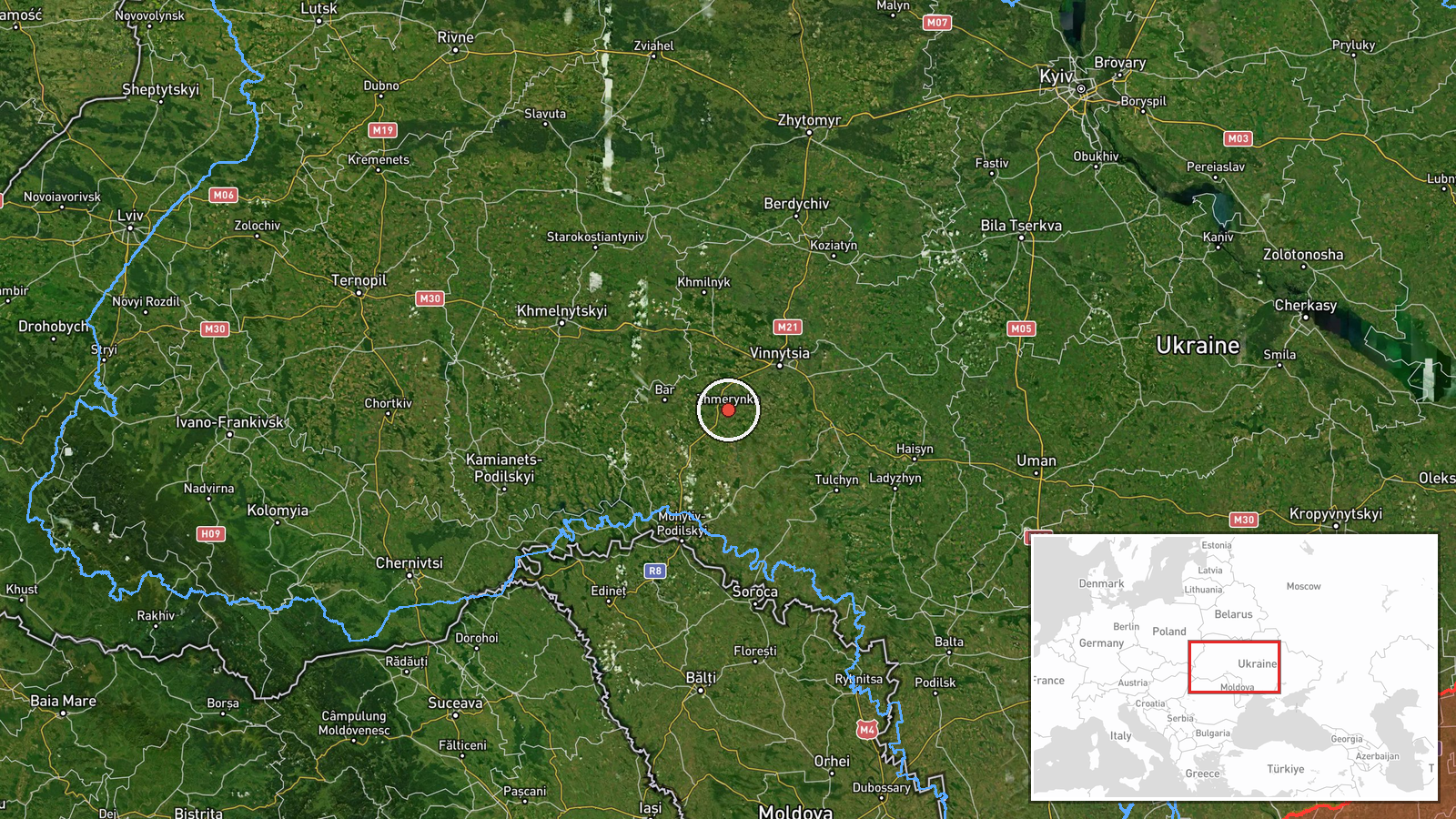
The location is tagged at settlement level, with Zhmerynka's coordinates at approximately 49.035 N, 28.114 E, and location confidence is rated high. The point almost certainly reflects the town itself rather than a specific facility, because the source names only the settlement. Zhmerynka sits in western-central Vinnytsia Oblast on the railway lines that run through the region. The terrain is mostly open agricultural land with river valleys, and the town is a rail node rather than a dense urban center. The drone's exact track between the named points is not given.
Related events nearby
- Ukrainian air monitoring: 1 Russian jet-powered Shahed (Geran-3) drone heading toward Zhmerynka.2026-10-22 16:58 UTC · Drone Transit · Zhmerynka, Ukraine
- Ukrainian air monitoring: 1 Russian jet-powered Shahed (Geran-3) drone heading toward Vinnytsia.2026-10-22 17:41 UTC · Drone Transit · Vinnytsia, Ukraine
- Ukrainian air monitoring: 1 Russian jet-powered Shahed (Geran-3) drone over Vinnytsia.2026-10-22 17:32 UTC · Drone Transit · Vinnytsia, Ukraine
- Ukrainian air monitoring: 1 Russian jet-powered Shahed (Geran-3) drone heading toward Vinnytsia.2026-10-22 17:28 UTC · Drone Transit · Vinnytsia, Ukraine
- Ukrainian air monitoring: 1 Russian jet-powered Shahed (Geran-3) drone passing Ananyiv, heading toward Vinnyts2026-10-22 09:09 UTC · Drone Transit · Vinnytsia Oblast, Ukraine
▶ View this event on the live map

Intel Mapper aggregates open-source reports from monitored Telegram and X channels, geolocates them, cross-checks duplicates across sources and assigns a confidence score. Entries are updated as new confirmations arrive. Read how we verify events.