Jet-powered Shahed drone reported over Vinnytsia, Ukraine, on 22 October 2026
What happened
A Ukrainian air monitoring report posted on Telegram by the channel @kpszsu states that one Russian jet-powered Shahed drone, designated Geran-3, was over the city of Vinnytsia at about 17:32 UTC on 22 October 2026. The original Ukrainian text, 'реактивний БпЛА над містом' (jet-powered UAV over the city), describes the aircraft's type and position. It does not mention impact, damage, or casualties, and none are recorded for this event. The report is the only source logged for this entry. It sits within a sequence of same-day tracking alerts in which the same drone type was reported heading toward Zhmerynka and then toward Vinnytsia and its oblast. The entry records a transit of airspace rather than a strike on a specific target.
Context and assessment
Vinnytsia is a regional administrative centre in west-central Ukraine on the Southern Bug River, with rail and road links that connect it to the south and east. That position places it along routes that long-range drones have used to move toward western and central Ukraine. The related reports show the drone being tracked through a chain of places: Ananyiv, which the report places on a route toward Vinnytsia Oblast, at 09:09 UTC; Zhmerynka at 16:58 and 17:02 UTC; and Vinnytsia itself at 17:28 and 17:41 UTC, with this event at 17:32 between them. Successive alerts naming the same type along one corridor could mean a single airframe followed over several hours or several aircraft on overlapping routes, and the data cannot distinguish these. Zhmerynka is a rail junction, so the sequence may trace a path across transport nodes, although no target is stated. Geran-3 jet variants are generally described as faster and harder to intercept than the piston-engined Shahed-136, which may explain why monitoring channels flag the type specifically. The timing suggests either transit toward other areas or a route through the region, but the record does not establish intent.
Sources and confidence
Only one channel is recorded: Telegram @kpszsu, which publishes Ukrainian air monitoring alerts. The record shows no independent confirmation from other outlets, official statements, or impact reports, and it is not marked as corrected. The confidence score of 8.0 out of 10 reflects a specific type designation, a clear source, and timing consistent with the related alerts, but not independent verification. Confidence would rise with corroboration from a second monitoring source, an official air force statement, or a debris or impact report. It would fall if later tracks contradicted the route or time, or if the channel issued a correction.
Location
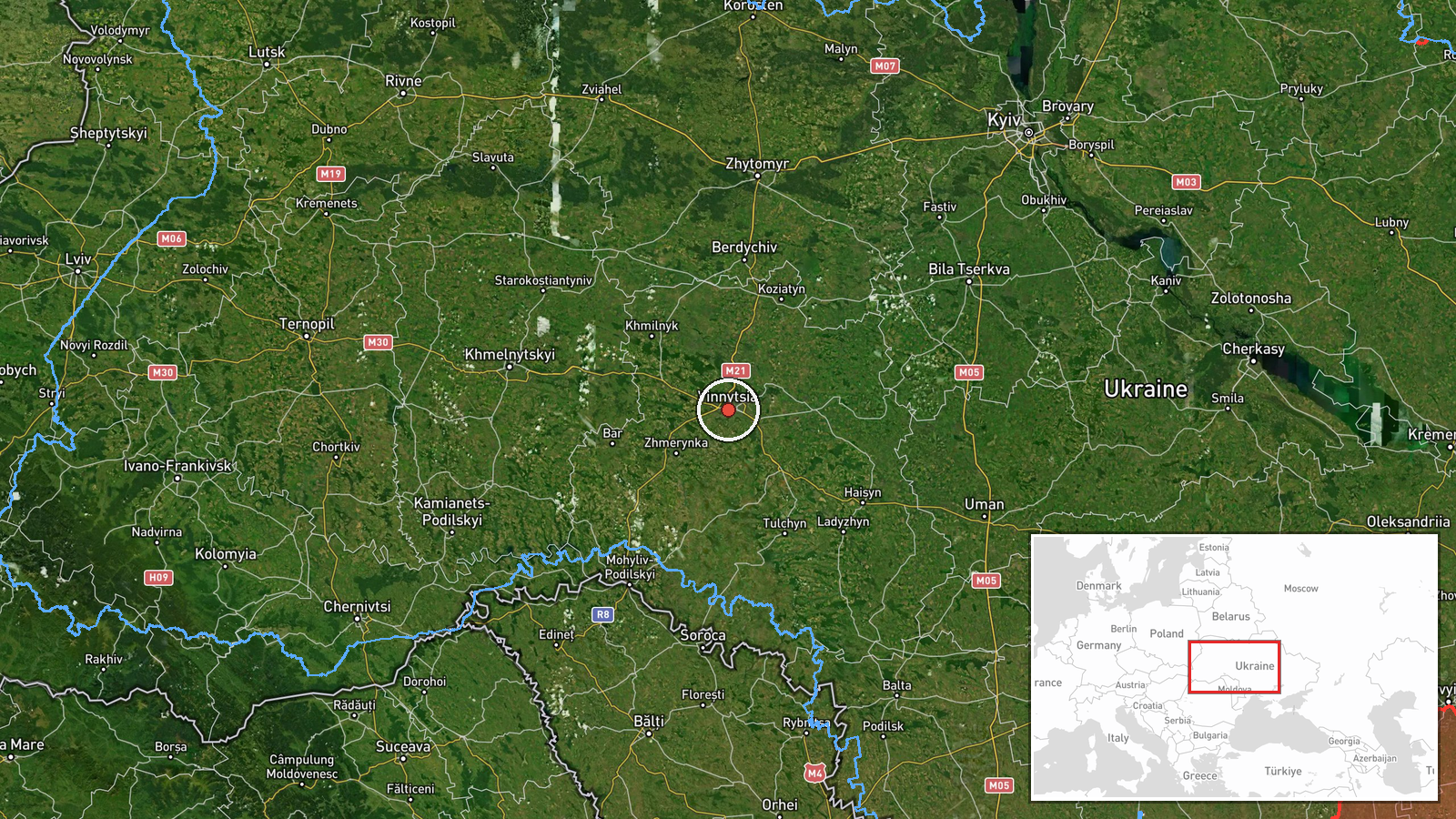
The location is recorded at settlement precision with high location confidence. The coordinates of 49.23 N and 28.47 E correspond to the city of Vinnytsia as a whole, not to a specific facility, so no site within the city is identified. Vinnytsia lies on the Southern Bug River in a largely agricultural landscape of rolling plains and river valleys. The city is a regional hub with rail lines, road junctions, and a dense urban core, and the river and surrounding terrain shape the approach routes used in the wider region.
Related events nearby
- Ukrainian air monitoring: 1 Russian jet-powered Shahed (Geran-3) drone heading toward Vinnytsia.2026-10-22 17:41 UTC · Drone Transit · Vinnytsia, Ukraine
- Ukrainian air monitoring: 1 Russian jet-powered Shahed (Geran-3) drone heading toward Vinnytsia.2026-10-22 17:28 UTC · Drone Transit · Vinnytsia, Ukraine
- Ukrainian air monitoring: 1 Russian jet-powered Shahed (Geran-3) drone passing Ananyiv, heading toward Vinnyts2026-10-22 09:09 UTC · Drone Transit · Vinnytsia Oblast, Ukraine
- Ukrainian air monitoring: 1 Russian jet-powered Shahed (Geran-3) drone heading toward Zhmerynka.2026-10-22 17:02 UTC · Drone Transit · Zhmerynka, Ukraine
- Ukrainian air monitoring: 1 Russian jet-powered Shahed (Geran-3) drone heading toward Zhmerynka.2026-10-22 16:58 UTC · Drone Transit · Zhmerynka, Ukraine
▶ View this event on the live map

Intel Mapper aggregates open-source reports from monitored Telegram and X channels, geolocates them, cross-checks duplicates across sources and assigns a confidence score. Entries are updated as new confirmations arrive. Read how we verify events.