Jet-powered Geran-3 drone reported over Rakhny-Lisovi in Vinnytsia Oblast, heading west
What happened
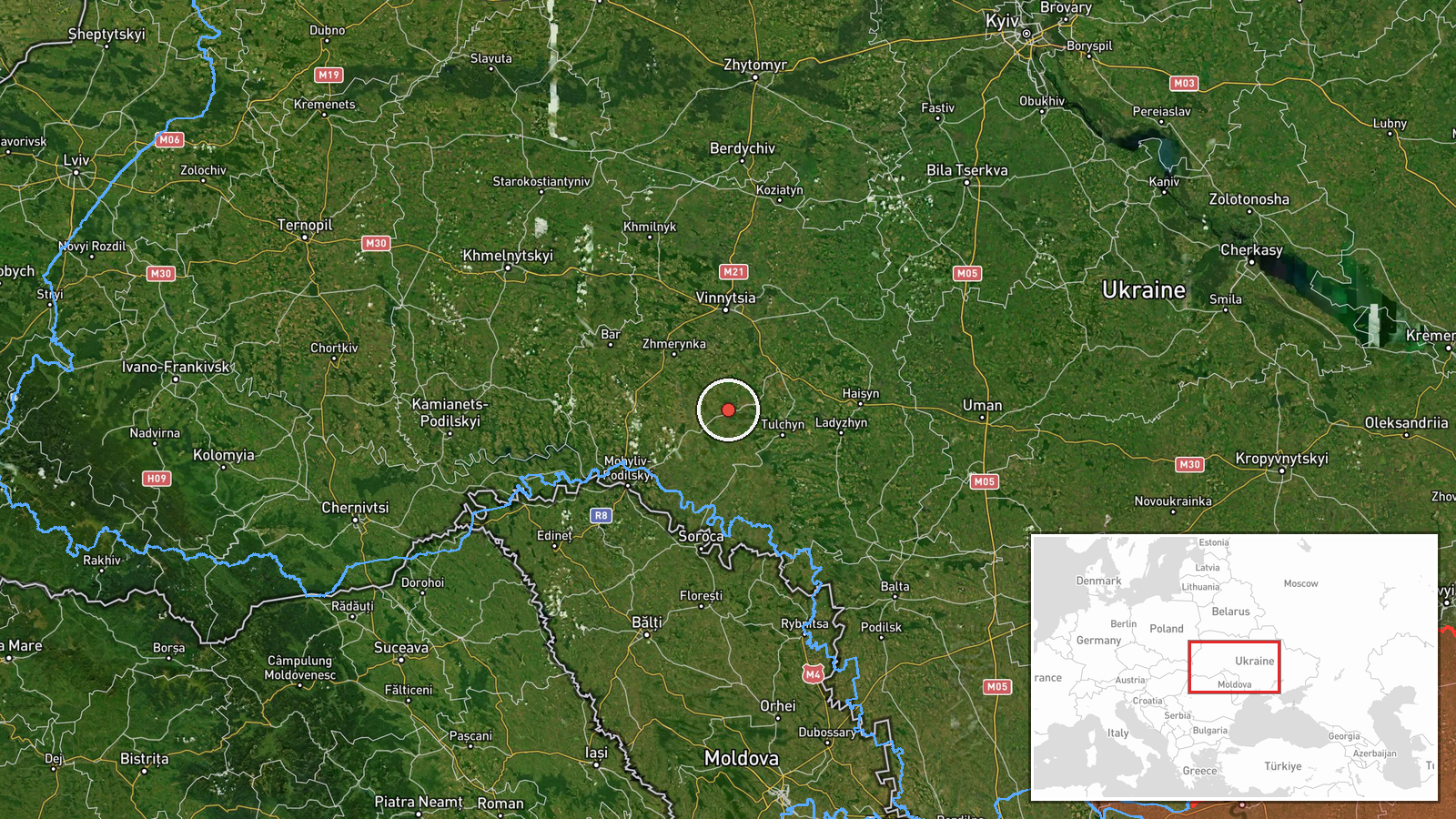
Ukraine's air monitoring channel on Telegram (@kpszsu) reported one Russian jet-powered Shahed (Geran-3) drone transiting the Rakhny-Lisovi area of Vinnytsia Oblast on 22 October 2026 at about 17:00 UTC. The original Ukrainian wording, which reads roughly as 'jet-type UAV via Rakhny-Lisovi, course west,' names the settlement and direction of travel but gives no altitude, speed, or payload. The report describes a transit only and does not mention impact, damage, or casualties. Because the message comes from a single military monitoring channel, the account stands as a reported sighting rather than a confirmed event with independent verification.
Context and assessment
Vinnytsia Oblast lies in west-central Ukraine and is crossed by rail and road routes that link the south and east of the country with the west. Zhmerynka, a major rail junction, and Vinnytsia city, the regional center, both appear in the same reporting window. The related events show a sustained pattern. On 21 October, monitoring reports logged one drone and then two or more drones passing through southern Vinnytsia Oblast heading west, around 17:39 and 18:54 UTC. The following day, further single-drone reports named Zhmerynka twice around 17:00 UTC and Vinnytsia about half an hour later. Taken together, this suggests a sequence of single or small-group drones moving along a west-bound corridor across the oblast over roughly 24 hours. Operationally, this pattern may indicate routing toward western Ukraine, the use of the corridor to test air defense coverage, or an intent to draw interceptors away from other areas. The data alone cannot confirm which of these, if any, was intended.
Sources and confidence
The event rests on one Telegram channel, @kpszsu, which is linked to Ukrainian air-monitoring reporting. No second outlet, regional administration, or independent tracker in the dataset confirms this specific sighting, so cross-confirmation is absent. The confidence score of 8.0 reflects the official military origin of the channel, the precise settlement name, and the consistency with a series of related transit reports on the same route. It is held below the maximum because of single-source dependence and the lack of any impact or follow-up. Confidence would rise with corroboration from other monitoring feeds, regional authorities, or reports of debris or impact. It would fall if later updates revised the track or identified it as a different object.
Location
The location is placed at settlement level, with Rakhny-Lisovi identified by name and coordinates of approximately 48.787 N, 28.483 E. The precision is rated high, and the point is a village-scale reference rather than a precise flight track. The settlement lies in the south-west of Vinnytsia Oblast, a largely rural area of rolling Podolian upland, closer to the Moldovan border than to the regional capital. Surrounding terrain is mainly farmland and river valleys, which are relevant when considering low-altitude transit routes.
Related events nearby
- Ukrainian air monitoring: 2+ Russian jet-powered Shahed (Geran-3) drones passing southern Vinnytsia Oblast, he2026-10-21 18:54 UTC · Drone Transit · southern Vinnytsia Oblast, Ukraine
- Ukrainian air monitoring: 1 Russian jet-powered Shahed (Geran-3) drone heading toward Zhmerynka.2026-10-22 17:02 UTC · Drone Transit · Zhmerynka, Ukraine
- Ukrainian air monitoring: 1 Russian jet-powered Shahed (Geran-3) drone heading toward Zhmerynka.2026-10-22 16:58 UTC · Drone Transit · Zhmerynka, Ukraine
- Ukrainian air monitoring: 1 Russian jet-powered Shahed (Geran-3) drone heading toward Vinnytsia.2026-10-22 17:41 UTC · Drone Transit · Vinnytsia, Ukraine
- Ukrainian air monitoring: 1 Russian jet-powered Shahed (Geran-3) drone over Vinnytsia.2026-10-22 17:32 UTC · Drone Transit · Vinnytsia, Ukraine
▶ View this event on the live map

Intel Mapper aggregates open-source reports from monitored Telegram and X channels, geolocates them, cross-checks duplicates across sources and assigns a confidence score. Entries are updated as new confirmations arrive. Read how we verify events.