Ukraine reports two or more jet-powered Shahed drones heading toward Korosten, Zhytomyr Oblast
What happened
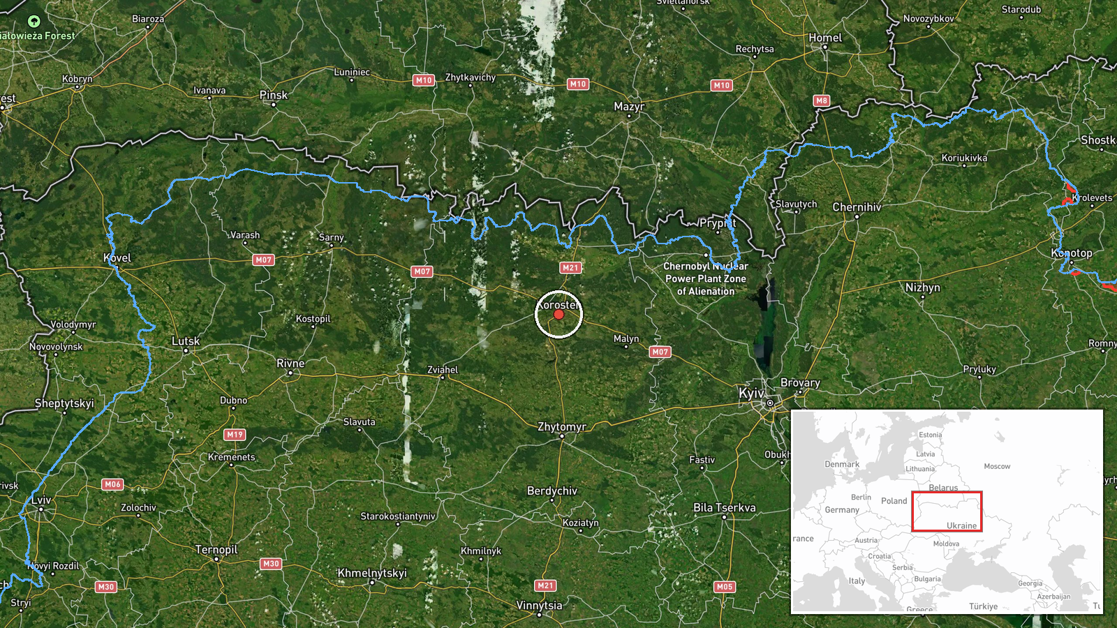
Ukrainian air monitoring reported at 06:41 UTC on 23 October 2026 that two or more Russian jet-powered Shahed drones, designated Geran-3, were moving toward Korosten in Zhytomyr Oblast. The original Ukrainian-language post, carried on the Telegram channel @kpszsu, described jet-powered UAVs heading to Korosten and Zvyahel from the northeast. The report describes transit only and does not state any impact, damage, casualties, or whether the drones were intercepted. The '2+' wording signals a minimum count, so the exact number was not confirmed. Several earlier alerts in the preceding day covered the same corridor, all classified as drone transit rather than strikes.
Context and assessment
Korosten is a rail and road hub in northwestern Zhytomyr Oblast, on the main routes linking the Kyiv region with the west and northwest of Ukraine. Its position makes it a recurring waypoint for drones passing through the region. The related events show a sustained pattern: from 08:09 on 22 October through early 23 October, at least five alerts were logged for Korosten or the wider Zhytomyr corridor, ranging from single drones to groups of two or more. Two alerts at 17:30 and 17:54 on 22 October described drones passing Korosten or northern Zhytomyr Oblast while heading west, which suggests tracks entering from the east or northeast and continuing westward. Operationally, this may indicate transit toward targets farther west, route testing, or attempts to avoid air defence concentrated around fixed sites. The data does not establish intent. Because jet-powered variants are faster than older piston-engined Shaheds, warning times for communities along these paths may be shorter, which is one reason repeated transit alerts matter for civil defence planning.
Sources and confidence
The report rests on a single Telegram channel, @kpszsu, with a source count of one and no cross-confirmation logged in the data. The confidence score of 8.0 is relatively high because the channel is linked to Ukraine's air force monitoring, and the related events from the same reporting stream show a consistent, detailed pattern of alerts. The score is still below maximum because no independent outlet, radar feed, or local official has confirmed the specific count. Confidence would rise with independent confirmation from regional authorities, open-source flight tracking, or debris reports. It would fall if the alert were corrected, withdrawn, or contradicted by later updates from the same channel.
Location
The location is recorded at settlement level, with coordinates placed at the centre of Korosten and a high location confidence, because the report names the city directly. Korosten lies in northwestern Zhytomyr Oblast, in the Polissia forest-steppe transition zone, near the Teteriv River. Its rail junction and surrounding forests are notable features. Zvyahel, mentioned in the original text, lies to the southwest and is not geolocated in this event.
Related events nearby
- Ukrainian air monitoring: 1 Russian jet-powered Shahed (Geran-3) drone heading toward Korosten.2026-10-23 00:18 UTC · Drone Transit · Korosten, Ukraine
- Ukrainian air monitoring: 2+ Russian jet-powered Shahed (Geran-3) drones passing Korosten, heading west.2026-10-22 17:30 UTC · Drone Transit · Korosten, Ukraine
- Ukrainian air monitoring: 1 Russian jet-powered Shahed (Geran-3) drone heading toward Korosten.2026-10-22 16:58 UTC · Drone Transit · Korosten, Ukraine
- Ukrainian air monitoring: 1 Russian jet-powered Shahed (Geran-3) drone heading toward Korosten.2026-10-22 08:09 UTC · Drone Transit · Korosten, Ukraine
- Ukrainian air monitoring: 1 Russian jet-powered Shahed (Geran-3) drone from northern Kyiv Oblast toward northe2026-10-23 07:08 UTC · Drone Transit · northern Zhytomyr Oblast, Ukraine
▶ View this event on the live map

Intel Mapper aggregates open-source reports from monitored Telegram and X channels, geolocates them, cross-checks duplicates across sources and assigns a confidence score. Entries are updated as new confirmations arrive. Read how we verify events.