Ukrainian air monitoring reports a jet-powered Geran-3 drone heading toward Desna from the north
What happened
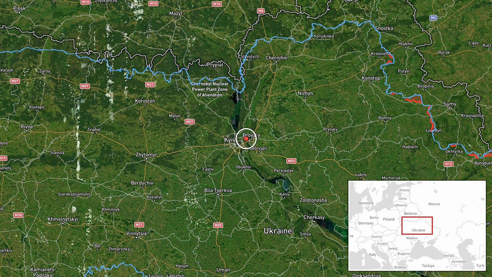
Ukraine's air monitoring channel on Telegram, @kpszsu, reported on 23 October 2026 at 07:09 UTC that one Russian jet-powered Shahed, identified as a Geran-3, was heading toward Desna. The original Ukrainian-language post describes a jet-powered UAV moving toward Desna from the north, wording that signals a transit alert rather than a report of impact. The post gives no casualty figures, no damage assessment and no statement about the drone's intended target. The alert places the track over Desna, a settlement in northern Ukraine on the river of the same name. Five earlier monitoring alerts on the same date, each for a single Shahed-type or jet-powered drone, referenced Brovary and Troieshchyna in the Kyiv area.
Context and assessment
Desna sits north of Kyiv, so a track approaching from the north places the drone on a route that has repeatedly passed through the Kyiv region this morning. Earlier alerts from the same channel on 23 October tracked single drones toward Troieshchyna on the western edge of Kyiv at 05:31 UTC and toward Brovary, east of the capital, at 00:19, 03:09, 05:28 and now again at 07:13 UTC. The repetition suggests a sustained series of individual drones moving through airspace north and east of Kyiv rather than one coordinated strike. The Geran-3 is the jet-powered variant of the Shahed family, generally understood to fly faster than the piston-engine Geran-2 and to be used in long-range strike and saturation roles. Because the alerts describe transit and heading rather than confirmed impact points, the most cautious reading is that Ukrainian air defence was tracking drones routed through the region, with the final targets unknown from this data. Repeated alerts of this kind usually indicate active drone traffic and possible pressure on air defence and warning systems rather than a single defined objective.
Sources and confidence
All of the event data comes from one source, the Telegram channel @kpszsu, which is the Ukrainian Air Force's official monitoring account. Its alerts are generally regarded as a primary channel for airborne threat tracking, but this record has not been independently confirmed by another outlet or by open-source flight tracking. The confidence score of 8.0 reflects the official origin and the specific, timestamped wording, offset by the single-source status and the absence of any corroborating impact or wreckage report. Confidence would rise with a second independent confirmation, such as a regional military administration statement or a verified track from open-source monitors. It would fall if later updates revised the target, altered the route, or if the drone's status were contradicted.
Location
The location is recorded as Desna, Ukraine, at 50.52207 N, 30.68228 E, with settlement-level precision and high location confidence. The coordinates correspond to the settlement on the Desna River in northern Ukraine, north of Kyiv. The Desna is a major left-bank tributary of the Dnipro and forms a broad, low-lying corridor of floodplains, wetlands and forest across the region. The river and its floodplain are notable landmarks for tracking drones along northern approaches to the capital.
Related events nearby
- Ukrainian air monitoring: 1 Russian jet-powered Shahed (Geran-3) drone heading toward Troieshchyna, Kyiv.2026-10-23 05:31 UTC · Drone Transit · Troieshchyna, Kyiv, Ukraine
- Ukrainian air monitoring: 1 Russian jet-powered Shahed (Geran-3) drone heading toward Brovary.2026-10-23 07:13 UTC · Drone Transit · Brovary, Ukraine
- Ukrainian air monitoring: 1 Russian jet-powered Shahed (Geran-3) drone heading toward Brovary.2026-10-23 05:28 UTC · Drone Transit · Brovary, Ukraine
- Ukrainian air monitoring: 1 Russian jet-powered Shahed (Geran-3) drone heading toward Brovary.2026-10-23 03:09 UTC · Drone Transit · Brovary, Ukraine
- Ukrainian air monitoring: 1 Russian Shahed-type drone heading toward Brovary.2026-10-23 00:19 UTC · Drone Transit · Brovary, Ukraine
▶ View this event on the live map

Intel Mapper aggregates open-source reports from monitored Telegram and X channels, geolocates them, cross-checks duplicates across sources and assigns a confidence score. Entries are updated as new confirmations arrive. Read how we verify events.