Jet-powered Shahed-type drones reported over Synelnykove district, heading northwest
What happened
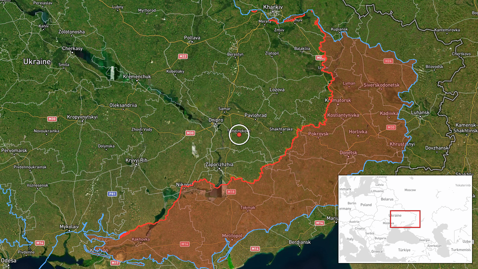
Ukraine's Air Force Telegram channel (@kpszsu) reported at about 07:32 UTC on 23 October 2026 that two or more jet-powered drones were moving through Synelnykove district in Dnipropetrovsk region, travelling in a northwest direction. The original Ukrainian post describes them as jet-powered UAVs, and the monitoring update does not identify a strike, impact site, or casualties. The system-generated summary identifies the aircraft as Russian Shahed-type drones of the Geran-3 variant, a classification that reflects the channel's jet-powered description rather than a separate confirmation. The report is a single-channel transit notice and was not corroborated by a second independent source at the time of logging.
Context and assessment
Synelnykove sits in the southeastern part of Dnipropetrovsk region, a corridor that Russian long-range drones have repeatedly crossed on routes toward the Dnipro city area and other central Ukrainian targets. The related events logged the same morning show a dense sequence of activity in this sector. Earlier on 22 October, two or more Geran-3 drones were reported passing Slavhorod heading west. Between 05:47 and 06:58 UTC on 23 October, several further jet-powered drone reports named Dnipro, and a Banderol mini cruise missile was reported heading toward Pavlohrad at 06:20. Taken together, these entries suggest a multi-axis raid or a sustained wave moving through the regional airspace rather than a single isolated flight. The northwest heading is consistent with drones either overflying toward the Dnipro area or continuing toward targets further north. Because transit reports describe only observed flight paths, the intended targets cannot be confirmed from these entries alone, and the pattern should be read as indicating coordinated air activity across the region.
Sources and confidence
This entry rests on one Telegram channel, the Ukrainian Air Force's official monitoring feed, which is generally regarded as an authoritative primary source for airspace alerts. The confidence score of 8.0 reflects that institutional origin and the specificity of the report, but it is held below the maximum because no second channel, radar-based outlet, or regional official corroborated the transit. Confidence would rise if independent monitoring accounts or local authorities confirmed the flight path, or if wreckage, impact, or air-defence engagement were reported nearby. It would fall if later updates revised the drone count, the direction, or the aircraft type.
Location
The location is placed at the settlement level for Synelnykove district, taken from the source's reference to the district rather than a specific village or facility, so the coordinates mark the approximate district centre. The area is flat steppe farmland on the Dnipropetrovsk plain, with river valleys, rail lines, and regional highways linking Synelnykove to Dnipro and Pavlohrad. The position is only approximate, and drones passing the district could have been over neighbouring communities.
Related events nearby
- Ukrainian air monitoring: 2+ Russian jet-powered Shahed (Geran-3) drones passing Slavhorod, heading west.2026-10-22 17:01 UTC · Drone Transit · Slavhorod, Ukraine
- Ukrainian air monitoring: 1 Russian Shahed-type drone from Dnipropetrovsk Oblast toward Pavlohrad.2026-10-23 08:25 UTC · Drone Transit · Pavlohrad, Ukraine
- Ukrainian air monitoring: 1 Russian Banderol mini cruise missile heading toward Pavlohrad.2026-10-23 06:20 UTC · Cruise Missile · Pavlohrad, Ukraine
- Ukrainian air monitoring: 1 Russian jet-powered Shahed (Geran-3) drone over Dnipro.2026-10-23 06:58 UTC · Drone Transit · Dnipro, Ukraine
- Ukrainian air monitoring: 1 Russian jet-powered Shahed (Geran-3) drone heading toward Dnipro.2026-10-23 06:44 UTC · Drone Transit · Dnipro, Ukraine
▶ View this event on the live map

Intel Mapper aggregates open-source reports from monitored Telegram and X channels, geolocates them, cross-checks duplicates across sources and assigns a confidence score. Entries are updated as new confirmations arrive. Read how we verify events.