Ukrainian air monitoring reports jet-powered Geran-3 drone heading toward Sarny, Rivne Oblast
What happened
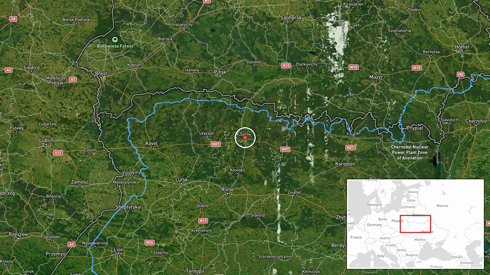
Ukrainian air monitoring, as posted on the Telegram channel @kpszsu, reported on 23 October 2026 at 09:36 UTC that one Russian jet-powered Shahed, designated Geran-3 in the report, was heading toward Sarny in Rivne Oblast, northwest Ukraine. The original post is a short Ukrainian-language alert, reading roughly as 'jet-powered UAV toward Sarny', with a motorcycle emoji used as an icon. The report does not give the drone's altitude, speed, or confirmed target, and it does not mention impacts, casualties, or damage. The alert is one of a series of transit notices from the same monitoring stream that morning and the evening before, in which a single drone was followed across several northern Ukrainian districts.
Context and assessment
Sarny is a rail and road junction in northern Rivne Oblast, close to the Belarusian border in the Polissia lowlands. Its significance here lies less in any fixed installation than in its position on routes linking northwestern Ukraine with central and western regions. Related reports in the same stream show a similar track. At 16:57 on 22 October a Geran-3 was reported heading toward Sarny, and at 00:54 on 23 October another was reported passing Sarny heading west. In between, the stream logged drones moving through Berezne and Kostopil, and at 09:18 and 09:24 drones were reported toward Kostopil and northern Rivne Oblast, the latter originating in northern Zhytomyr Oblast. Taken together, these notices suggest individual jet-powered drones entering from the north and routing through the Rivne region rather than a single coordinated strike package. Operationally, this could indicate routing toward targets further west, or transit by drones that could not be engaged over the area. The data alone cannot say which. Repeated notices over the same settlements may also reflect monitoring coverage concentrated along these corridors rather than the full drone flow.
Sources and confidence
Only one channel reported this item, the Telegram account @kpszsu, which is associated with Ukraine's Air Force air-monitoring reporting. Cross-confirmation is therefore absent at the time of writing. The confidence score of 8.0 reflects an official military source operating a continuous stream of related notices, offset by the single-source status and the lack of independent tracking data or imagery. Confidence would rise if a second national channel, a regional military administration, or an open-source flight tracker corroborated the trajectory, or if a later report confirmed the drone's arrival or interception. It would fall if subsequent updates contradicted the heading or if the alert were corrected.
Location
The point is set at settlement level, using the centre of Sarny, which is why location confidence is rated high. The report names the town itself rather than a facility, so the coordinates should be read as the community, not a specific site. Sarny sits in northern Rivne Oblast on the flat Polissia lowland, an area of forest, marshland and river valleys near the Belarusian frontier. The terrain offers little natural high ground, which is relevant to how aerial movement is tracked there.
Related events nearby
- Ukrainian air monitoring: 1 Russian jet-powered Shahed (Geran-3) drone passing Sarny, heading west.2026-10-23 00:54 UTC · Drone Transit · Sarny, Ukraine
- Ukrainian air monitoring: 1 Russian jet-powered Shahed (Geran-3) drone heading toward Sarny.2026-10-22 16:57 UTC · Drone Transit · Sarny, Ukraine
- Ukrainian air monitoring: 1 Russian jet-powered Shahed (Geran-3) drone from northern Zhytomyr Oblast toward no2026-10-23 09:24 UTC · Drone Transit · northern Rivne Oblast, Ukraine
- Ukrainian air monitoring: 1 Russian jet-powered Shahed (Geran-3) drone from Rivne Oblast toward Berezne.2026-10-23 07:55 UTC · Drone Transit · Berezne, Ukraine
- Ukrainian air monitoring reports a Russian jet-powered Shahed (Geran-3) drone heading toward Kostopil, Rivne O2026-10-23 09:18 UTC · Drone Transit · Kostopil, Rivne Oblast, Ukraine
▶ View this event on the live map

Intel Mapper aggregates open-source reports from monitored Telegram and X channels, geolocates them, cross-checks duplicates across sources and assigns a confidence score. Entries are updated as new confirmations arrive. Read how we verify events.