Ukrainian air monitoring tracks Russian Geran-3 drone heading toward Kostopil, Rivne Oblast
What happened
On 23 October 2026 at about 09:18 UTC, the Telegram channel @kpszsu, which relays Ukrainian air monitoring alerts, reported a single Russian jet-powered Shahed, known as Geran-3, heading toward Kostopil in Rivne Oblast, northwestern Ukraine. The original alert text, written in Ukrainian, reads "На Костопіль на Рівненщині", which translates roughly as "toward Kostopil in Rivne region." The report describes a drone in transit and does not state that it struck anything, caused damage, or produced casualties. The alert is a warning of an aerial track rather than a confirmed impact, and no follow-up report on the outcome appears in the data.
Context and assessment
Kostopil sits in northern Rivne Oblast, close to the Belarusian border and well inside Ukrainian territory away from the front line, so a drone heading there reflects deep-strike routing rather than tactical battlefield support. The related events show a sustained pattern on the same morning. Between 00:20 and 09:24 UTC, air monitoring logged several Geran-3 and Shahed-type drones moving through Zhytomyr, Rivne and Zaporizhzhia, with tracks converging on Rivne Oblast and later on Berezne and northern Rivne. Multiple drones on overlapping paths suggest a wave or sustained flight rather than a single isolated launch. The track from northern Zhytomyr toward northern Rivne at 09:24, shortly after the Kostopil alert, is consistent with a drone moving along the same corridor. Operationally, such routing may indicate an intent to stress regional air defence and early warning coverage, or to strike infrastructure in the northwest, but the data alone cannot confirm the intended target. Assessments of targeting should be treated as provisional.
Sources and confidence
The alert comes from a single Telegram channel, @kpszsu, and no second independent source is listed for this event, so cross-confirmation is absent. The confidence score of 8.0 is relatively high because the channel is an official-linked Ukrainian air monitoring feed, the drone type is specified, and the related events from the same morning share a consistent reporting style and timing. It is held below the maximum because the report is a single-channel track warning rather than confirmed impact, and because the origin is not recorded. Confidence would rise with corroboration from regional military administration statements, independent flight tracking, or reports of impact in Kostopil. It would fall if later alerts retracted or re-routed the track.
Location
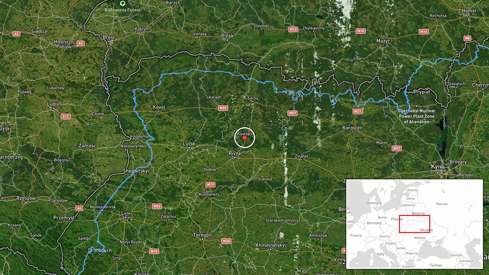
The location is recorded at settlement level for Kostopil in Rivne Oblast, with coordinates near 50.877 N, 26.448 E and high location confidence. The alert names the settlement directly, so the point marks the town rather than any specific facility, and the drone's exact final position is not given. Kostopil lies in the Polissia lowlands of northwestern Ukraine, an area of forests, marshland and rivers including the Horyn basin. The region is sparsely built up and relatively distant from the front, and the town is a regional centre in the Polissia zone.
Related events nearby
- Ukrainian air monitoring: 1 Russian jet-powered Shahed (Geran-3) drone from Rivne Oblast toward Berezne.2026-10-23 07:55 UTC · Drone Transit · Berezne, Ukraine
- Ukrainian air monitoring: 1 Russian jet-powered Shahed (Geran-3) drone heading toward Rivne Oblast.2026-10-23 00:39 UTC · Drone Transit · Rivne Oblast, Ukraine
- Ukrainian air monitoring: 1 Russian Shahed-type drone heading toward Rivne; 1 Russian Shahed-type drone passin2026-10-23 00:20 UTC · Drone Transit · Rivne, Ukraine
- Ukrainian air monitoring: 2+ Russian jet-powered Shahed (Geran-3) drones from Zhytomyr Oblast toward Rivne Obl2026-10-23 00:20 UTC · Drone Transit · Rivne Oblast, Ukraine
- Ukrainian air monitoring: 1 Russian jet-powered Shahed (Geran-3) drone from northern Zhytomyr Oblast toward no2026-10-23 09:24 UTC · Drone Transit · northern Rivne Oblast, Ukraine
▶ View this event on the live map

Intel Mapper aggregates open-source reports from monitored Telegram and X channels, geolocates them, cross-checks duplicates across sources and assigns a confidence score. Entries are updated as new confirmations arrive. Read how we verify events.