Russian cruise missiles strike residential areas in Pryluky, Chernihiv Oblast
What happened
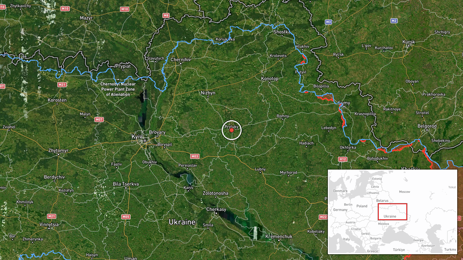
Russian cruise missiles targeted Pryluky in Chernihiv Oblast on the morning of 7 October 2026. Ukrainian air monitoring tracked multiple cruise missile groups converging on the city between 03:30 and 05:00 UTC, with at least one missile confirmed to have struck a residential building. The attack was reported by Telegram channel @supernova_plus. Related tracking data indicates at least three separate waves of cruise missiles passed over or approached Pryluky during the early morning hours.
Context and assessment
Pryluky is a significant infrastructure hub in northern Ukraine, home to military and energy facilities that have attracted repeated Russian strikes throughout the conflict. The 7 October attacks formed part of a broader Russian cruise and ballistic missile campaign that same morning, with strikes also reported against Kyiv's Trypillia power substation and ongoing missile activity toward Kremenchuk. The targeting pattern suggests a coordinated effort against Ukrainian civilian infrastructure and power generation capacity, consistent with Russia's strategy of degrading Ukraine's energy grid as winter approaches. The residential impact underscores the repeated civilian cost of such operations.
Sources and confidence
Single-source reporting via Telegram (@supernova_plus). Corroboration provided by contemporaneous Ukrainian air monitoring alerts (03:30–03:47 UTC) confirming multiple cruise missiles in the Pryluky area. Confidence of 6.0 reflects the single primary source for the strike confirmation itself, though the tracking data from official Ukrainian channels strengthens the overall picture of the attack sequence.
Location
Pryluky is located at approximately 50.60°N, 32.39°E in Chernihiv Oblast, northern Ukraine, roughly 280 kilometres northeast of Kyiv. The city sits on the Supiy River and historically served as a Soviet air base and industrial centre. Geographic precision is regional; the residential building struck was not pinpointed to a specific address.
Related events nearby
- Ukrainian air monitoring: 1 Russian cruise missile heading toward Pryluky; 1 Russian cruise missile heading to2026-10-07 03:52 UTC · Cruise Missile · Pryluky, Ukraine
- Ukrainian air monitoring: 2 Russian cruise missiles over Pryluky; 1 Russian cruise missile over Kremenchuk; 2 2026-10-07 03:47 UTC · Cruise Missile · Pryluky, Ukraine
- Ukrainian air monitoring: 1 Russian cruise missile heading toward Pryluky.2026-10-07 03:30 UTC · Cruise Missile · Pryluky, Ukraine
- Russian ballistic missiles targeted Kyiv with reported direct hits on Trypillia substation. Additionally, 13 R2026-10-07 00:44 UTC · Ballistic Missile · Trypillia Substation, Kyiv, Ukraine
- Ukrainian air monitoring: 1 Russian ballistic missile over Kyiv.2026-10-07 02:16 UTC · Ballistic Missile · Kyiv, Ukraine
▶ View this event on the live map
Intel Mapper aggregates open-source reports from monitored Telegram and X channels, geolocates them, cross-checks duplicates across sources and assigns a confidence score. Entries are updated as new confirmations arrive. Read how we verify events.