Russian Shahed-variant drone detected transiting toward Pereyaslav, Kyiv Oblast
What happened
A single Russian reactive (jet-powered) Shahed-type kamikaze drone was detected in flight toward Pereyaslav in central Kyiv Oblast on the morning of September 5, 2026, at approximately 04:43 UTC. The drone remained in transit at time of report with no impact or interception yet confirmed. The sighting was reported via Telegram channel @war_monitor.
Context and assessment
Pereyaslav lies roughly 70 kilometers southeast of Kyiv city and sits near major transport corridors and civilian infrastructure. This drone detection follows a broader pattern of Russian Shahed launches across Kyiv Oblast on September 4, with Ukrainian air defense recording 103 enemy drones intercepted overnight, approximately half of which were reactive jet-powered variants. A related transit sighting near Kozyn and Bilohorodka on September 4 suggests continued Russian air activity despite a declared ceasefire regime. The persistence of drone operations in this corridor indicates sustained Russian targeting of rear-area logistics and civilian targets despite stated military constraints.
Sources and confidence
Single-source report from Telegram channel @war_monitor with no cross-confirmation visible in available data. Confidence score of 6.0 reflects the single source and lack of Ukrainian air defense corroboration or impact confirmation. Score would rise with Ukrainian official air defense acknowledgment or documented interception; would lower if follow-up reports contradict the detection.
Location
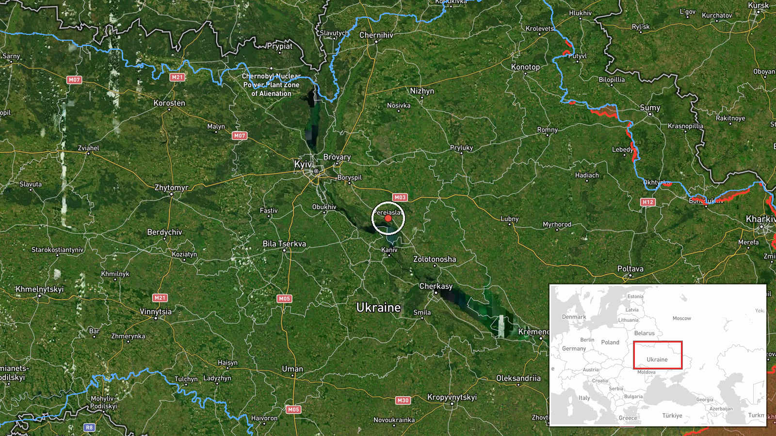
Pereyaslav is a major town in central Kyiv Oblast, located approximately 50.06°N, 31.44°E. It sits on the Dnipro River's left bank, southeast of Kyiv, along important north-south supply routes. Geo-precision rated high based on settlement-level identification. Nearby features include transport infrastructure and civilian population centers.
Related events nearby
- Russian FPV drone deployed net-based interdiction and shot down a Ukrainian Leleka-100 reconnaissance UAV duri2026-09-04 09:25 UTC · Drone Shootdown · Boryspil, Kyiv Oblast, Ukraine
- Russian Shahed-type kamikaze drones detected transiting Kyiv Oblast near Bilohorodka and Obukhiv sectors, head2026-09-04 10:19 UTC · Drone Transit · Kozyn, Kyiv Oblast, Ukraine
- Ukrainian military situation report as of 00:00 UTC 05 September 2026. Enemy declared ceasefire regime until 02026-09-04 21:05 UTC · Statement · Ukraine
- Ukrainian air defense shot down/suppressed 103 enemy drones overnight, including Shahed-type (about half react2026-09-04 07:53 UTC · Air Defense · Ukraine (National Air Defense)
- Ukrainian air monitoring reports all-clear for Kyiv region. No new drone launches detected; previous air alert2026-09-04 19:19 UTC · Siren · Kyiv Oblast, Ukraine
▶ View this event on the live map
Intel Mapper aggregates open-source reports from monitored Telegram and X channels, geolocates them, cross-checks duplicates across sources and assigns a confidence score. Entries are updated as new confirmations arrive. Read how we verify events.