Russian Shahed-136 drone detected transiting toward Brovary, Kyiv Oblast
What happened
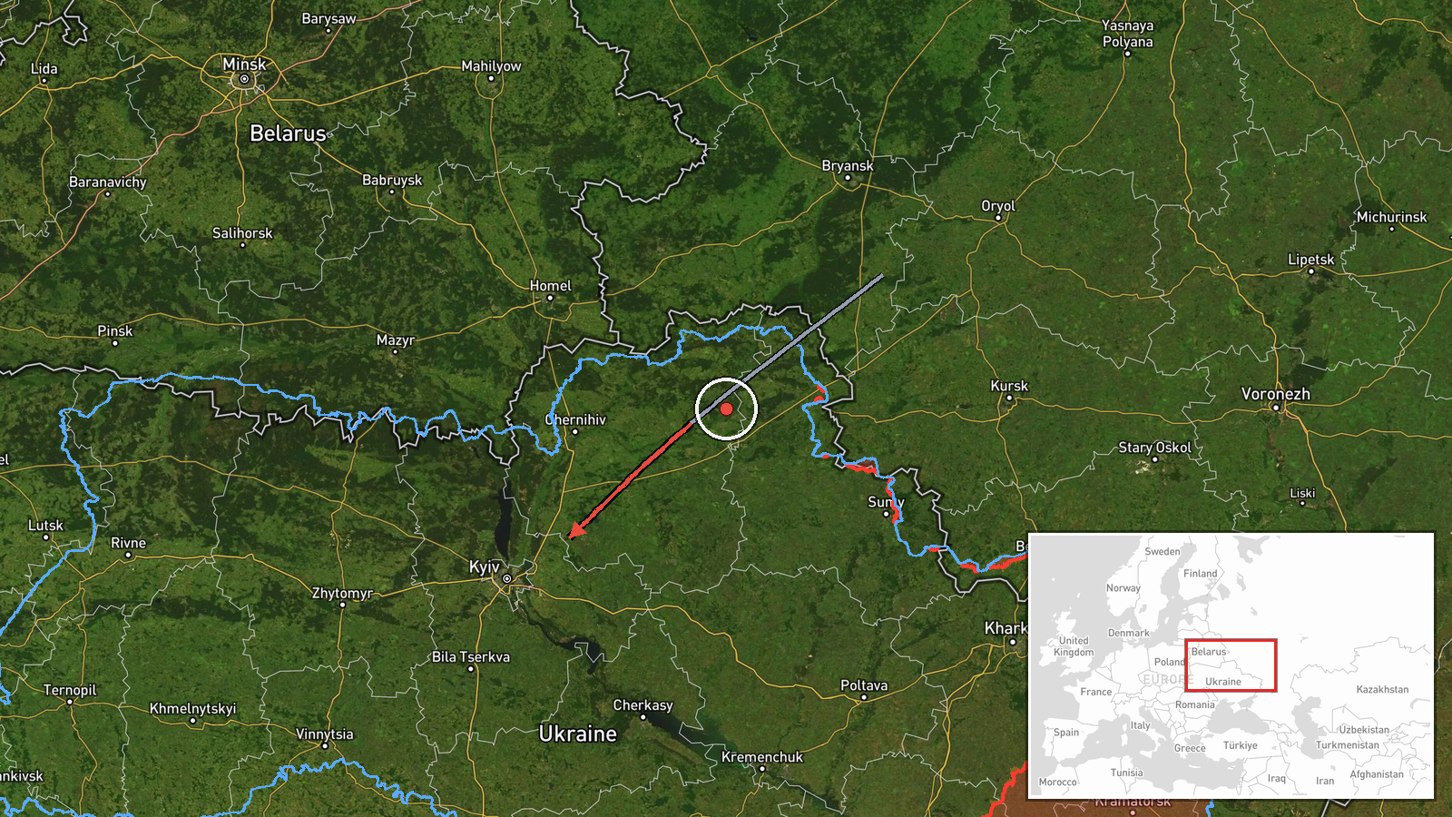
A single Russian reactive (jet-powered) Shahed-136 kamikaze drone was detected in transit toward Brovary, a northeastern suburb of Kyiv, on the morning of September 9, 2026. An air raid alert was issued following detection, though the report does not specify whether the drone was intercepted. The alert came as part of sustained Russian drone activity across Kyiv Oblast, with multiple vectors tracked over the preceding hours.
Context and assessment
Brovary lies approximately 25 kilometers northeast of central Kyiv and represents a recurring target area within Russia's ongoing campaign against the capital region. This single-drone detection follows a pattern of repeated Shahed-136 transit attempts documented throughout September 8–9, with Ukrainian air defenses reportedly intercepting 165 enemy drones and air-launched weapons overnight. The persistence of inbound vectors toward suburban settlements suggests Russia continues probing Kyiv's air defenses across multiple approach routes. Residential and industrial infrastructure in Brovary remain within typical engagement range for these loitering munitions.
Sources and confidence
Reported by Telegram channel @war_monitor on September 9, 2026, at 09:30 UTC. Single-source reporting with no cross-confirmation from other open channels, limiting confidence. Confidence score of 6.0 reflects the established pattern of similar detections and the timing alignment with broader air defense activity. Corroborating reports of wider drone activity that morning and the issuance of air raid alerts would raise confidence; independent confirmation of interception or impact would be necessary for higher certainty.
Location
Brovary is a large suburban settlement located 25 kilometers northeast of Kyiv's city center, situated in Kyiv Oblast along the eastern approaches to the capital. Geographically positioned on relatively flat terrain north of the Dnieper River, the settlement lies in a corridor frequently used for Russian drone transits. Coordinates: 50.51°N, 30.79°E.
Related events nearby
- Russian Shahed-136 kamikaze drones detected transiting Kyiv airspace. Three separate vectors tracked: 2x towar2026-09-08 17:27 UTC · Drone Transit · Brovary, Kyiv Oblast, Ukraine
- Russian Shahed-136 kamikaze drones detected transiting Kyiv Oblast. One drone tracked toward Krukivshchyna, on2026-09-08 16:34 UTC · Drone Transit · Kyiv Oblast, Ukraine
- Two reactive (jet-powered) Shahed-136 kamikaze drones detected transiting from Bobrovsky direction toward Kyiv2026-09-09 09:23 UTC · Drone Transit · Lyubychiv, Kyiv Oblast, Ukraine
- Air raid alert issued for Kyiv (Darnytskyy district). 'Реактив' (reactive/jet-powered UAV) detected, likely Sh2026-09-09 09:22 UTC · Siren · Darnytskyy District, Kyiv, Ukraine
- Ukrainian air defense forces intercepted 165 enemy drones and air-launched weapons overnight (Sept 8-9). Russi2026-09-09 09:15 UTC · Air Defense · Kyiv, Ukraine
▶ View this event on the live map
Intel Mapper aggregates open-source reports from monitored Telegram and X channels, geolocates them, cross-checks duplicates across sources and assigns a confidence score. Entries are updated as new confirmations arrive. Read how we verify events.