Russia launches Kh-35U cruise missiles toward Kherson Oblast
What happened
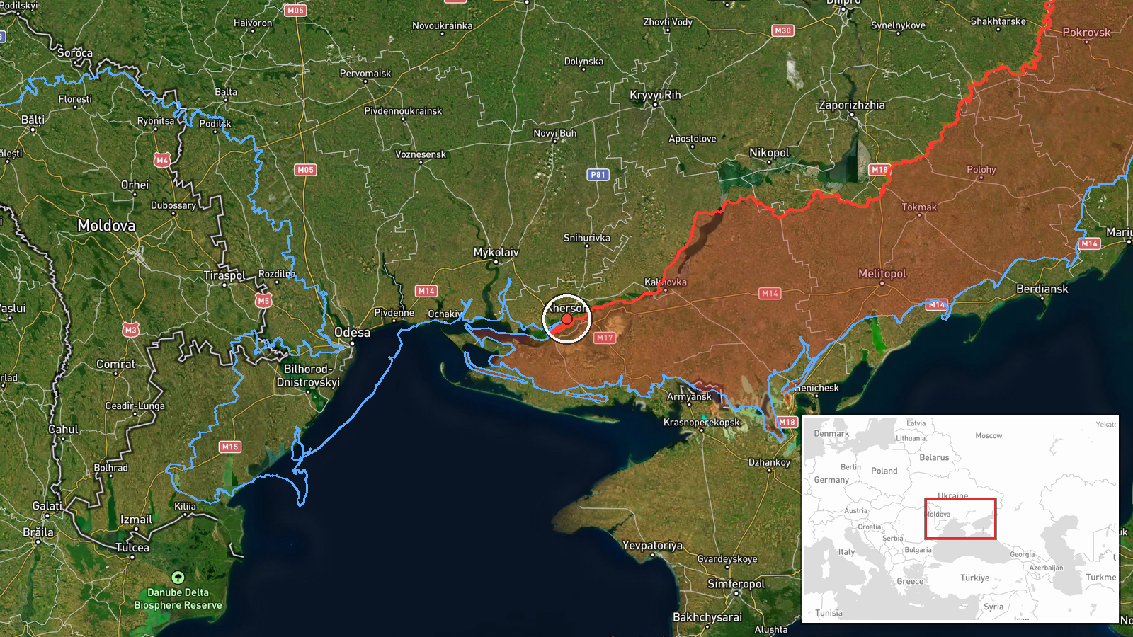
Russian forces conducted a strike using UMPB-5 (Kh-35U) cruise missiles directed at Kherson Oblast on September 9, 2026, at approximately 11:57 UTC, according to a report from the Telegram channel @war_monitor. The Kh-35U is a subsonic anti-ship cruise missile adapted for land targets. Specific impact assessment and damage details have not yet been confirmed. The strike occurred in the context of ongoing Russian air operations across Ukrainian-held territory.
Context and assessment
Kherson city and its surrounding oblast remain contested territory, with Ukraine maintaining control of the western bank while Russian forces hold positions to the east across the Dnipro River. Kherson has been a consistent target for Russian strikes throughout the conflict, including cruise missile, drone, and artillery attacks on civilian infrastructure and military positions. The timing of this strike follows a Ukrainian attack on a Russian signals intelligence facility in occupied Crimea earlier that morning, suggesting possible escalation in the operational tempo. Such cruise missile strikes typically target military installations, infrastructure, or supply lines, though Russian strikes in the region have frequently affected civilian areas.
Sources and confidence
The report originates from Telegram channel @war_monitor, a single source. No cross-confirmation from other open-source intelligence channels has been noted in the available data. The confidence score of 6.0 reflects the single-source reporting status. Confirmation would be strengthened by additional independent reports, satellite imagery showing strike impacts, or Ukrainian military official statements regarding the attack.
Location
Kherson city, located on the western bank of the Dnipro River in southern Ukraine at coordinates 46.64°N, 32.61°E. The city serves as the regional administrative center and remains under Ukrainian control. The geographic precision is regional rather than point-specific, indicating the strike direction was toward the city or surrounding oblast rather than a confirmed individual facility.
Related events nearby
- One reactive (jet-powered) Shahed-136 kamikaze drone detected transiting south of Mykolaiv. Ukrainian air defe2026-09-09 12:03 UTC · Drone Transit · South of Mykolaiv, Mykolaiv Oblast, Ukraine
- Russian forces launched UMPB-5 (Kh-35U) cruise missiles toward Mykolaiv Oblast. Attack details and impact conf2026-09-09 12:09 UTC · UAS Strike · Mykolaiv Oblast, Ukraine
- Ukrainian forces struck a radio-electronic reconnaissance antenna complex in temporarily occupied Olenivka, Cr2026-09-09 10:50 UTC · UAS Strike · Olenivka, Crimea, Russia-occupied Ukraine
- Three jet-powered Shahed-136 kamikaze drones detected transiting through Berezhivsky District, Odesa Oblast, h2026-09-09 13:13 UTC · Drone Transit · Berezhivsky District, Odesa Oblast, Ukraine
▶ View this event on the live map
Intel Mapper aggregates open-source reports from monitored Telegram and X channels, geolocates them, cross-checks duplicates across sources and assigns a confidence score. Entries are updated as new confirmations arrive. Read how we verify events.