Shahed-136 drone detected transiting south of Mykolaiv
What happened
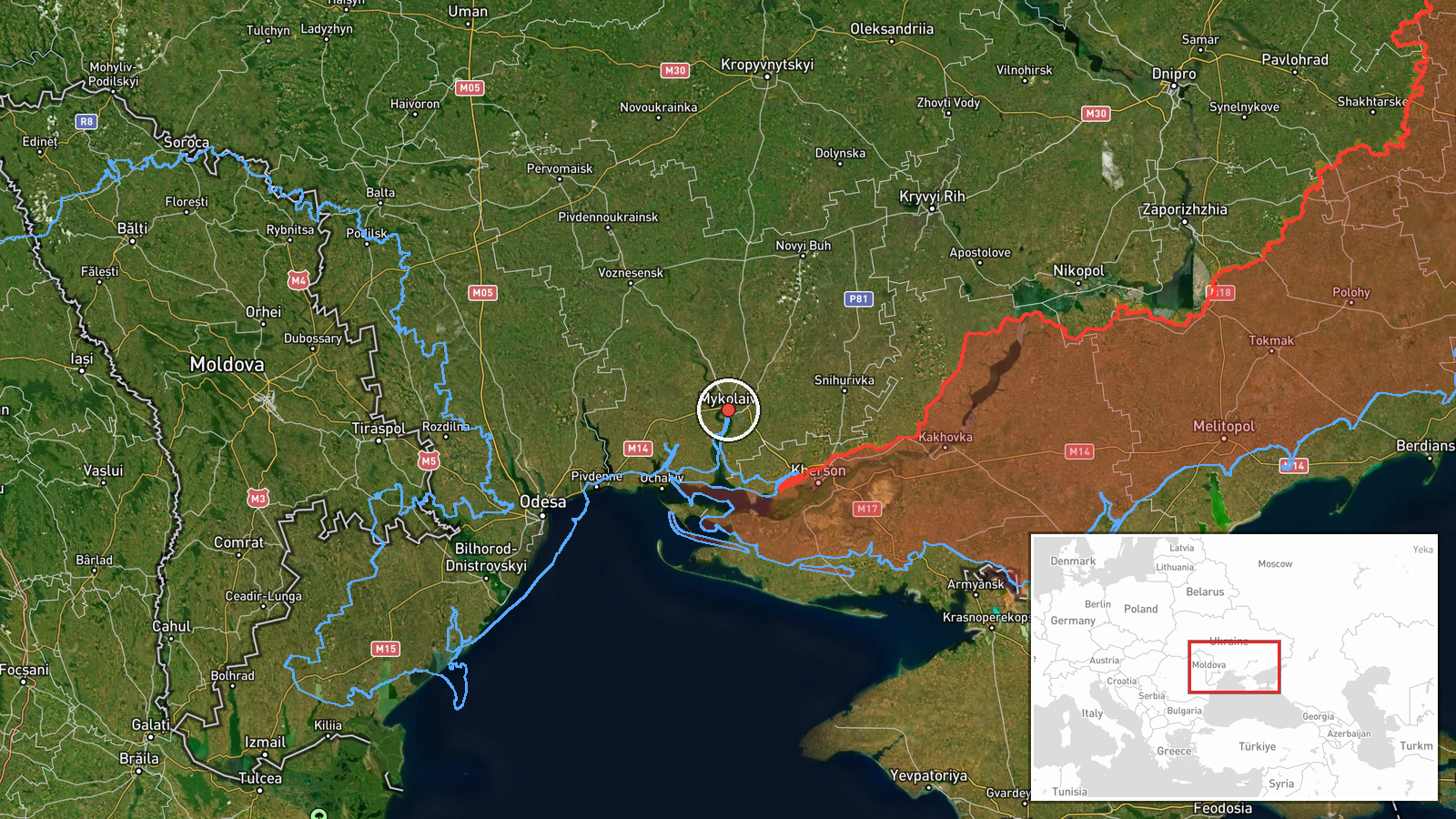
Ukrainian monitoring channels reported detection of one reactive (jet-powered) Shahed-136 kamikaze drone moving south of Mykolaiv city in Mykolaiv Oblast on September 9 at approximately 12:03 UTC. The report indicates the drone was in transit rather than conducting an active strike at the time of detection. Ukrainian air defense forces were noted as maintaining monitoring of the situation. No immediate impact assessment was provided in the initial report.
Context and assessment
The transit occurred amid a broader pattern of Russian aerial activity across southern Ukraine on the same date. Concurrent reports indicate cruise missile launches targeting both Mykolaiv and Kherson Oblasts within minutes of this drone detection, suggesting a coordinated multi-vector strike effort. Mykolaiv city remains a strategically significant target as a regional administrative center and logistics hub near the front lines. Shahed-136 drones typically serve as attrition weapons in Russian strike campaigns, often deployed alongside cruise missiles to saturate air defenses or exploit momentary gaps in coverage. The detection and tracking of individual unmanned systems reflects ongoing Ukrainian air defense monitoring capability.
Sources and confidence
Single source: Telegram channel @war_monitor. No corroborating reports from alternative channels or official Ukrainian military sources cited. Confidence score of 6.0 reflects limited source verification and the preliminary nature of a transit detection rather than confirmed impact. Confirmation from additional monitoring channels or official air defense statements would raise confidence; absence of follow-up reporting on intercept or impact would lower assessment reliability.
Location
Region-level precision, approximately 47.0°N, 32.0°E, south of Mykolaiv city in Mykolaiv Oblast. The location was determined from the channel's reference to positioning relative to Mykolaiv city rather than precise coordinates. The area lies in the Black Sea coastal plain region of southern Ukraine, north of the Kinburn Peninsula and west of the Dnipro River estuary.
Related events nearby
- Russian forces launched UMPB-5 (Kh-35U) cruise missiles toward Mykolaiv Oblast. Attack details and impact conf2026-09-09 12:09 UTC · UAS Strike · Mykolaiv Oblast, Ukraine
- Russian forces launched UMPB-5 (Kh-35U) cruise missiles toward Kherson Oblast. Attack type and impact details 2026-09-09 11:57 UTC · UAS Strike · Kherson city, Kherson Oblast, Ukraine
- Three jet-powered Shahed-136 kamikaze drones detected transiting through Berezhivsky District, Odesa Oblast, h2026-09-09 13:13 UTC · Drone Transit · Berezhivsky District, Odesa Oblast, Ukraine
▶ View this event on the live map
Intel Mapper aggregates open-source reports from monitored Telegram and X channels, geolocates them, cross-checks duplicates across sources and assigns a confidence score. Entries are updated as new confirmations arrive. Read how we verify events.