Russia launches Kh-35U cruise missiles toward Mykolaiv Oblast
What happened
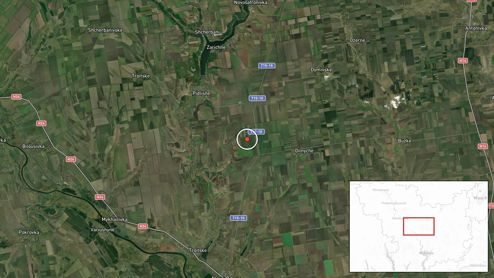
Russian forces reportedly launched UMPB-5 (Kh-35U) cruise missiles targeting Mykolaiv Oblast on September 9, 2026, at approximately 12:09 UTC. The report, posted in Ukrainian via the Telegram channel @war_monitor, does not specify the intended target within the oblast or confirm impact. The announcement came amid a broader pattern of Russian drone and missile activity across southern Ukraine that morning, including Shahed-136 transit south of Mykolaiv city minutes earlier and concurrent strikes on Kherson Oblast.
Context and assessment
Mykolaiv Oblast, positioned along Ukraine's southwestern frontier bordering Transnistria and the Black Sea, remains a persistent focus of Russian air operations. The oblast's administrative and economic infrastructure, along with potential military positions, have drawn repeated cruise missile and drone strikes throughout the conflict. Today's reported Kh-35U strike follows closely on a similar attack against Kherson Oblast and drone detection in the same region, suggesting a coordinated multi-vector air campaign targeting southern Ukraine's rear areas. The Kh-35U, a subsonic anti-ship cruise missile, indicates Russia may be targeting infrastructure near coastal or riverine areas, or adapting naval weapons for land targets given inventory constraints.
Sources and confidence
Single source: @war_monitor on Telegram. No independent cross-confirmation reported. Confidence score of 6.0 reflects the single-channel report and lack of Ukrainian air defense or official government confirmation. Score would increase with corroboration from Ukrainian military or air defense statements, photographic evidence, or reports from multiple independent channels. Score would decrease if subsequent reporting contradicts the strike occurrence or location.
Location
Mykolaiv Oblast, southern Ukraine, at approximate coordinates 47.43°N, 31.8°E. Precision marked as exact but without specification of the precise target settlement or facility. The oblast lies inland from the Black Sea coast and encompasses the major city of Mykolaiv approximately 60 kilometers northwest of the reported coordinates, and extends northward toward Kirovohrad Oblast.
Related events nearby
- One reactive (jet-powered) Shahed-136 kamikaze drone detected transiting south of Mykolaiv. Ukrainian air defe2026-09-09 12:03 UTC · Drone Transit · South of Mykolaiv, Mykolaiv Oblast, Ukraine
- Three jet-powered Shahed-136 kamikaze drones detected transiting through Berezhivsky District, Odesa Oblast, h2026-09-09 13:13 UTC · Drone Transit · Berezhivsky District, Odesa Oblast, Ukraine
- Russian forces launched UMPB-5 (Kh-35U) cruise missiles toward Kherson Oblast. Attack type and impact details 2026-09-09 11:57 UTC · UAS Strike · Kherson city, Kherson Oblast, Ukraine
▶ View this event on the live map
Intel Mapper aggregates open-source reports from monitored Telegram and X channels, geolocates them, cross-checks duplicates across sources and assigns a confidence score. Entries are updated as new confirmations arrive. Read how we verify events.