Russian Shahed-136 drone transits Desna River toward Liubychiv in Kyiv Oblast
What happened
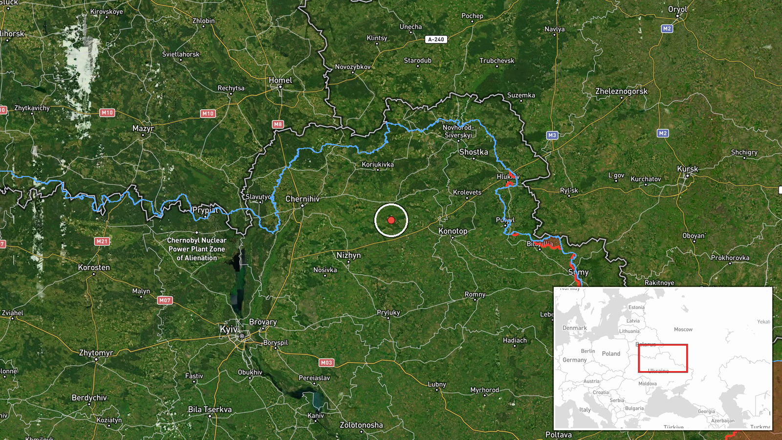
Ukrainian air defense detected one reactive jet-powered Shahed-136 kamikaze drone crossing the Desna River in Chernihiv Oblast on September 9 at approximately 13:01 UTC, heading in the direction of Liubychiv in Kyiv Oblast. The drone was tracked in transit; interception status was not reported. The detection was logged by war monitoring channels tracking Russian air operations over northern Ukraine.
Context and assessment
The Desna River crossing represents a northern approach vector into Kyiv Oblast, where Russian drone operations have intensified over recent days. On September 8, multiple Shahed-136 drones were detected transiting Kyiv airspace on multiple vectors, and on the same day a Geran-2 drone struck a Ukrainian FP-2 UAV launch facility, suggesting Russian targeting of Ukrainian drone infrastructure alongside continued strikes toward populated areas. The Liubychiv approach follows patterns of Russian unmanned operations attempting to penetrate Ukrainian air defenses from the north, consistent with sustained pressure on the capital region.
Sources and confidence
Single source: Telegram channel @war_monitor. Reported in Ukrainian, indicating local monitoring infrastructure. Single-source reporting limits confidence to 6.0; cross-confirmation from additional channels or official Ukrainian air defense statements would strengthen assessment. No contradicting reports noted.
Location
Desna River, northern Kyiv Oblast near Chernihiv Oblast border. The river marks a key geographic boundary and represents a standard transit corridor for Russian drones approaching Kyiv from the northeast. Liubychiv lies approximately 40 kilometers northeast of central Kyiv. Precision: regional-level based on river crossing identification and settlement reference.
Related events nearby
- Russian Shahed-136 kamikaze drones detected transiting Kyiv Oblast. One drone tracked toward Krukivshchyna, on2026-09-08 16:34 UTC · Drone Transit · Kyiv Oblast, Ukraine
- Russian Geran-2 kamikaze drone struck a Ukrainian FP-2 UAV launch facility. The attack targeted Ukrainian dron2026-09-09 00:37 UTC · UAS Strike · FP-2 UAV Launch Site, Kyiv Oblast, Ukraine
- One reactive (jet-powered) Shahed-136 kamikaze drone detected in transit toward Brovary, Kyiv Oblast. Air raid2026-09-09 09:30 UTC · Drone Transit · Brovary, Kyiv Oblast, Ukraine
- Russian Shahed-136 kamikaze drones detected transiting Kyiv airspace. Three separate vectors tracked: 2x towar2026-09-08 17:27 UTC · Drone Transit · Brovary, Kyiv Oblast, Ukraine
▶ View this event on the live map
Intel Mapper aggregates open-source reports from monitored Telegram and X channels, geolocates them, cross-checks duplicates across sources and assigns a confidence score. Entries are updated as new confirmations arrive. Read how we verify events.