Russian Shahed-136 drone detected transiting Zhytomyr Oblast toward Korostén
What happened
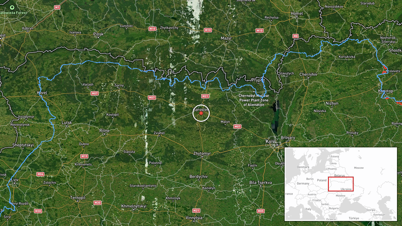
Ukrainian air defense monitoring detected one Russian Shahed-136 jet-powered kamikaze drone in transit through Zhytomyr Oblast in the direction of Korostén on September 10, 2026, at approximately 12:01 UTC. The drone was reportedly tracked by Ukrainian defenders. Korostén is a city in central-northern Ukraine located roughly 150 kilometers north-northwest of Kyiv. The report was published via Telegram by @war_monitor, a channel that provides real-time air defense monitoring updates.
Context and assessment
This drone detection occurs within an apparent multi-day Russian drone campaign across central Ukraine. Related reports from September 9–10 document Shahed-136 transits originating near Chornobyl and moving toward Kyiv Oblast, as well as separate detections near Teremky and Boryspil. Korostén has been periodically targeted or threatened over the conflict; the city sits on major transport corridors and infrastructure routes. The pattern suggests sustained Russian reconnaissance and attack drone operations, likely probing air defense density and seeking targets across Kyiv, Zhytomyr, and surrounding regions. Such transits may indicate preparation for strikes on civilian or military infrastructure, though the ultimate target and outcome of this particular drone sortie remain unreported.
Sources and confidence
Single source: Telegram channel @war_monitor. No cross-confirmation from other Ukrainian air defense monitoring accounts or official statements is noted in available data. Confidence scored 6.0 out of 10, reflecting limited corroboration. Confirmation from additional monitoring channels or official Ukrainian air force statements, or reports of interception, would strengthen confidence. Absence of follow-up reports on drone outcome lowers certainty regarding whether the drone was engaged or reached its intended target.
Location
Korostén is a settlement in Zhytomyr Oblast, central-northern Ukraine, situated approximately 150 kilometers north of Kyiv. The city lies along the Uzh River and serves as a regional transport hub. Geographic precision is rated high based on settlement-level identification. Nearby features include railway infrastructure and access routes toward Kyiv and northwestern Ukraine.
Related events nearby
- Ukrainian air defense monitoring detected multiple reactive (jet-powered) Shahed-136 kamikaze drones in transi2026-09-09 17:33 UTC · Drone Transit · En route: Chornobyl → Kyiv Oblast, Ukraine
- Russian Shahed-136 kamikaze drone detected transiting Kyiv Oblast near Teremky and Boryspil sector. Ongoing Ru2026-09-10 07:11 UTC · Drone Transit · Teremky, Kyiv, Ukraine
- Ukrainian air defense monitoring reports overnight threat assessment for Ukraine (night of 10 September 2026).2026-09-09 18:54 UTC · Siren · Kyiv, Ukraine
- Greek media Pentapostagma reports secret UAV technology cooperation agreement between Ukraine and Syria. Ukrai2026-09-10 07:40 UTC · Diplomacy · Kyiv, Ukraine
- Russian Shahed-136 kamikaze drones detected transiting Kyiv Oblast. Confirmed sightings: 1x near Koncha-Zaspa,2026-09-10 05:52 UTC · Drone Transit · Vasylkiv, Kyiv Oblast, Ukraine
▶ View this event on the live map
Intel Mapper aggregates open-source reports from monitored Telegram and X channels, geolocates them, cross-checks duplicates across sources and assigns a confidence score. Entries are updated as new confirmations arrive. Read how we verify events.