Russian jet-powered Shahed drone strikes Bozhdarivka in Dnipropetrovsk Oblast
What happened
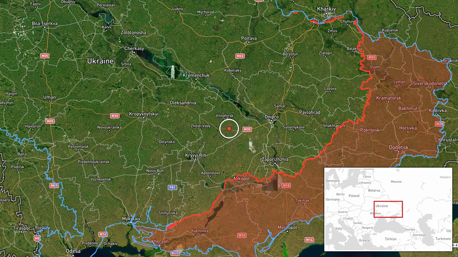
A Russian Shahed-class jet-powered (reactive) kamikaze drone, designated a 'Siker' variant, struck the Bozhdarivka sector in Dnipropetrovsk Oblast on 19 September at approximately 12:57 UTC. One drone was detected and reported by Ukrainian monitoring sources. The strike represents a confirmed impact after the drone transited through multiple eastern Ukrainian regions over the preceding 24 hours.
Context and assessment
Bozhdarivka lies in the Zaporizhzhia Oblast borderland region, an area of active Russian drone operations spanning multiple fronts. The strike follows a pattern of sustained Russian unmanned aerial operations detected across central and eastern Ukraine on 18–19 September, with reactive Shahed variants transiting through Poltava, Dnipropetrovsk, Zaporizhzhia, and Kirovohrad oblasts. Multiple drone transits detected on 18 September in Kremenchuk, Pavlohrad, and Zaporizhzhia suggest coordinated or dispersed attacks. The penetration to Bozhdarivka indicates either gaps in air defense coverage or deliberate targeting of infrastructure or military positions in the region.
Sources and confidence
Reported by Telegram channel @war_monitor on 19 September. Single-source reporting; no cross-confirmation from other Ukrainian official channels documented. Confidence score reflects confirmed strike status and consistent terminology with previous regional drone detections, but lack of secondary verification limits rating. Confirmation by regional military administration or additional independent channels would strengthen confidence.
Location
Bozhdarivka is a settlement in the borderland zone of Dnipropetrovsk Oblast near Zaporizhzhia Oblast, located at approximately 48.36°N, 34.12°E. The settlement sits in the flat steppe terrain of the Dnipro basin, roughly 15–20 km northwest of the Zaporizhzhia conflict zone. No specific facility details provided; impact location precision is settlement-level.
Related events nearby
- One Russian Shahed-class jet-powered (reactive) UAV variant designated 'Siker' continued transiting through Ka2026-09-19 02:53 UTC · Drone Transit · Dnipro (Kamyanske sector), Dnipropetrovsk Oblast,
- One Russian reactive (jet-powered Shahed-136) drone detected transiting over Zaporizhzhia city. Ukrainian air 2026-09-18 15:02 UTC · Drone Transit · Zaporizhzhia, Zaporizhzhia Oblast, Ukraine
- Russian ballistic missile strikes reported against Zaporizhzhia Oblast. Specific impact sites and casualty fig2026-09-19 14:00 UTC · Ballistic Missile · Zaporizhzhia Oblast, Ukraine
- Five Russian reactive (jet-powered Shahed-136) drones detected transiting eastward through Poltava Oblast (Pav2026-09-18 14:12 UTC · Drone Transit · Kremenchuk, Poltava Oblast, Ukraine
- Ukrainian air defense monitoring detected 1 Russian reactive (jet-powered Shahed-136) drone transiting over Pa2026-09-18 18:04 UTC · Drone Transit · Pavlohrad, Dnipropetrovska Oblast, Ukraine
▶ View this event on the live map
Intel Mapper aggregates open-source reports from monitored Telegram and X channels, geolocates them, cross-checks duplicates across sources and assigns a confidence score. Entries are updated as new confirmations arrive. Read how we verify events.