Russian Shahed drone intercepted en route to Slavutych in Kyiv Oblast
What happened
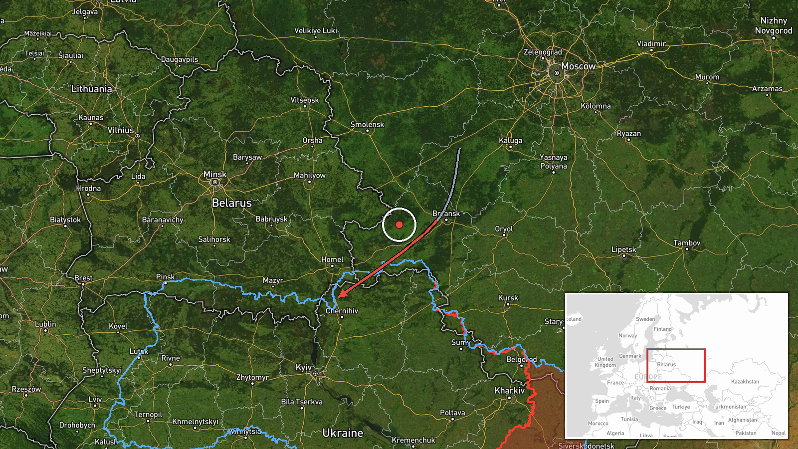
A Russian jet-powered Shahed-class kamikaze drone was detected transiting from Bryansk Oblast toward Slavutych, a settlement in Kyiv Oblast, on 19 September at 13:22 UTC. Ukrainian air defense reportedly intercepted and shot down the drone before it reached its target. The engagement occurred in the Makariv sector according to the monitoring report.
Context and assessment
Slavutych lies approximately 50 kilometers northeast of Kyiv and hosts the Chornobyl Nuclear Power Plant administrative facilities, making it a strategically sensitive location. This interception is part of a sustained pattern of Russian drone strikes originating from Bryansk and Oryol Oblasts, with related transit events reported on 18 September across Chernihiv and Kyiv Oblasts targeting the Kyiv Reservoir, Nizhyn, and Bobrovytsia. The repeated routing through this corridor suggests Russia is maintaining pressure on infrastructure and civilian areas across northern Ukraine despite Ukrainian air defense responses.
Sources and confidence
Single source: Telegram channel @war_monitor. No cross-confirmation from other open channels reported. Confidence score of 6.0 reflects limited source diversity; would increase with corroboration from Ukrainian official air force statements or secondary monitoring channels. Score would lower if interception claim cannot be independently verified.
Location
Slavutych settlement, Kyiv Oblast, located approximately 50 km northeast of Kyiv city center near the administrative complex of Chornobyl Nuclear Power Plant. Coordinates place it in the northern periphery of Kyiv Oblast. High precision confidence based on settlement-level identification.
Related events nearby
- Ukrainian air defense monitoring detected 3 Russian reactive (jet-powered Shahed-136 variant) drones in transi2026-09-18 18:54 UTC · Drone Transit · Chernihiv Oblast, Ukraine
- Ukrainian air defense monitoring confirms Russian drone/projectile transit profile matching earlier reports. V2026-09-18 16:35 UTC · Drone Transit · Nizhyn, Chernihiv Oblast, Ukraine
- Russian ballistic missile or long-range projectile detected descending toward Nizhyn. Ukrainian air defense mo2026-09-18 16:28 UTC · Drone Transit · Nizhyn, Chernihiv Oblast, Ukraine
- Russian ballistic missile descent detected over Bobrovytsia, beyond Kyiv direction. Ukrainian air defense moni2026-09-18 16:34 UTC · Ballistic Missile · Bobrovytsia, Chernihiv Oblast, Ukraine
- Ukraine's Defence Minister Yevhen Khmara announced approval of expanded long-range operations in response to R2026-09-19 12:46 UTC · Statement · Kyiv, Kyiv Oblast, Ukraine
▶ View this event on the live map
Intel Mapper aggregates open-source reports from monitored Telegram and X channels, geolocates them, cross-checks duplicates across sources and assigns a confidence score. Entries are updated as new confirmations arrive. Read how we verify events.