Russian Shahed drones detected transiting over Mirhhorod, Poltava Oblast
What happened
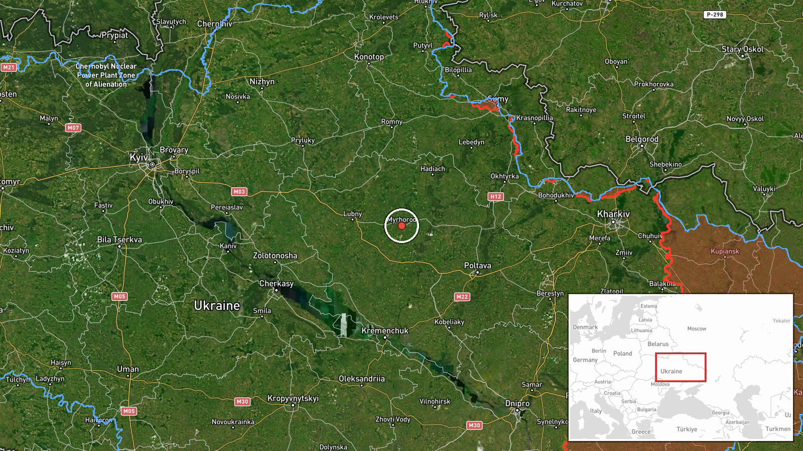
Ukrainian air monitoring systems detected two Russian Shahed-variant unmanned aerial vehicles, identified as jet-engined reactive drones, passing over Mirhhorod in Poltava Oblast on the morning of 24 September at approximately 03:38 UTC. A separate alert was issued for drone activity in the Kremenchuk sector. The report comes from Ukrainian air defence monitoring channels tracking Russian drone operations across eastern Ukraine.
Context and assessment
Mirhhorod sits in central Poltava Oblast, a region that has experienced sustained Russian drone operations throughout 2026. This transit detection occurs as part of a broader pattern: earlier the same morning, Ukrainian monitors tracked 15 Shahed drones over Kharkiv Oblast, and approximately one hour later, five additional Shahed variants were observed transiting from the Lubny-Pyriatyn area toward Cherkasy Oblast. The frequency and routing of these detections suggest Russian drone operations are targeting multiple sectors across eastern and central Ukraine simultaneously, possibly coordinating strikes or reconnaissance missions across dispersed objectives.
Sources and confidence
Single source report via Telegram channel @war_monitor, which aggregates Ukrainian air alert data. Confidence score of 6.0 reflects the inherent limitations of single-source reporting and the region-level precision of the location data. Confirmation through additional independent channels or official Ukrainian military statements would raise confidence. Direct damage assessment or attack outcome reporting would also strengthen the analysis.
Location
Mirhhorod is a city in central Poltava Oblast, approximately 280 kilometres southeast of Kyiv. The location was determined at regional precision level. The city lies in relatively flat terrain characteristic of central Ukraine, with the Khorol River passing nearby. The broader Poltava region contains significant Soviet-era industrial infrastructure and transportation nodes.
Related events nearby
- Ukrainian air monitoring detected 15 Russian reactive (jet-engined) Shahed variant UAVs transiting over Kharki2026-09-24 00:13 UTC · Drone Transit · Poltava Oblast, Ukraine
- Ukrainian air monitoring detects 5 Russian reactive (jet-engined) Shahed-variant UAVs transiting from Poltava 2026-09-24 02:38 UTC · Drone Transit · Zolotonosha, Cherkasy Oblast, Ukraine
▶ View this event on the live map
Intel Mapper aggregates open-source reports from monitored Telegram and X channels, geolocates them, cross-checks duplicates across sources and assigns a confidence score. Entries are updated as new confirmations arrive. Read how we verify events.