Russian Shahed-136 drone transits Kirovohrad Oblast without reported impacts
What happened
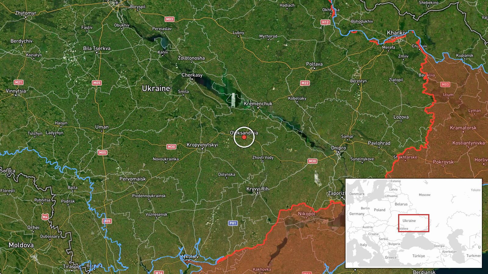
Ukrainian air monitoring detected one Russian Shahed-136 attack drone passing over Oleksandriia in Kirovohrad Oblast on 30 September at 03:05 UTC. No impacts or interceptions were reported at the time of notification. The drone continued in transit; surveillance remained ongoing. The report originates from the Telegram channel @war_monitor, which tracks Ukrainian air defense and drone activity.
Context and assessment
Kirovohrad Oblast lies in central Ukraine and has seen periodic drone transits as Russian forces conduct strikes across Ukrainian territory. This sighting occurred within a broader pattern of Russian drone activity detected over 29–30 September, with multiple Shahed-136 transits reported over Poltava, Cherkasy, and Dnipropetrovsk Oblasts during the same period. Such transits often indicate either attempts to reach strategic targets in western or central Ukraine or probing of air defenses. The concentration of reports across multiple oblasts suggests a coordinated or sustained campaign, though individual transit reports without confirmed impacts provide limited operational insight.
Sources and confidence
Reported solely by @war_monitor on Telegram. Single-source reporting lowers confidence. No cross-confirmation from Ukrainian General Staff, regional military administrations, or independent monitors is noted in available data. Confidence score of 6.0 reflects the source's established track record in air monitoring but the absence of corroboration. Independent verification or official statement would raise confidence; retraction or contradicting reports would lower it.
Location
Oleksandriia is a city in Kirovohrad Oblast, central Ukraine, located at approximately 48.67°N, 33.12°E. The oblast is a major agricultural region situated between Dnipropetrovsk Oblast to the east and Cherkasy Oblast to the north, roughly 200 km south of Kyiv. Geo precision is regional; the exact flight path or interception point remains unspecified.
Related events nearby
- Ukrainian air monitoring reports 3 Russian reactive drones (Shahed variants) transiting over Poltava Oblast to2026-09-29 18:38 UTC · Drone Transit · Poltava Oblast to Cherkasy Oblast, Ukraine
- Ukrainian air monitoring confirms 1 Russian Shahed-136 reactive drone transiting over Kremenchuk, Poltava Obla2026-09-30 00:49 UTC · Drone Transit · Kremenchuk, Poltava Oblast, Ukraine
- Ukrainian air monitoring confirms 1 Russian Shahed-136 reactive drone transiting over Cherkasy, Cherkasy Oblas2026-09-30 03:05 UTC · Drone Transit · Cherkasy, Cherkasy Oblast, Ukraine
- Ukrainian air monitoring detected 2× Russian Shahed-136 reactive kamikaze drones transiting over Berestin towa2026-09-29 08:50 UTC · Drone Transit · Dniprovskyi District, Dnipropetrovsk Oblast, Ukrai
- Ukrainian 3rd Army Corps reports territorial gains under Operation Vivaldi. Ukrainian General Staff documents 2026-09-29 21:40 UTC · Report · Ukraine (Multiple Fronts)
▶ View this event on the live map
Intel Mapper aggregates open-source reports from monitored Telegram and X channels, geolocates them, cross-checks duplicates across sources and assigns a confidence score. Entries are updated as new confirmations arrive. Read how we verify events.