Russian Shahed drone detected over Obukhiv south of Kyiv
What happened
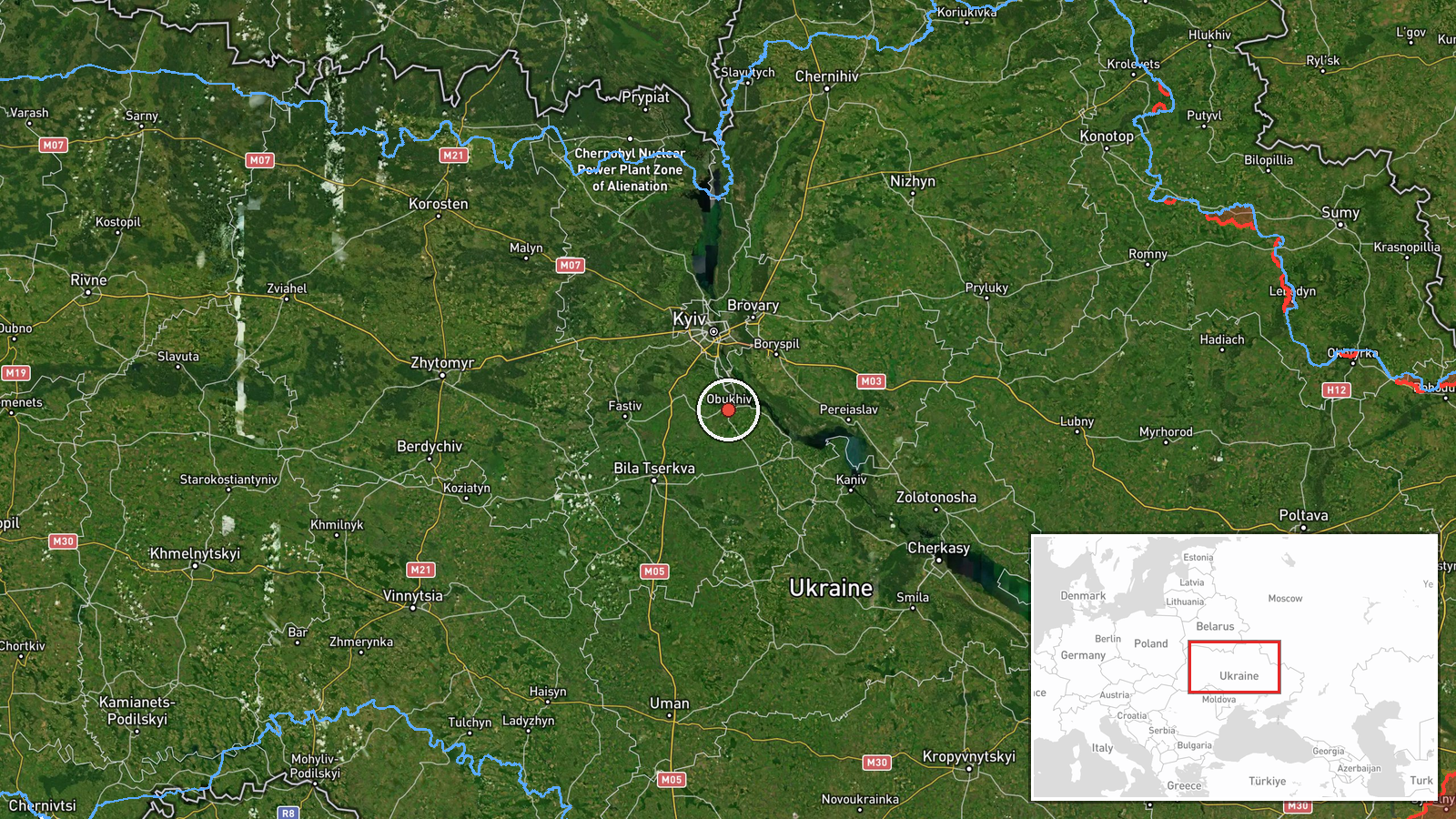
Ukrainian air monitoring reported detection of a Russian Shahed-type kamikaze drone over Obukhiv, a settlement approximately 30 kilometers south of central Kyiv, on 1 October at 17:08 UTC. The detection was logged by the Telegram channel @war_monitor, which aggregates Ukrainian air defence reports. The drone's intended target and final outcome were not specified in the report.
Context and assessment
Obukhiv sits on a main southbound approach corridor to Kyiv and lies near the Kyiv Reservoir, a significant geographic feature in the regional logistics network. The detection occurred during an intensive wave of Russian drone activity across the Kyiv region on the same date, with simultaneous or near-simultaneous Shahed transits reported over Hnidyn, Bortnychi, Nova Zabudova, Lisnyky, and toward central Kyiv itself. This pattern suggests a coordinated multi-vector strike or transit operation typical of Russian deep-strike campaigns against the capital, in which decoys and multiple attack vectors are used to complicate Ukrainian air defence response.
Sources and confidence
Single source: Telegram channel @war_monitor, which curates Ukrainian state air monitoring feeds. No cross-confirmation from independent observers or alternative channels reported. Confidence score of 6.0 reflects the single-source constraint and lack of visual or secondary verification, balanced against the source's consistent alignment with official Ukrainian air defence reporting.
Location
Obukhiv, a settlement in Kyiv Oblast, lies at approximately 50.11°N, 30.62°E, roughly 30 km south-southeast of central Kyiv. The town is situated between the Dnieper River and the Kyiv Reservoir. Location precision is classified as settlement-level, determined through standard Ukrainian administrative boundaries and air monitoring grid references.
Related events nearby
- Russian Shahed-type kamikaze drone detected transiting from Pyrohiv toward Lisnyky (Ukrainian air monitoring).2026-10-01 17:55 UTC · Drone Transit · Lisnyky, Ukraine
- Russian Shahed-type kamikaze drone detected over Hnidyn (Ukrainian air monitoring).2026-10-01 17:08 UTC · Drone Transit · Hnidyn, Ukraine
- Russian Shahed-type kamikaze drone detected over Bortnychi (Ukrainian air monitoring).2026-10-01 17:07 UTC · Drone Transit · Bortnychi, Ukraine
- Russian Shahed-136 reactive (jet-engine) kamikaze drone detected transiting from Pirogovo through Lisnyky dist2026-10-01 17:54 UTC · Drone Transit · Telychka, Ukraine
- Russian Shahed-type kamikaze drone detected over Nova Zabudova (Ukrainian air monitoring).2026-10-01 15:28 UTC · Drone Transit · Nova Zabudova, Ukraine
▶ View this event on the live map
Intel Mapper aggregates open-source reports from monitored Telegram and X channels, geolocates them, cross-checks duplicates across sources and assigns a confidence score. Entries are updated as new confirmations arrive. Read how we verify events.