Russian Kh-101 cruise missile tracked toward Kremenchuk in early October strike
What happened
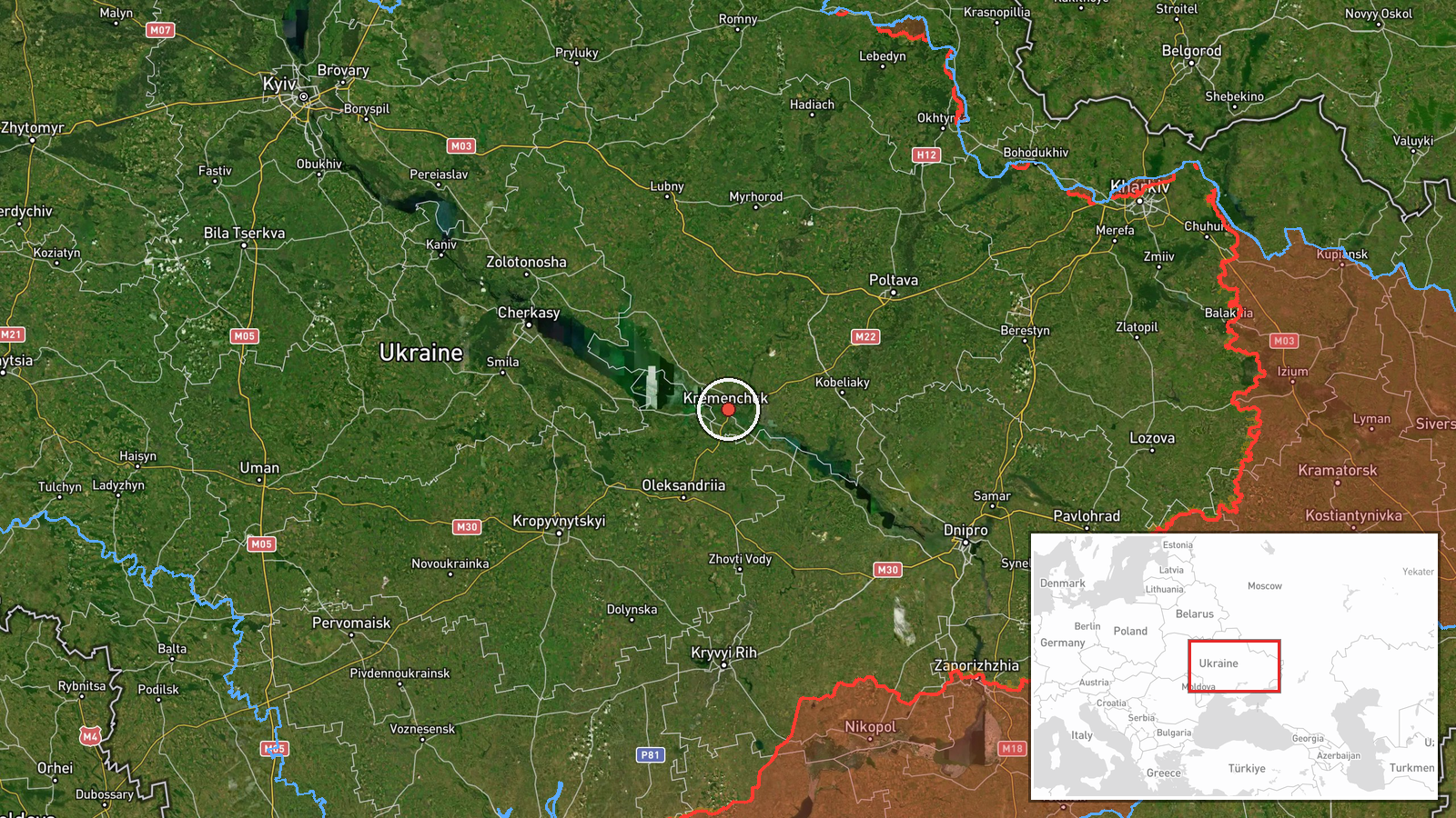
Ukrainian air monitoring reported a single Russian Kh-101 cruise missile heading toward Kremenchuk on the morning of October 7, 2026, at 03:03 UTC. The missile was detected entering the air defense sector covering the city. Related reports from the same monitoring channel tracked the weapon's progression across Ukrainian airspace, with subsequent detections at 03:09 and 03:14 UTC as it passed near Poltava en route to its reported target.
Context and assessment
Kremenchuk, a major industrial city in central Ukraine with a population of over 200,000, has been repeatedly targeted throughout the conflict due to its strategic importance and industrial capacity. The strike appears part of a sustained Russian air campaign; related events from the same date show additional cruise missile activity targeting the city, including Kalibr variants approaching from the southeast, as well as ballistic missile activity detected over Kyiv earlier that evening. This pattern suggests a coordinated multi-vector strike operation. Kremenchuk's infrastructure, particularly its refinery and manufacturing facilities, remain operationally significant targets for Russian long-range strikes.
Sources and confidence
Single source: Telegram channel @war_monitor, which provides real-time Ukrainian air defense monitoring data. The channel's repeated, time-sequenced detections of the same missile across multiple reports provide internal corroboration of the tracking. However, the single-source nature means no independent cross-confirmation is available. Confidence score reflects Ukrainian official monitoring capability but limited external verification of impact or final outcome.
Location
Kremenchuk is a major city in Poltava Oblast in central Ukraine, located approximately 330 kilometers south of Kyiv on the Dnipro River. The settlement is a regional industrial and transport hub. Detection precision is at settlement level (approximately 49.07°N, 33.42°E). Nearby cities include Poltava to the north and Dnipro to the south.
Related events nearby
- Ukrainian air monitoring: 1 Russian cruise missile heading toward Kremenchuk; 1 Russian cruise missile passing2026-10-07 03:30 UTC · Cruise Missile · Kremenchuk, Ukraine
- Ukrainian air monitoring: 1 Russian Kh-101 cruise missile passing Poltava, heading toward Kremenchuk.2026-10-07 03:30 UTC · Cruise Missile · Kremenchuk, Ukraine
- Ukrainian air monitoring: 1 Russian Kh-101 cruise missile passing Poltava, heading toward Kremenchuk.2026-10-07 03:14 UTC · Cruise Missile · Kremenchuk, Ukraine
- Ukrainian air monitoring: 1 Russian Kh-101 cruise missile passing Poltava, heading toward Kremenchuk.2026-10-07 03:09 UTC · Cruise Missile · Kremenchuk, Ukraine
- Ukrainian air monitoring: 1 Russian Kh-101 cruise missile heading toward Kremenchuk.2026-10-07 02:58 UTC · Cruise Missile · Kremenchuk, Ukraine
▶ View this event on the live map
Intel Mapper aggregates open-source reports from monitored Telegram and X channels, geolocates them, cross-checks duplicates across sources and assigns a confidence score. Entries are updated as new confirmations arrive. Read how we verify events.