Russian cruise missiles tracked toward Kremenchuk in multi-wave strike
What happened
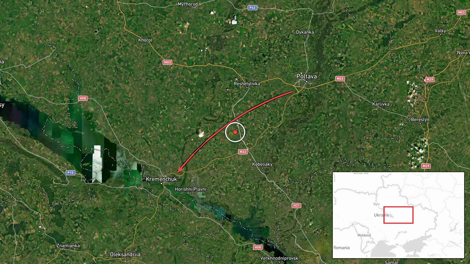
Ukrainian air monitoring reported multiple Russian cruise missiles in flight toward Kremenchuk and Kremenchuk district on October 7, 2026, at approximately 03:30 UTC. The report indicated three cruise missile groups heading toward Kremenchuk and four groups passing over Poltava region in the same direction. Related observations from the preceding 27 minutes show repeated Kh-101 cruise missile detections on similar flight paths, suggesting a coordinated multi-wave strike operation.
Context and assessment
Kremenchuk, an industrial city in central Poltava Oblast, has been a recurring target of Russian missile strikes throughout the conflict, particularly its petroleum refinery and manufacturing facilities. The city's location on the Dnipro River and its transport infrastructure make it strategically significant. The reported strike follows the pattern of Russian nighttime cruise missile campaigns targeting Ukrainian energy and industrial capacity. Multiple groups detected over a short timespan suggest Russia may be attempting to overwhelm air defenses through saturation, a tactic increasingly employed in recent months. The concentration of successive detections indicates sustained pressure on this sector.
Sources and confidence
Single source: Telegram channel @war_monitor, which provides Ukrainian air monitoring data. No cross-confirmation from independent sources or Ukrainian military statements provided. Confidence score of 6.0 reflects single-source reporting of real-time air monitoring, which typically has high reliability but limited independent verification. Additional confirmation from Ukrainian air defense statements or damage reports would substantially increase confidence.
Location
Kremenchuk settlement (49.07°N, 33.42°E) in Poltava Oblast, central Ukraine. Located approximately 350 kilometers east of Kyiv on the Dnipro River. The city is a significant industrial center and transportation hub. Related detections also reference Poltava region to the north along the missile flight path.
Related events nearby
- Ukrainian air monitoring: 1 Russian Kh-101 cruise missile passing Poltava, heading toward Kremenchuk.2026-10-07 03:30 UTC · Cruise Missile · Kremenchuk, Ukraine
- Ukrainian air monitoring: 1 Russian Kh-101 cruise missile passing Poltava, heading toward Kremenchuk.2026-10-07 03:14 UTC · Cruise Missile · Kremenchuk, Ukraine
- Ukrainian air monitoring: 1 Russian Kh-101 cruise missile passing Poltava, heading toward Kremenchuk.2026-10-07 03:09 UTC · Cruise Missile · Kremenchuk, Ukraine
- Ukrainian air monitoring: 1 Russian Kh-101 cruise missile heading toward Kremenchuk.2026-10-07 03:03 UTC · Cruise Missile · Kremenchuk, Ukraine
- Ukrainian air monitoring: 1 Russian Kh-101 cruise missile heading toward Kremenchuk.2026-10-07 02:58 UTC · Cruise Missile · Kremenchuk, Ukraine
▶ View this event on the live map
Intel Mapper aggregates open-source reports from monitored Telegram and X channels, geolocates them, cross-checks duplicates across sources and assigns a confidence score. Entries are updated as new confirmations arrive. Read how we verify events.