Russian Kh-101 cruise missile tracked toward Oleksandriya in central Ukraine
What happened
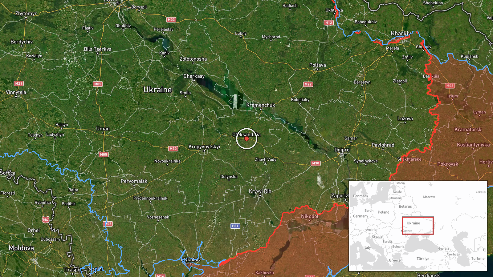
Ukrainian air monitoring channels reported a Russian Kh-101 cruise missile heading toward Oleksandriya in Kirovohrad Oblast on October 7 at 03:30 UTC. The missile was detected as part of a broader cruise missile strike across central Ukraine, with simultaneous reports of other Kh-101 and Kalibr missiles targeting Kremenchuk and passing over Poltava. The report originates from the Telegram channel @war_monitor, which tracks Ukrainian air defense alerts.
Context and assessment
Oleksandriya, an industrial city in central Ukraine with a population of roughly 100,000, has been a recurring target in Russian cruise missile campaigns. The October 7 strike appears coordinated, with multiple missiles from different launch corridors converging on separate targets—Kremenchuk and Oleksandriya—within the same operational window. This pattern reflects Russia's continued strategy of striking civilian and industrial infrastructure across Ukraine's heartland using standoff cruise missiles. The concentration of Kh-101 strikes on this date suggests a sustained effort to degrade Ukrainian logistics and civilian morale, consistent with recent months of similar strikes across the central regions.
Sources and confidence
Report sourced solely from Telegram channel @war_monitor, a Ukrainian air monitoring account. No cross-confirmation from independent or Western sources is noted. Confidence score of 6.0 reflects single-source reporting; the information aligns with known Ukrainian air defense practices and the pattern of related cruise missile detections on the same date, which increases plausibility. Confirmation from Ukrainian official sources or post-strike damage assessment would substantially raise confidence.
Location
Oleksandriya is a city in Kirovohrad Oblast in central Ukraine, approximately 290 kilometers southeast of Kyiv. Located at 48.67°N, 33.12°E, it sits near the Inhul River in a region characterized by steppe terrain and industrial facilities. The city is a known transportation hub and has hosted Soviet-era munitions and chemical plants, making it strategically relevant to logistics networks.
Related events nearby
- Ukrainian air monitoring: 1 Russian cruise missile heading toward Oleksandriya.2026-10-07 03:52 UTC · Cruise Missile · Oleksandriya, Ukraine
- Ukrainian air monitoring: 1 Russian Kalibr cruise missile passing Kamyanske, heading toward Kremenchuk; 1 Russ2026-10-07 01:50 UTC · Cruise Missile · Kremenchuk, Ukraine
- Ukrainian air monitoring: 1 Russian cruise missile heading toward Kremenchuk; 1 Russian cruise missile passing2026-10-07 03:30 UTC · Cruise Missile · Kremenchuk, Ukraine
- Ukrainian air monitoring: 1 Russian Kh-101 cruise missile passing Poltava, heading toward Kremenchuk.2026-10-07 03:30 UTC · Cruise Missile · Kremenchuk, Ukraine
- Ukrainian air monitoring: 1 Russian Kh-101 cruise missile passing Poltava, heading toward Kremenchuk.2026-10-07 03:14 UTC · Cruise Missile · Kremenchuk, Ukraine
▶ View this event on the live map
Intel Mapper aggregates open-source reports from monitored Telegram and X channels, geolocates them, cross-checks duplicates across sources and assigns a confidence score. Entries are updated as new confirmations arrive. Read how we verify events.