Russian Shahed drones detected over Poltava Oblast during multi-vector strike wave
What happened
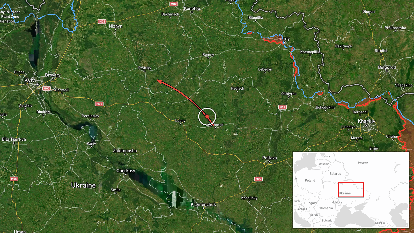
Ukrainian air monitoring reported the detection of Russian Shahed-type unmanned aerial vehicles over Poltava Oblast on the morning of 7 October 2026. One drone was tracked over Poltava city itself, while a second was observed passing near Myrhorod and heading toward Pryluky to the northeast. The detections occurred at 03:36 UTC as part of a broader Russian air operation targeting the region.
Context and assessment
Poltava Oblast has emerged as a consistent target in Russian strike operations, particularly its industrial and infrastructure nodes. The detection of Shahed drones over Poltava follows closely on cruise missile activity in the same timeframe, with Kh-101s detected heading toward both Poltava and Kremenchuk earlier that morning. This pattern suggests a coordinated multi-vector attack employing different munition types across the oblast. Shahed drones typically serve roles in reconnaissance, terminal strike, or attrition missions. The northeastern routing toward Pryluky may indicate targeting of military or logistical assets in that direction, though Ukrainian air monitoring does not specify intended targets.
Sources and confidence
Reported by Telegram channel @war_monitor, a widely cited open-source intelligence source for Ukrainian air defense notifications. Single-source reporting limits independent verification. Confidence score of 6.0 reflects the source's general reliability in air monitoring but lack of corroborating reports from other channels. Confirmation by Ukrainian official defense sources or follow-up damage reports would strengthen confidence.
Location
Poltava city and the broader Poltava Oblast, central Ukraine. The detections span from Poltava proper eastward through Myrhorod toward Pryluky, covering approximately 80 kilometers of airspace. Poltava lies on the Vorskla River; Kremenchuk, also targeted in the same operation, sits further south on the Dnieper.
Related events nearby
- Ukrainian air monitoring: 1 Russian Kh-101 cruise missile heading toward Poltava district.2026-10-07 02:53 UTC · Cruise Missile · Poltava district, Ukraine
- Ongoing Russian ballistic missile strikes continue against Kyiv. Multiple ballistic threats detected over the 2026-10-07 00:33 UTC · Ballistic Missile · Kremenchuk, Poltava Oblast, Ukraine
- Ukrainian air monitoring: 1 Russian cruise missile heading toward Kremenchuk; 1 Russian cruise missile passing2026-10-07 03:30 UTC · Cruise Missile · Kremenchuk, Ukraine
- Ukrainian air monitoring: 1 Russian Kh-101 cruise missile passing Poltava, heading toward Kremenchuk.2026-10-07 03:30 UTC · Cruise Missile · Kremenchuk, Ukraine
- Ukrainian air monitoring: 1 Russian Kh-101 cruise missile passing Poltava, heading toward Kremenchuk.2026-10-07 03:14 UTC · Cruise Missile · Kremenchuk, Ukraine
▶ View this event on the live map
Intel Mapper aggregates open-source reports from monitored Telegram and X channels, geolocates them, cross-checks duplicates across sources and assigns a confidence score. Entries are updated as new confirmations arrive. Read how we verify events.