Russian ballistic missile strikes residential building in Pryluky, Chernihiv Oblast
What happened
A Russian ballistic missile struck a five-story residential building in Pryluky, Chernihiv Oblast on the morning of October 7, according to reports from Suspilne's correspondent at the scene. Ukrainian officials reported five people killed and 26 wounded in the strike. Emergency services were actively working at the site to extract people from the rubble. President Zelensky characterized the attack as Putin's 'birthday gift' to the Russian military, connecting it to a broader campaign of strikes across Ukraine.
Context and assessment
Pryluky, a city in northern Chernihiv Oblast roughly 200 kilometers from the Russian border, hosts military and infrastructure facilities that have made it a recurring target. The October 7 strike followed an intensive Russian air campaign that morning, with multiple cruise and ballistic missiles tracked heading toward Pryluky between 03:30 and 07:31 UTC, alongside simultaneous strikes on Kyiv's power infrastructure and Kremenchuk. The pattern suggests a coordinated, multi-axis strike operation targeting both military logistics hubs and civilian infrastructure to degrade Ukrainian resilience and morale. Residential targeting in populated areas indicates either deliberate targeting or indiscriminate use of unguided or inaccurate weapons.
Sources and confidence
Reported by Telegram channel @war_monitor and X account @ConflictTR, citing Suspilne correspondent reporting from the scene. Cross-confirmation between two independent channels supports basic facts of the strike. Confidence score of 6.0 reflects corroboration of impact and casualties but limited independent verification of exact death toll. Confirmation by Ukrainian air monitoring of incoming missiles toward Pryluky strengthens timeline plausibility. Video verification or additional international media presence would increase confidence.
Location
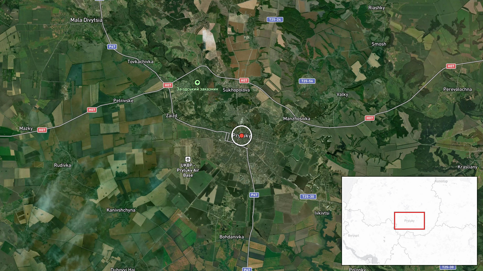
Pryluky is located in north-central Chernihiv Oblast at approximately 50.60°N, 32.39°E. The city sits on the Supiy River in Ukraine's northern region, roughly 180 kilometers north of Kyiv and 200 kilometers from the Russian border. Pryluky is known to host military logistics and maintenance facilities, making it strategically significant in Russian targeting patterns.
Related events nearby
- Ukrainian air monitoring: 1 Russian cruise missile heading toward Pryluky; 1 Russian cruise missile heading to2026-10-07 03:52 UTC · Cruise Missile · Pryluky, Ukraine
- Ukrainian air monitoring: 2 Russian cruise missiles over Pryluky; 1 Russian cruise missile over Kremenchuk; 2 2026-10-07 03:47 UTC · Cruise Missile · Pryluky, Ukraine
- Ukrainian air monitoring: 1 Russian cruise missile heading toward Pryluky.2026-10-07 03:30 UTC · Cruise Missile · Pryluky, Ukraine
- Russian ballistic missiles targeted Kyiv with reported direct hits on Trypillia substation. Additionally, 13 R2026-10-07 00:44 UTC · Ballistic Missile · Trypillia Substation, Kyiv, Ukraine
- Ukrainian air monitoring: 1 Russian ballistic missile over Kyiv.2026-10-07 02:16 UTC · Ballistic Missile · Kyiv, Ukraine
▶ View this event on the live map
Intel Mapper aggregates open-source reports from monitored Telegram and X channels, geolocates them, cross-checks duplicates across sources and assigns a confidence score. Entries are updated as new confirmations arrive. Read how we verify events.