Russian Shahed drones tracked over Kyiv region; one jet-powered variant near Vasylkiv
What happened
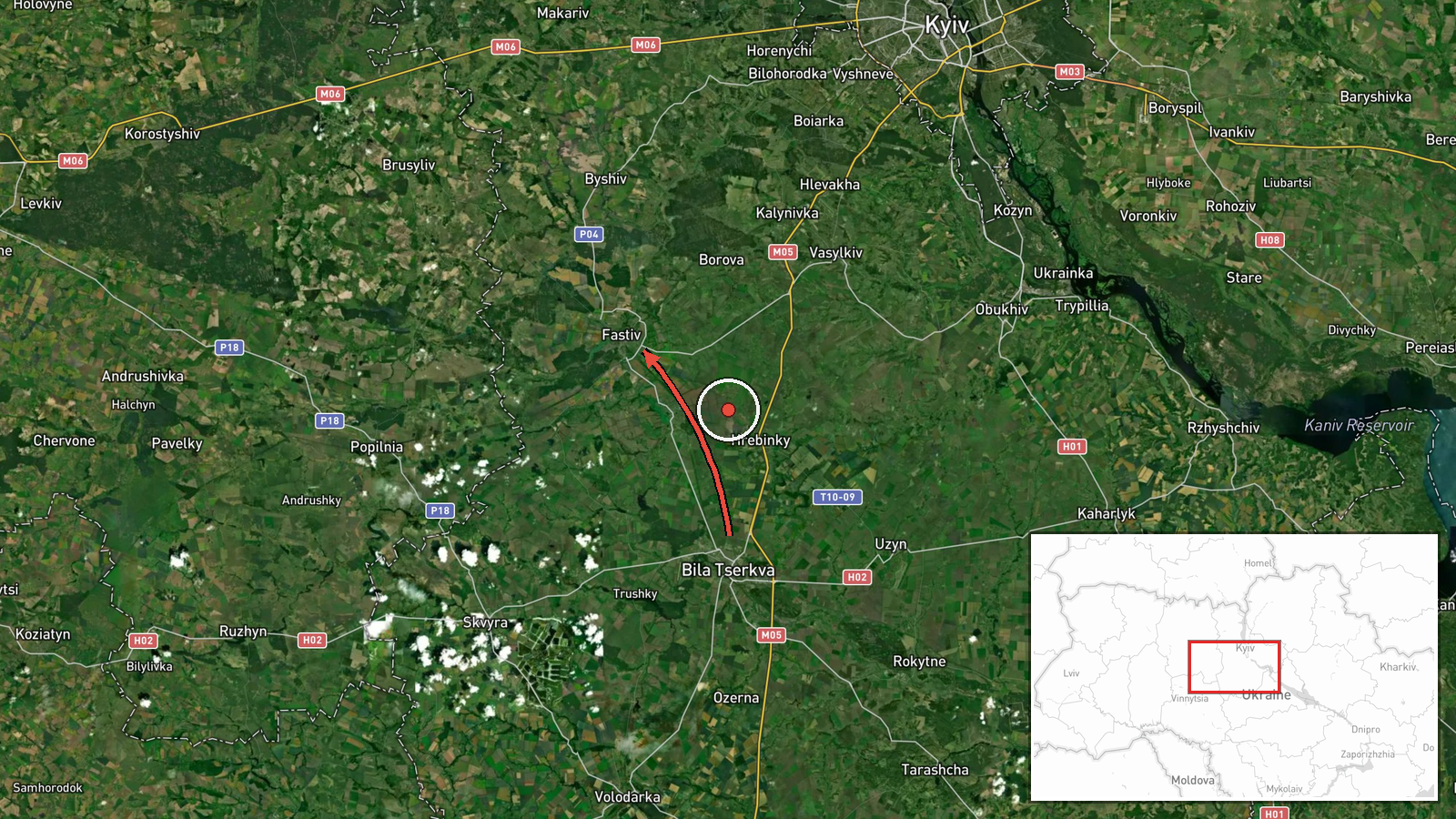
Ukrainian air monitoring reported one jet-powered Shahed (Geran-3) drone operating over Vasylkiv and the nearby Hlevakha area on the morning of 8 October. A separate Shahed-type drone was tracked passing south of Bila Tserkva on a trajectory toward Fastiv. The reports came from the Telegram channel @war_monitor at approximately 12:55 UTC, following earlier sightings of similar drones across the Kyiv region throughout the day.
Context and assessment
Vasylkiv lies approximately 40 kilometers south of Kyiv and hosts strategically significant infrastructure including an air base and fuel storage facilities. The sustained drone activity across the greater Kyiv region on 8 October—with sightings reported from Obukhiv, Korchuvate, Borshchahivka, and Fastiv—suggests a coordinated or distributed strike operation targeting multiple areas. The jet-powered Geran-3 variant, reportedly a modified Iranian Shahed design with greater range, indicates Russian intent to strike targets deeper within Ukrainian-held territory. The southwesterly trajectory toward Fastiv may indicate targeting of industrial or military assets in that direction, though intentions remain unclear from air monitoring reports alone.
Sources and confidence
Single source: Telegram channel @war_monitor, which monitors Ukrainian air defense announcements and drone tracking. Confidence score of 6.0 reflects single-source reporting without cross-confirmation from Ukrainian official channels or independent verification. Score would increase with corroboration from additional monitoring channels or official statements; would decrease if subsequent events contradict the reported flight paths.
Location
Vasylkiv is a city in Kyiv Oblast approximately 40 kilometers southwest of Kyiv city center, situated near the Stugna River. Bila Tserkva lies further southwest; Fastiv is approximately 90 kilometers southwest of Kyiv. The reported drone transits tracked movement across multiple settlements in a southwest vector across the Kyiv region.
Related events nearby
- Ukrainian air monitoring: 1 Russian jet-powered Shahed (Geran-3) drone circling over Obukhiv.2026-10-08 05:06 UTC · Drone Transit · Obukhiv, Ukraine
- Ukrainian air monitoring: 1 Russian Shahed-type drone over Korchuvate, Kyiv.2026-10-08 06:16 UTC · Drone Transit · Korchuvate, Kyiv, Ukraine
- Ukrainian air monitoring: 1 Russian Shahed-type drone in terminal descent over Borshchahivka, Kyiv.2026-10-08 09:17 UTC · Drone Transit · Borshchahivka, Kyiv, Ukraine
- Ukrainian air monitoring: 1 Russian Shahed-type drone over Borshchahivka, Kyiv.2026-10-08 09:17 UTC · Drone Transit · Borshchahivka, Kyiv, Ukraine
- Ukrainian air monitoring: 1 Russian jet-powered Shahed (Geran-3) drone passing Bila Tserkva, heading toward Fa2026-10-08 12:37 UTC · Drone Transit · Fastiv, Ukraine
▶ View this event on the live map
Intel Mapper aggregates open-source reports from monitored Telegram and X channels, geolocates them, cross-checks duplicates across sources and assigns a confidence score. Entries are updated as new confirmations arrive. Read how we verify events.