Russian Shahed drones tracked south of Kyiv and toward Vasylkiv
What happened
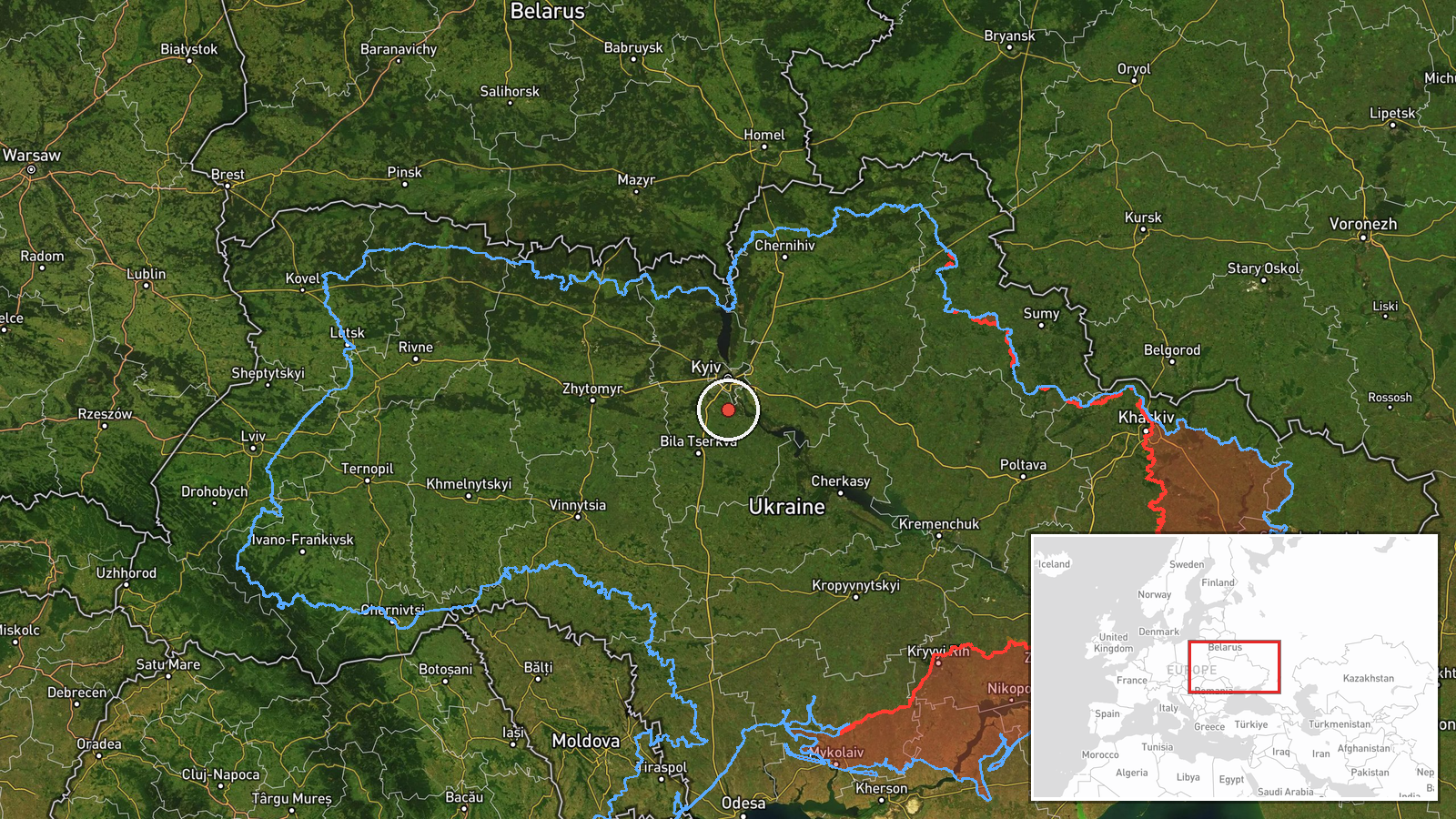
Ukrainian air monitoring reported two Russian Shahed-type drones in the Kyiv region on October 9 at 09:13 UTC. One drone was detected south of Kyiv; a second was reported heading toward Vasylkiv from an unspecified starting point. The report comes from @war_monitor on Telegram, a channel that provides real-time Ukrainian air defense tracking. No immediate impact or interception was noted in the report.
Context and assessment
Vasylkiv, located approximately 40 km south of Kyiv, hosts critical infrastructure including an air base and oil refinery, making it a recurring target. The detected drones continue a pattern of sustained Russian unmanned aircraft activity over the greater Kyiv region throughout October 9, with multiple Shahed variants—including the longer-range Geran-3 model—tracked over Vasylkiv, Obukhiv, and surrounding areas since midnight. The frequency and repetition suggest either reconnaissance missions, attempts to saturate air defenses, or coordination with planned strikes. Such drone activity typically precedes or accompanies larger attack waves.
Sources and confidence
Single source: @war_monitor on Telegram, a widely-followed Ukrainian air monitoring channel. No independent cross-confirmation from other trackers or official statements is noted. Confidence score of 6.0 reflects sole-source reporting and regional-level geographic precision. Cross-confirmation from official Ukrainian air force statements or multiple independent monitoring accounts would strengthen confidence.
Location
South of Kyiv, Ukraine, at approximately 50.18°N, 30.52°E (regional precision). The second drone was reported heading toward Vasylkiv, a city 40 km south of the capital in Kyiv Oblast, known for military and industrial facilities. The region is flat steppe terrain with scattered settlements and Soviet-era infrastructure.
Related events nearby
- Ukrainian air monitoring: 1 Russian Shahed-type drone circling over Obukhiv.2026-10-09 04:56 UTC · Drone Transit · Obukhiv, Ukraine
- Ukrainian air monitoring: 1 Russian jet-powered Shahed (Geran-3) drone over Vasylkiv.2026-10-09 04:44 UTC · Drone Transit · Vasylkiv, Ukraine
- Ukrainian air monitoring: 1 Russian jet-powered Shahed (Geran-3) drone over Vasylkiv.2026-10-09 00:42 UTC · Drone Transit · Vasylkiv, Ukraine
- Ukrainian air monitoring: 1 Russian jet-powered Shahed (Geran-3) drone over Vasylkiv; 1 Russian Shahed-type dr2026-10-08 12:55 UTC · Drone Transit · Vasylkiv, Ukraine
- Ukrainian air monitoring: 1 Russian Shahed-type drone over Chabany; 1 Russian Shahed-type drone over Vasylkiv.2026-10-09 09:16 UTC · Drone Transit · Chabany, Ukraine
▶ View this event on the live map

Intel Mapper aggregates open-source reports from monitored Telegram and X channels, geolocates them, cross-checks duplicates across sources and assigns a confidence score. Entries are updated as new confirmations arrive. Read how we verify events.