Hezbollah expands control in southern Lebanon by approximately 65 square kilometers
What happened
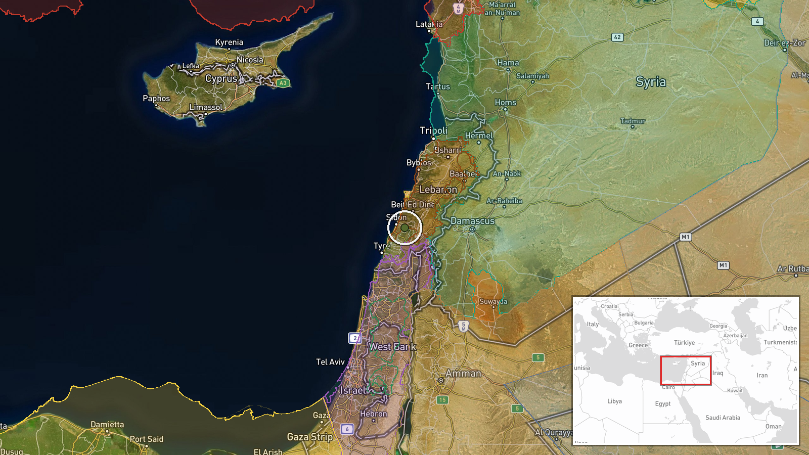
According to a conflict control map update, Hezbollah forces have expanded their territorial control in the Liban-Sud (South Lebanon) region by roughly 65 square kilometers as of 6 October 2026. The expansion was recorded on a Wiki-maintained conflict control map, which tracks shifting frontlines and zone control across active conflict areas. The timing and specific tactical circumstances of this expansion are not detailed in the available report.
Context and assessment
Southern Lebanon has been a zone of contested influence and military activity for decades, with Hezbollah maintaining significant presence there. This reported expansion occurs within a broader pattern of heightened Israeli-Hezbollah tensions in early October 2026, evidenced by concurrent Israeli military incursions into neighboring Syrian territory (Quneitra and rural Damascus), IDF warnings of imminent military activity across northern Israel, and statements from Hezbollah officials regarding international peacekeeping arrangements. The timing suggests possible correlation with wider regional escalation, though direct causal links remain unclear. Such territorial shifts typically indicate either military advances, repositioning of forces, or changes in de facto administrative control following armed confrontations.
Sources and confidence
Single source: Wiki-maintained conflict control map, which aggregates open-source geographic intelligence. The low source count and single-channel reporting substantially limits confidence. Cross-confirmation from independent military analysts, satellite imagery assessments, or statements from Lebanese government sources would strengthen assessment reliability. Confidence score of 7.5 reflects the credibility of conflict mapping platforms but acknowledges dependence on a sole reporting channel.
Location
Liban-Sud (South Lebanon), a region encompassing the southern portion of Lebanon bordering Israel. Coordinates place the report center at approximately 33.53°N, 35.48°E. Southern Lebanon is geographically characterized by hilly terrain sloping toward Israel's northern border. Precision is regional rather than site-specific, indicating the expansion spans multiple locations rather than a single defined facility or settlement.
Related events nearby
- Over two days, Israeli forces conducted multiple incursions, gunfire exchanges, and military movements in Qune2026-10-05 15:54 UTC · Combat · Tel Abu Qubis, Quneitra Countryside, Syria
- IDF warns of imminent military activity across northern Israel. Explosions may be heard over Western Galilee, 2026-10-05 09:14 UTC · Siren · Western Galilee, Upper Galilee, Hula Valley, Ramim
- Hezbollah MP Hassan Ezz ad-Din calls for UNIFIL to extend deployment beyond 2026 withdrawal deadline, warning 2026-10-05 14:16 UTC · Statement · Beirut, Lebanon
- Israeli occupation forces detonated an abandoned building in agricultural lands between Bayt Jan village and B2026-10-05 06:49 UTC · Combat · Bayt Cin, Rif Dimashq Governorate, Syria
- Israeli forces conducted an airstrike targeting a civilian vehicle in Bayt Jan village, Rif Dimashq (Damascus 2026-10-05 12:14 UTC · Airstrike · Bayt Jan, Rif Dimashq, Syria
▶ View this event on the live map
Intel Mapper aggregates open-source reports from monitored Telegram and X channels, geolocates them, cross-checks duplicates across sources and assigns a confidence score. Entries are updated as new confirmations arrive. Read how we verify events.