Israel expands control by ~15 km² in southern Lebanon's Nabatîyé region
What happened
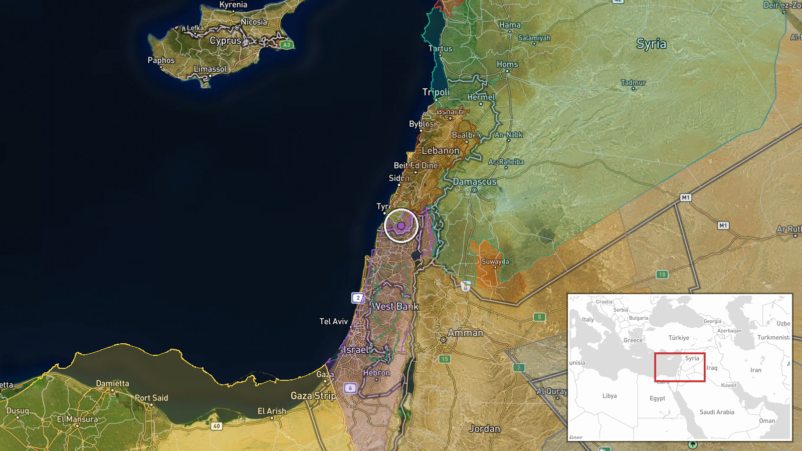
According to updated conflict control mapping, Israeli forces expanded their area of control by approximately 15 square kilometres in the Nabatîyé region of southern Lebanon on 26 September. The report indicates a shift in territorial control but does not specify the tactical nature of the expansion—whether through ground manoeuvre, consolidation of previously contested terrain, or other military operations. The timing and precise boundaries derive from conflict mapping sources.
Context and assessment
Nabatîyé, located in southern Lebanon roughly 15 km from the Israeli border, has been a focal point of Israeli military operations following escalations in 2024–2026. Control of this area is strategically significant as it lies within Lebanon's traditionally contested border zone and affects Israeli operational depth toward Hezbollah-affiliated positions further north. The expansion may reflect Israeli efforts to establish buffer zones or secure territory ahead of potential diplomatic arrangements. This development occurs amid concurrent Israeli security operations in Syria—including the arrest of a Syrian pilot and a reported patrol incursion near Damascus—suggesting a broader pattern of Israeli military assertiveness in the Levantine theatre.
Sources and confidence
The report originates from Wiki control map, a crowd-sourced conflict mapping platform. Single-source reporting limits independent corroboration; no secondary channels have yet confirmed the specific 15 km² figure or timing. The moderate confidence score reflects reliance on a single mapping source rather than military statements or multiple independent observers. Confirmation from satellite imagery, Israeli military announcements, or Lebanese sources would strengthen confidence.
Location
Nabatîyé is a town and district in South Governorate, Lebanon, situated approximately 15 kilometres north of the Israeli border in the Litani River valley. The region-level precision reflects that the expansion was mapped across the broader Nabatîyé area rather than a discrete facility or settlement. Nearby features include the Litani River to the north and Israeli-controlled territory to the south.
Related events nearby
- Pilot Khaldoun Husein Mubarak, known for threatening repeated civilian strikes after his aircraft was shot dow2026-09-26 14:11 UTC · Security · Damascus, Syria
- Israeli military patrol of 5 armored vehicles infiltrated the outskirts of Bayt Jan village west of Damascus, 2026-09-26 13:48 UTC · Security · Bayt Jan, Rif Dimashq Governorate, Syria
▶ View this event on the live map
Intel Mapper aggregates open-source reports from monitored Telegram and X channels, geolocates them, cross-checks duplicates across sources and assigns a confidence score. Entries are updated as new confirmations arrive. Read how we verify events.