Houthi forces expand control in Ta'izz Governorate by approximately 92 km²
What happened
Houthi (Ansar Allah) forces reportedly expanded territorial control in Ta'izz Governorate by approximately 92 square kilometers, according to updates to a conflict control map dated October 4, 2026. The expansion was documented through map analysis rather than direct combat reporting. The timing and scale suggest either new territorial gains or a cartographic correction reflecting earlier unconfirmed movements in this contested region.
Context and assessment
Ta'izz Governorate has remained one of Yemen's most volatile frontlines throughout the ongoing conflict between Houthi forces and the internationally recognized Yemen Government (PLC) and its allies. Control of Ta'izz is strategically significant due to its location and population density. The reported Houthi expansion occurs amid concurrent territorial shifts in neighboring Lahij Governorate, where PLC forces expanded control by roughly 405 square kilometers on October 3–4. These simultaneous movements across multiple governorates may reflect broader repositioning or localized tactical adjustments rather than a single coordinated offensive.
Sources and confidence
This report originates from a single source: Wiki control map, a crowd-sourced conflict mapping resource. The map-based documentation provides moderate reliability but lacks independent corroboration from military statements or field observers. Confidence (7.5/10) reflects the single-source limitation and reliance on cartographic data rather than direct reporting. Confirmation from independent conflict monitors or local sources would strengthen confidence significantly.
Location
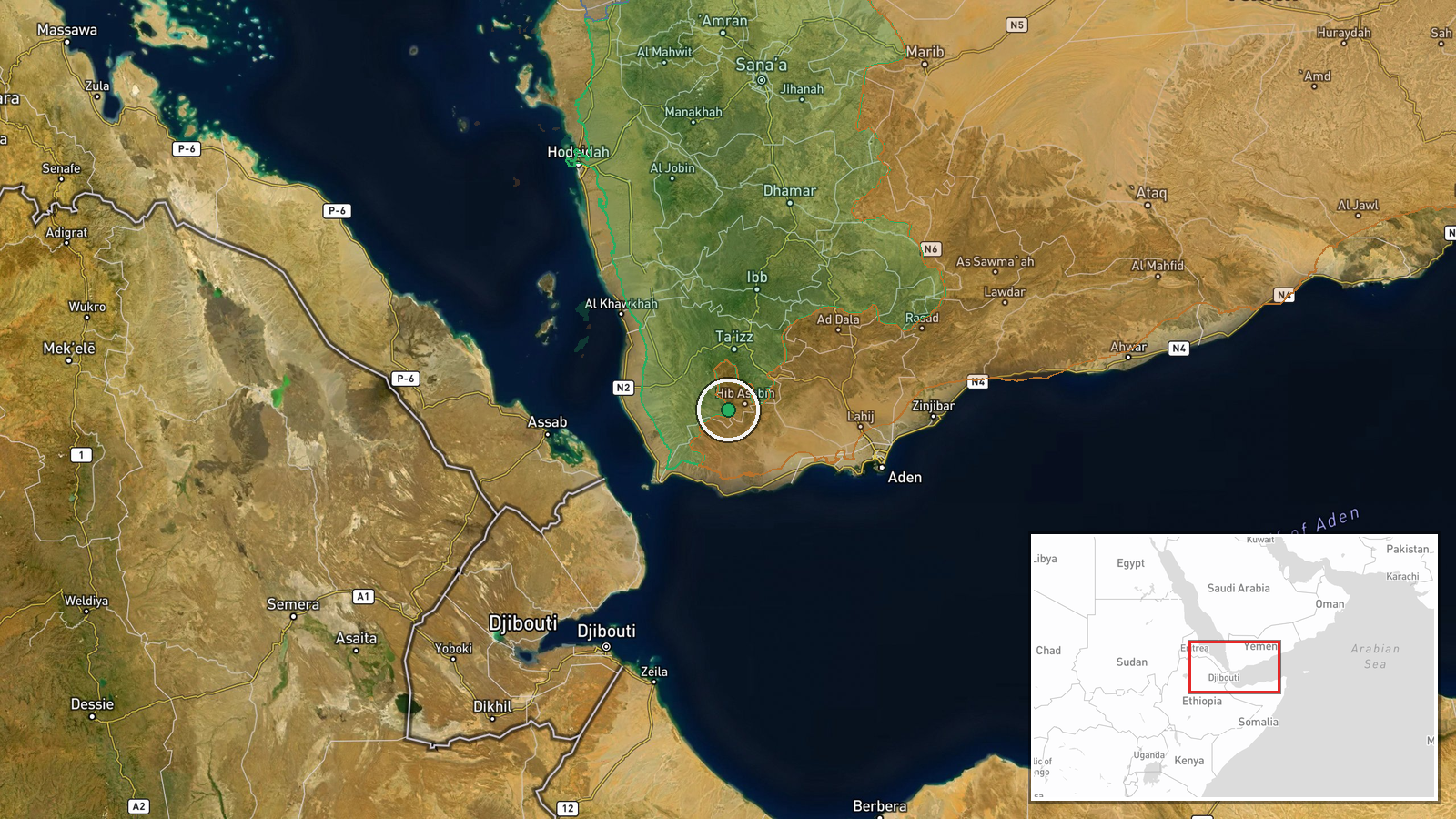
Ta'izz Governorate is located in southwestern Yemen at approximately 13.17°N, 43.98°E. The region encompasses diverse terrain from coastal plains to mountainous areas. The 92 km² expansion covers an unspecified portion of the governorate; the exact settlements or districts affected remain unidentified in available reporting. Ta'izz city itself lies nearby and has historically been a contested urban center.
Related events nearby
- Yemen Government (PLC) forces expanded control (~400 km²) in the Lahij Governorate area per updated conflict c2026-10-03 17:55 UTC · Combat · Lahij Governorate
- Yemen Government (PLC) forces expanded control (~5 km²) in the Lahij Governorate area per updated conflict con2026-10-04 05:55 UTC · Combat · Lahij Governorate
▶ View this event on the live map
Intel Mapper aggregates open-source reports from monitored Telegram and X channels, geolocates them, cross-checks duplicates across sources and assigns a confidence score. Entries are updated as new confirmations arrive. Read how we verify events.