Yemen Government forces gain territory in Lahij Governorate
What happened
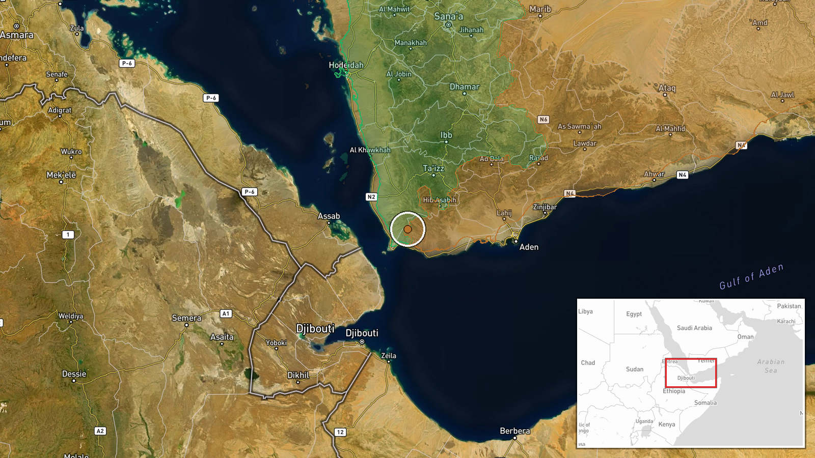
According to Wiki control map updates, Yemen Government (Presidential Leadership Council) forces expanded their territorial control by approximately 5 square kilometers in Lahij Governorate on October 4, 2026. This follows a larger reported advance of around 400 square kilometers in the same governorate the previous day. The gains represent incremental consolidation rather than a major operational shift in the southern governorate.
Context and assessment
Lahij Governorate in southern Yemen has been contested between government and Houthi forces throughout the conflict. Government control in this region, nominally under the Presidential Leadership Council, typically depends on various local militias and Saudi-led coalition support. The successive advances reported over two days may reflect either map corrections consolidating earlier gains or ongoing pressure in specific districts. However, control map updates can reflect administrative reassessments rather than active combat. Concurrent Houthi gains of 92 square kilometers reported in nearby Ta'izz Governorate suggest the broader southern front remains fluid, with multiple actors adjusting positions.
Sources and confidence
Single source: Wiki control map. One source limits confidence assessment; no cross-confirmation from other open-source conflict monitoring platforms or independent channels. Map-based updates sometimes reflect delayed recording of earlier changes rather than real-time events. Confidence raised by consistent reporting of sequential gains; would require corroboration from additional monitors or field reports to strengthen assessment.
Location
Lahij Governorate lies in southwestern Yemen, approximately 80 kilometers north of Aden. The governorate is characterized by mountainous terrain and includes several populated districts. The coordinate places the event in the central governorate region. Exact sub-locations of territorial changes are not specified by source precision.
Related events nearby
- Yemen Government (PLC) forces expanded control (~400 km²) in the Lahij Governorate area per updated conflict c2026-10-03 17:55 UTC · Combat · Lahij Governorate
- Houthi (Ansar Allah) forces expanded control (~92 km²) in the Ta'izz Governorate area per updated conflict con2026-10-04 05:55 UTC · Combat · Ta'izz Governorate
▶ View this event on the live map
Intel Mapper aggregates open-source reports from monitored Telegram and X channels, geolocates them, cross-checks duplicates across sources and assigns a confidence score. Entries are updated as new confirmations arrive. Read how we verify events.