Houthi forces expand territorial control in Ta'izz Governorate amid renewed fighting
What happened
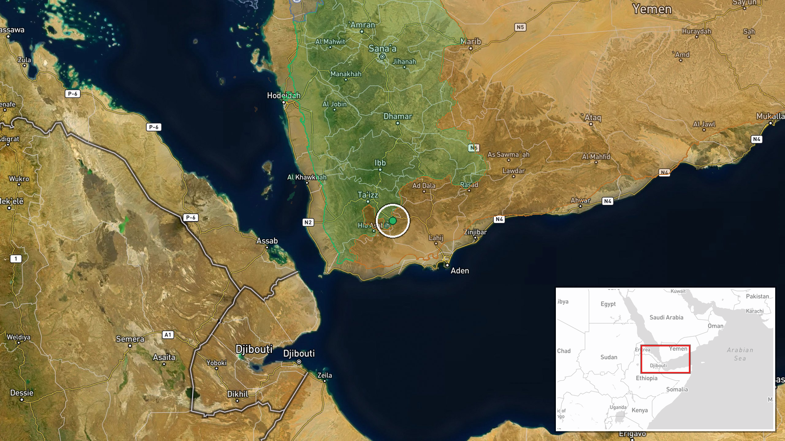
According to conflict control mapping updates, Houthi (Ansar Allah) forces reportedly expanded their territorial control by approximately four square kilometers in Ta'izz Governorate on October 4, 2026. The update was registered in the Wiki control map at 17:58 UTC. This localized expansion occurred alongside broader Houthi advances in the same governorate, where the group gained significantly larger territorial holdings on the same date, suggesting sustained offensive operations across the region.
Context and assessment
Ta'izz Governorate in southwestern Yemen remains a contested zone where Houthi forces and Saudi-backed Yemeni government units compete for territory. The reported four-square-kilometer expansion fits within a pattern of substantial Houthi gains across the governorate on October 4, including seizure of the residence of Yemen's Parliament Speaker in Al-Hawban and advances that reportedly cut supply routes between Taiz city and the port of Aden. These moves suggest coordinated Houthi offensive operations aimed at consolidating control over key infrastructure and population centers. The concurrent expansion by government-aligned forces indicates active fighting rather than uncontested territorial shifts.
Sources and confidence
Single source from Wiki control map conflict tracking database, updated at 17:58 UTC on October 4, 2026. Cross-referenced with related territorial updates from the same timestamp showing simultaneous gains by both Houthi and government forces in Ta'izz. Confidence score of 7.5 reflects reliance on single mapping source; independent verification from ground reports or military statements would strengthen confidence.
Location
Ta'izz Governorate in southwestern Yemen, a mountainous region south of the capital Sana'a and west of the coastal city of Aden. The four-square-kilometer expansion was mapped at regional precision (latitude 13.3417, longitude 44.3326) rather than a specific settlement, indicating the update reflects aggregate territorial shift across the broader governorate rather than a discrete location.
Related events nearby
- Yemen Government (PLC) forces expanded control (~9 km²) in the Ta'izz Governorate area per updated conflict co2026-10-04 17:58 UTC · Combat · Ta'izz Governorate
- Houthi (Ansar Allah) forces expanded control (~161 km²) in the Ta'izz Governorate area per updated conflict co2026-10-04 17:58 UTC · Combat · Ta'izz Governorate
- Houthi (Ansar Allah) forces expanded control (~92 km²) in the Ta'izz Governorate area per updated conflict con2026-10-04 05:55 UTC · Combat · Ta'izz Governorate
- Houthi forces seized the residence of Yemeni Parliament Speaker Sultan al-Barakani in Al-Hawban, south of Taiz2026-10-04 12:27 UTC · Combat · Al-Hawban, Ta'izz Governorate, Yemen
- Houthi forces advance near Taiz in southwestern Yemen and cut the route between Taiz city and Aden port. Saudi2026-10-04 16:40 UTC · Combat · Taiz, Yemen
▶ View this event on the live map
Intel Mapper aggregates open-source reports from monitored Telegram and X channels, geolocates them, cross-checks duplicates across sources and assigns a confidence score. Entries are updated as new confirmations arrive. Read how we verify events.