Iranian forces reportedly stop Saudi tanker Cedar in Strait of Hormuz
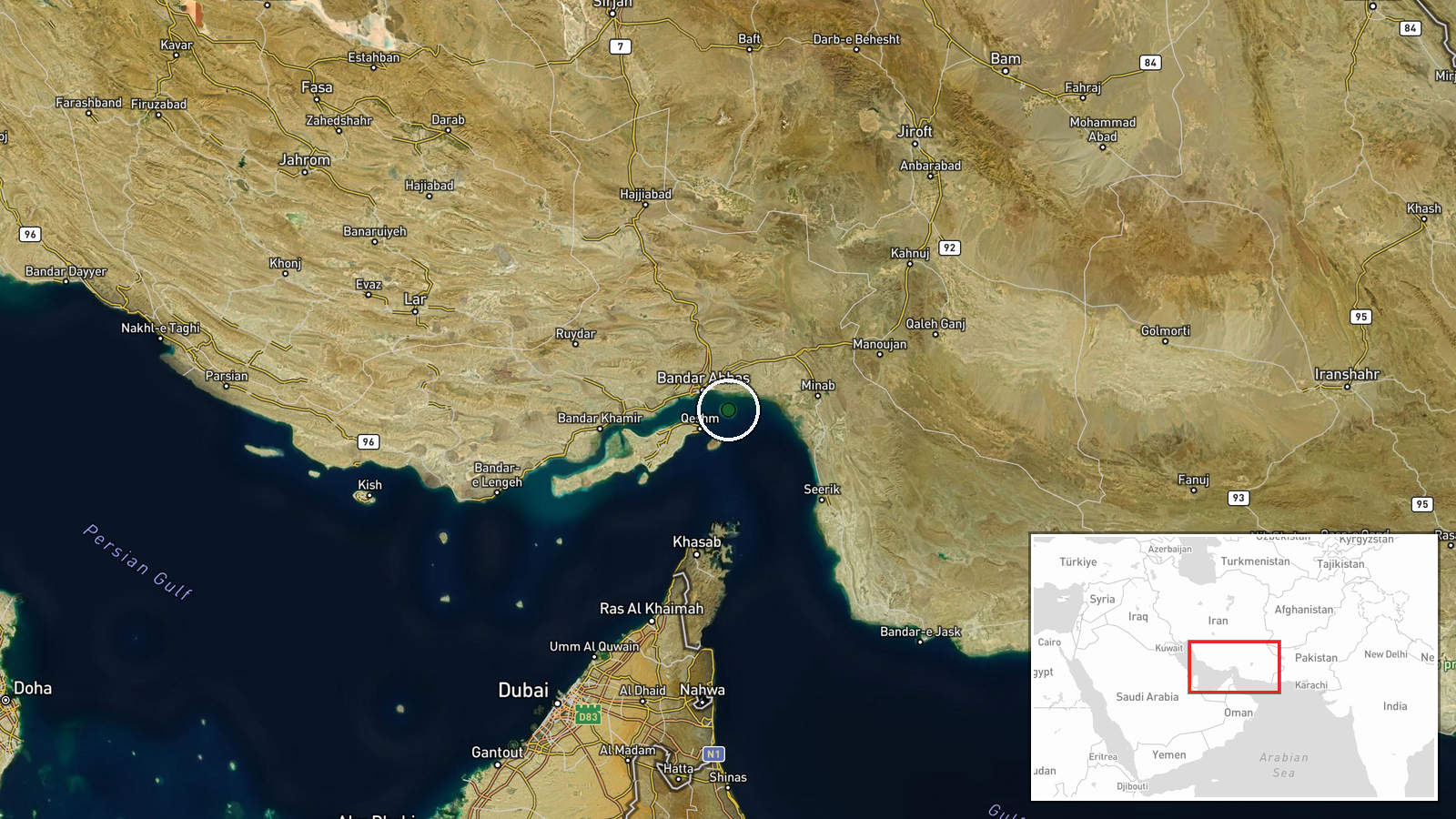
What happened
Iranian reports claim that the Saudi-flagged oil tanker Cedar, with a carrying capacity of 2 million barrels, was halted while transiting the southern corridor of the Strait of Hormuz on August 31. The vessel maintained an active automatic identification system during passage. The United Kingdom Maritime Trade Operations (UKMTO) received notification of a security incident involving an oil tanker approximately one hour before the Iranian claim, though UKMTO's report did not identify the vessel by name or nationality.
Context and assessment
The Strait of Hormuz remains one of the world's most critical chokepoints for energy trade, with roughly one-third of globally traded seaborne oil passing through its narrow waters. The reported seizure follows a pattern of escalating Iranian actions on August 31, including claimed shootdowns of U.S. reconnaissance drones, anti-aircraft fire at American F-35 fighters, and reported kamikaze drone attacks on commercial shipping in the same waters. The incident coincides with Trump administration statements about considering limited military strikes against Iranian air defense and anti-ship missile systems around the strait, suggesting a heightened operational tempo and potential Iranian countermeasures.
Sources and confidence
A single X account (@Osint613) reported the Iranian claim; UKMTO independently confirmed receipt of a security incident report for an oil tanker around the same timeframe, though without vessel identification. Cross-confirmation between the Iranian narrative and UKMTO's notice provides partial corroboration of an incident occurring, though the specific identity and outcome remain unconfirmed. Confidence is moderate (6.0/10) because independent maritime authorities acknowledged an incident but did not independently verify Iran's characterization of events.
Location
The southern corridor of the Strait of Hormuz, located at approximately 27.07°N, 56.46°E. This region lies between the Omani coast to the south and Iranian territorial waters to the north, representing the primary transit lane for international commercial shipping. The coordinates indicate a position within the main shipping channel of one of the world's most strategically sensitive maritime passages.
Related events nearby
- Iran fired anti-aircraft missiles at U.S. F-35 fighters in the Strait of Hormuz. No confirmation of hits or da2026-08-31 18:47 UTC · Air Defense · Strait of Hormuz, Persian Gulf
- Trump administration considering limited U.S. military strikes on Iranian radar, air defense systems, and anti2026-08-31 18:13 UTC · Statement · Strait of Hormuz, Persian Gulf
- Iran reportedly launches kamikaze drone attacks (UAS) against commercial shipping transiting the Strait of Hor2026-08-31 17:44 UTC · UAS Strike · Strait of Hormuz, Persian Gulf
- Iran's IRGC claims its Aerospace Force air defense system shot down a U.S. MQ-9 Reaper drone east of the Strai2026-08-31 16:42 UTC · Drone Shootdown · Strait of Hormuz, Persian Gulf
- Iran's Revolutionary Guards claimed to have shot down a U.S. MQ-9 Reaper drone valued at approximately $30 mil2026-08-31 05:29 UTC · Drone Shootdown · Strait of Hormuz, Iran-Oman Waters
▶ View this event on the live map
Intel Mapper aggregates open-source reports from monitored Telegram and X channels, geolocates them, cross-checks duplicates across sources and assigns a confidence score. Entries are updated as new confirmations arrive. Read how we verify events.