Israeli forces kill four in alleged infiltration attempt in southern Syria Golan Heights
What happened
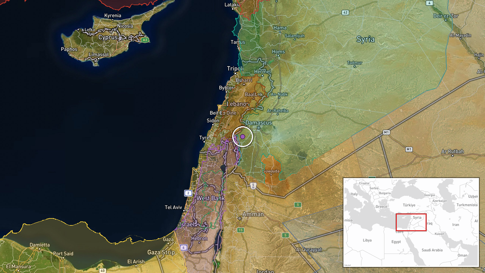
Israeli forces reportedly killed four individuals described as narco-terrorists during an attempted infiltration of a military position in the Kafr Hawar area of Quneitra Governorate in southern Syria's Golan Heights security zone on October 5. The incident was reported via X by an OSINT account citing U.S. Southern Command, though the original SOUTHCOM statement refers to a Caribbean counter-narcotics operation involving a go-fast vessel. The exact nature of the connection between the two operations remains unclear from available reporting.
Context and assessment
The incident occurred in Syrian territory under Israeli military control following the 1973 war. The Golan Heights remains a heavily militarized zone with Israeli forces maintaining a security perimeter. This event follows a pattern of increased Israeli operational activity in southern Quneitra in early October, including illumination operations near Al-Hamidiyah and infrastructure work on Sofa 53 Road. The characterization of the casualties as narco-terrorists may reflect tensions surrounding drug trafficking networks operating across the Syria-Lebanon-Palestinian territories corridor. The incident's timing coincides with Syrian Interior Security Forces arresting senior figures including Mihaç Ural and Cemal Trablusi, suggesting possible regional security coordination or parallel enforcement operations.
Sources and confidence
Single source: X account @Osint613 citing U.S. Southern Command. The original SOUTHCOM statement describes a Caribbean maritime counter-narcotics strike, creating discrepancy with the reported Syria location. No independent confirmation from Israeli military, Syrian authorities, or regional media located. Confidence score of 6.0 reflects source limitations and geographic/operational inconsistency. Confirmation by Israeli IDF or Syrian government sources would substantially raise confidence; clarification of SOUTHCOM's actual operational theater is essential.
Location
Kafr Hawar village, Quneitra Governorate, southern Syria. Located in Israeli-controlled Golan Heights territory east of the 1973 armistice line. The area forms part of Israel's declared security zone with military installations and fortified positions. Nearby reference points include Al-Hamidiyah village to the northwest and Sofa 53 Road infrastructure project to the south, both sites of recent Israeli military activity.
Related events nearby
- Israeli forces dropped illumination rounds over agricultural land near Al-Hamidiyah village, sparking fires. I2026-10-04 21:58 UTC · Security · Al-Hamidiyah, Quneitra, Syria
- Israeli occupation forces resumed work on Sofa 53 road in southern Quneitra countryside, deploying vehicles to2026-10-04 06:41 UTC · Security · Sofa 53 Road, southern Quneitra Governorate, Syria
- Syrian Interior Security Forces shared photo evidence of arrested individuals Mihaç Ural and Cemal Trablusi to2026-10-04 21:56 UTC · Security · Damascus, Syria
- Turkish Ambassador Dr. Nuh Yılmaz comments on the arrest of Jamal Trablusi, deputy to Mihaç Ural, by Syrian In2026-10-04 17:10 UTC · Security · Damascus, Syria
- Syrian Interior Ministry lays foundation stone for rehabilitation and training management complex in Damascus 2026-10-04 14:40 UTC · Humanitarian Aid · Damascus, Syria
▶ View this event on the live map
Intel Mapper aggregates open-source reports from monitored Telegram and X channels, geolocates them, cross-checks duplicates across sources and assigns a confidence score. Entries are updated as new confirmations arrive. Read how we verify events.