Iranian Rezvan drone targets merchant shipping in Strait of Hormuz Oman corridor
What happened
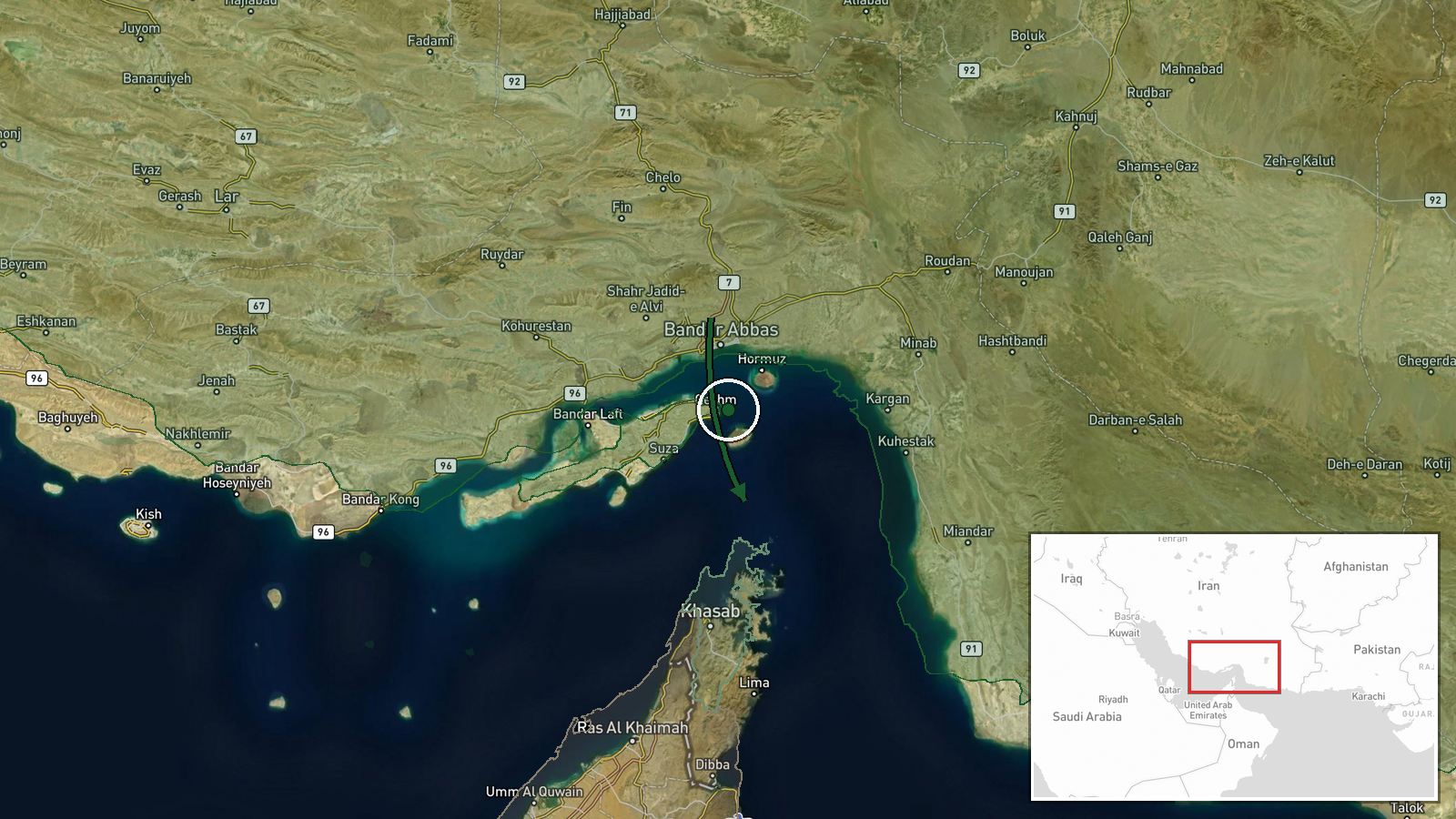
An Iranian Rezvan one-way attack drone was reportedly launched overnight toward commercial vessels transiting the Omani corridor of the Strait of Hormuz, according to OSINT source X (@Osint613). The Rezvan is an Iranian loitering munition designed for anti-ship operations. The report does not specify whether the drone struck any target or caused damage. The timing follows escalating maritime incidents in the waterway over recent days.
Context and assessment
The Strait of Hormuz is a critical chokepoint for global energy supplies, with roughly 20 percent of world oil transit passing through it. Iranian naval and drone operations in the waterway have intensified sharply since late September, with Iran's Islamic Revolutionary Guard Corps reportedly conducting at least 12 attacks on tankers between September 29 and October 5. These actions parallel broader regional tensions and follow an October 6 attack on a Panama-flagged tanker that wounded 12 crew members. Greece's declaration on October 7 of readiness to support US naval operations in the region suggests rising diplomatic concern about freedom of navigation.
Sources and confidence
Single source: X account @Osint613. No independent confirmation reported. Confidence score of 6.0 reflects sole-source reporting and lack of corroboration from maritime tracking, shipping operators, or regional authorities. Confirmation from vessel tracking systems, shipping associations, or US Navy statements would raise confidence. Retraction or contradiction by the source would lower it.
Location
Strait of Hormuz, Omani corridor. Geographic precision rated low; report identifies region rather than specific coordinates. The Strait lies between Iran and Oman at approximately 26.5°N, 56.4°E. The Omani corridor refers to waters closer to Oman's coast, offering passage for vessels avoiding Iranian territorial waters.
Related events nearby
- Greek Foreign Minister declares readiness to provide naval support in the Strait of Hormuz region in cooperati2026-10-07 11:01 UTC · Statement · Strait of Hormuz, Persian Gulf
- Panama-flagged oil tanker attacked in Strait of Hormuz; 12 crew injured by unidentified projectile. Oman evacu2026-10-06 18:27 UTC · Naval · Strait of Hormuz
- Iran's IRGC conducted 12 tanker attacks in the Strait of Hormuz between September 29 and October 5, striking v2026-10-06 16:51 UTC · Naval · Strait of Hormuz
▶ View this event on the live map
Intel Mapper aggregates open-source reports from monitored Telegram and X channels, geolocates them, cross-checks duplicates across sources and assigns a confidence score. Entries are updated as new confirmations arrive. Read how we verify events.