One killed, 19 wounded by unexploded ordnance on Ramim Ridge near Lebanese border
What happened
One person was killed and 19 wounded, including schoolchildren and teachers, when unexploded ordnance detonated near the Pe'er observation point on Ramim Ridge in northern Israel on October 12. The casualties were reportedly on a hiking excursion when the blast occurred. The IDF deployed Yahalom combat engineers to scan the area for additional ordnance, while police sappers attended the scene and three Air Force helicopters were mobilized to evacuate two people in serious condition and three in moderate condition.
Context and assessment
Ramim Ridge, located near the Lebanese border in Israel's northernmost region, sits within an area of intense military activity. The incident occurs as IDF operations intensify across the border region, with documented air defense engagements, tunnel discoveries, and cross-border incursions in southern Lebanon and Syrian territory in recent days. The presence of unexploded ordnance suggests ordnance from prior exchanges has contaminated civilian-accessible terrain. The rapid deployment of specialized engineers and air evacuation indicates Israeli concern about both immediate hazard and potential further civilian exposure in a zone where military and civilian spaces intersect closely.
Sources and confidence
Reported by X account @Osint613 as sole source, limiting independent confirmation. The account provided detailed casualty numbers, unit designations (Yahalom engineers), and response specifics. Confidence score of 6.5 reflects single-source reporting and lack of cross-confirmation from Israeli official channels or independent verification, though the specificity of tactical and medical details provides some reliability indicator. Official Israeli statement or hospital confirmation would substantially raise confidence.
Location
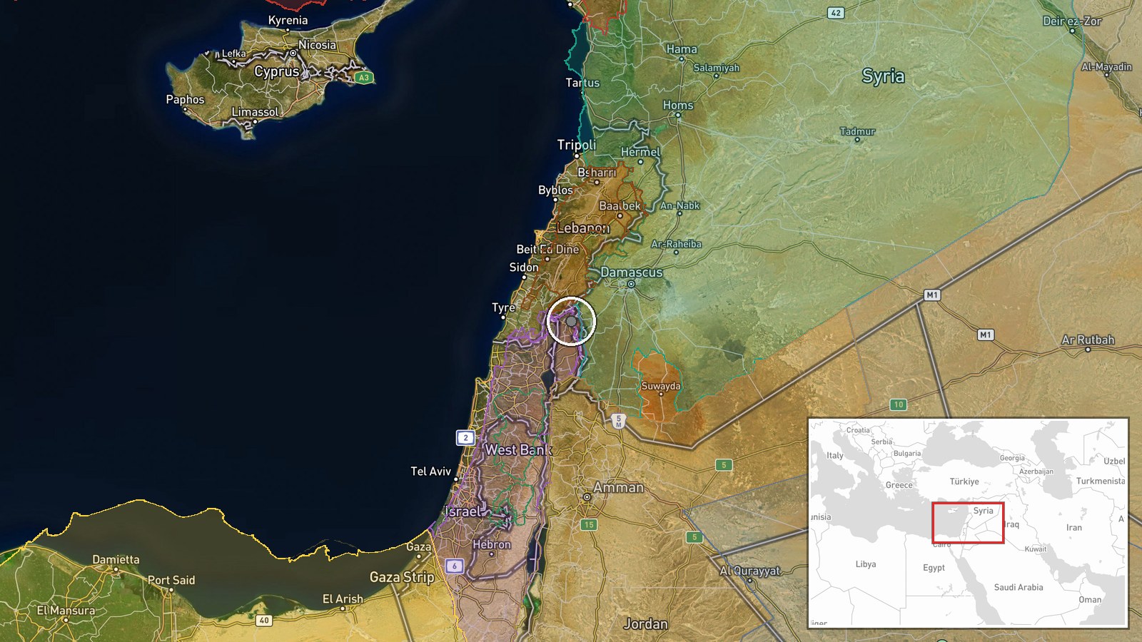
Ramim Ridge lies in Israel's far north near the Lebanese border, approximately 33.2°N, 35.8°E. The Pe'er observation point is a known vantage location on the ridge overlooking cross-border terrain. The area is characterized by rocky, elevated terrain typical of the northern Galilee region, offering views across the Israel-Lebanon border zone and adjacent Syrian territory.
Related events nearby
- IDF air defense system launched interceptor at unidentified aerial target over southern Lebanon in area of Isr2026-10-12 07:23 UTC · Air Defense · Near Kfar Shouba, Nabatieh, near Israeli operation
- Israeli forces conducting multiple military operations and violations in Quneitra and Daraa rural areas (Octob2026-10-11 19:54 UTC · Combat · Quneitra Governorate, Syria
- Air raid sirens activated in Arab al Aramsha near Lebanese border after Israeli lookouts spotted unidentified 2026-10-11 17:11 UTC · Siren · Arab al Aramsha, Quneitra Governorate, Syria
- IDF located and dismantled extensive Hezbollah underground tunnel network in southern Lebanon containing weapo2026-10-12 13:02 UTC · Security · Southern Lebanon
- Hezbollah MP Ibrahim al-Moussawi addresses seized explosives truck in Beqaa Valley, claims if it belongs to mi2026-10-12 11:32 UTC · Statement · Beqaa Valley, Lebanon
▶ View this event on the live map

Intel Mapper aggregates open-source reports from monitored Telegram and X channels, geolocates them, cross-checks duplicates across sources and assigns a confidence score. Entries are updated as new confirmations arrive. Read how we verify events.