Israeli airstrikes hit southern Lebanon settlements of Kafr Tibnit and Wadi al-Hujair
What happened
Israeli aircraft struck two locations in southern Lebanon on the morning of October 13, 2026. The strikes targeted Kafr Tibnit and Wadi al-Hujair, both in the Nabatîyé District of Lebanon's South Governorate. Al Hadath, a Lebanese news outlet, reported the incidents. The report does not specify the extent of damage or any casualties. No statement from Israeli forces regarding the strikes has been provided in available sources.
Context and assessment
Southern Lebanon remains a focal point of Israeli military operations given the region's proximity to the Israeli border and historical presence of armed groups. The strikes occur amid wider regional tensions, including recent Israeli airstrikes in Syria near Damascus on October 12 and a fatal incident in northern Israel involving ordnance from cross-border fire. This pattern suggests sustained Israeli military activity across multiple fronts in the Levant. Kafr Tibnit lies approximately 8 kilometers from the Israeli border, placing it within typical operational range for air-to-ground strikes. The timing and targets may reflect broader security assessments rather than response to a specific immediate incident.
Sources and confidence
Reported by X account @Osint613, citing Al Hadath media. Single-source reporting limits independent verification; no cross-confirmation from Israeli military statements or additional Lebanese media sources is currently available. Confidence score of 6.6 reflects accurate location data and credible channel, but absence of corroboration. Confirmation from additional Lebanese outlets or Israeli official statements would strengthen confidence significantly.
Location
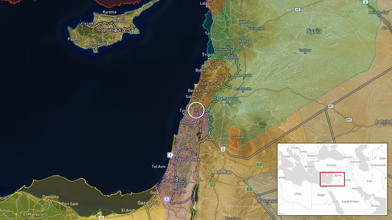
Kafr Tibnit is a settlement in the Nabatîyé District of Lebanon's South Governorate, located at approximately 33.35°N, 35.51°E. The settlement sits in southern Lebanon's populated belt, roughly 8 kilometers north of the Israeli border. Wadi al-Hujair is a nearby valley area in the same region. The terrain is predominantly hilly with mixed agricultural and residential areas.
Related events nearby
- A 14-year-old student was killed and 24 wounded when an unexploded BRB1 submunition from a Hezbollah Grad rock2026-10-12 15:25 UTC · Explosion · Mitzpe Pe'er Lookout, Ramim Ridge, Upper Galilee,
- Israeli occupation forces infiltrated Krom Mazra'a farmland west of Damascus and opened fire on farmers. Local2026-10-13 06:22 UTC · Security · Beit Jan, Rif Dimashq, Syria
- Israeli Air Force conducted airstrike and detonated an abandoned military barracks at Tel Harbon near Beit Jan2026-10-12 14:50 UTC · Airstrike · Tel Harbon, Beit Jan, Rif Dimashq, Syria
- Syrian Government delegation from the People's Council visited Quneitra Governorate to assess local conditions2026-10-13 09:30 UTC · Statement · Quneitra, Quneitra Governorate, Syria
- IDF statement clarifies unidentified object detected in northern Israel was likely a harmless balloon or hot-a2026-10-13 06:41 UTC · Statement · Arab al-Aramshe, Western Galilee, Israel
▶ View this event on the live map

Intel Mapper aggregates open-source reports from monitored Telegram and X channels, geolocates them, cross-checks duplicates across sources and assigns a confidence score. Entries are updated as new confirmations arrive. Read how we verify events.