Oil tanker El Gaia struck again near Strait of Hormuz after month-old Iranian missile hit
What happened
The Panama-flagged tanker El Gaia was reportedly hit by an Iranian drone this weekend near the Strait of Hormuz, according to CENTCOM, with Oman and India confirming the attack and resulting fire. The incident follows a missile strike on the same vessel last month. The tanker is being towed to an Omani port. One Indian crew member remains missing. Iran claims the vessel struck naval mines in a restricted zone, but CENTCOM attributes the damage to Iranian attack. The tanker's automatic identification system (AIS) had been offline for days preceding the incident.
Context and assessment
The Strait of Hormuz, a critical chokepoint for global oil transit, has seen escalating maritime incidents over recent weeks. This repeated targeting of El Gaia—struck by missile in August then drone in mid-September—suggests a pattern of deliberate Iranian operations against commercial shipping in contested waters. The incident aligns with concurrent Iranian military activity: the IRGC claimed destruction of a fourth U.S. MQ-1 Predator drone on the same day east of the strait, and a separate warning to a Chinese-flagged vessel preceded engagement of nearby tanker traffic. The targeting of commercial vessels, combined with air defense claims and naval warnings, may indicate Iranian efforts to assert control over regional waters or respond to perceived security threats.
Sources and confidence
Reported via Telegram (@ClashReport). CENTCOM, Oman, and India provided cross-confirmation of the attack and fire damage. Single-source reporting limits confidence; no independent maritime or satellite confirmation noted. Confidence of 7/10 reflects official multi-national confirmation but lack of direct independent verification of strike mechanics or responsibility attribution.
Location
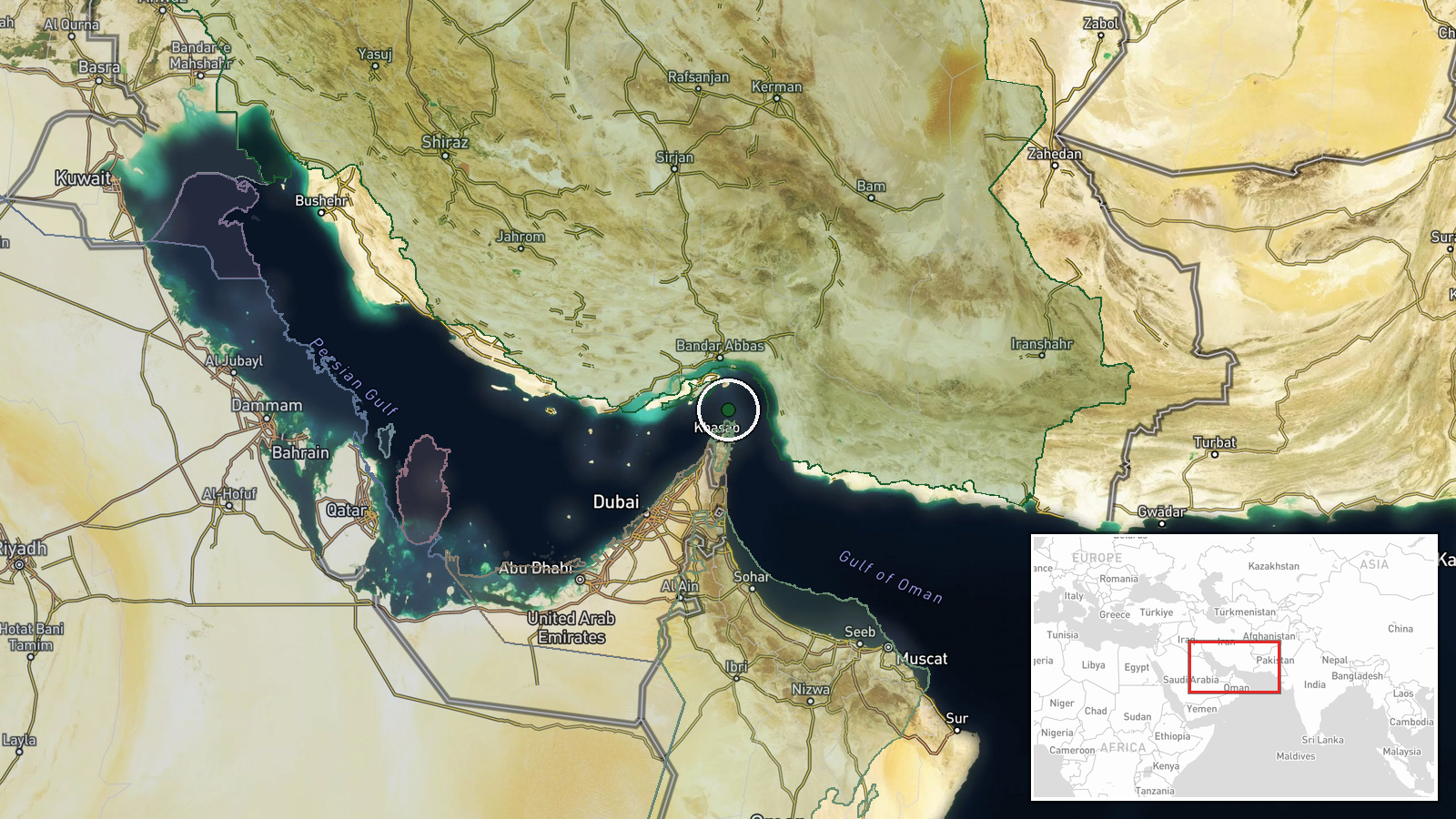
Approximate location in the Strait of Hormuz region, Persian Gulf, near Omani territorial waters off the Oman coast. Coordinates place the incident in a major shipping lane transiting between the Arabian Sea and Persian Gulf. The strait is approximately 53 nautical miles wide at its narrowest point and represents one of the world's most strategically significant maritime passages.
Related events nearby
- Turkish Foreign Minister Hakan Fidan stated that Iran's security directly affects the region and called for sa2026-09-15 10:57 UTC · Statement · Strait of Hormuz, Persian Gulf
- Iran's IRGC claims interception and destruction of a fourth U.S. MQ-1 Predator drone in four days east of the 2026-09-15 07:11 UTC · Drone Shootdown · East of Strait of Hormuz, Persian Gulf
- U.S. naval forces issued warning to Chinese-flagged vessel in Strait of Hormuz before engaging nearby oil tank2026-09-15 05:37 UTC · Naval · Strait of Hormuz, Persian Gulf
- Iran's IRGC conducted drone strike on Panama-flagged tanker El Gaia in Persian Gulf waters off Oman coast. Ves2026-09-14 19:03 UTC · Cargo Ship · Strait of Hormuz, Persian Gulf
▶ View this event on the live map
Intel Mapper aggregates open-source reports from monitored Telegram and X channels, geolocates them, cross-checks duplicates across sources and assigns a confidence score. Entries are updated as new confirmations arrive. Read how we verify events.