Ukraine reports one Russian airstrike, two glide bombs and 37 shellings on Sumy-area front
What happened
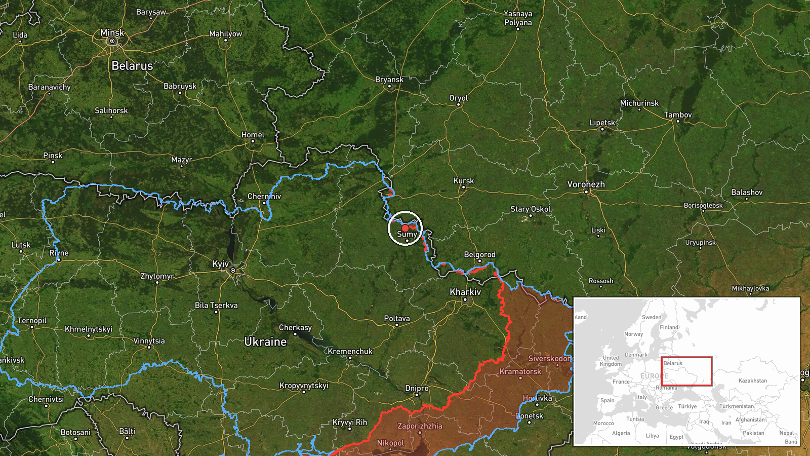
Ukraine's General Staff reported on its Telegram channel that Russian forces operating on the Northern Slobozhanshchyna and Kursk directions carried out one airstrike, used two guided aerial bombs and conducted 37 shelling attacks against Ukrainian positions and settlements since the start of the day. One of the shellings reportedly involved multiple launch rocket system fire. The post is timestamped 21 October 2026 at 19:02 UTC. Its original Ukrainian wording describes the activity as a cumulative daily tally rather than a list of incidents, and it does not name individual settlements or describe damage, casualties or specific targets. The map point is therefore an estimate placed near the front line close to Kindrativka in Sumy Oblast.
Context and assessment
The location sits in northeastern Ukraine, a border region where Sumy Oblast meets the Russian regions of Kursk and Belgorod. Front-line sectors here have seen repeated artillery, aerial bomb and drone activity over the past several years, and the Sumy axis has been a recurring focus of Russian fire since 2024. The related events on the same day fit that pattern. Early in the morning, a Banderol mini cruise missile was reported flying from Sumy Oblast toward Krolevets, and a separate artillery entry logged shelling of roughly 20 settlements across Sumy Oblast along with an airstrike on Pustohorod. Shahed-type drones were then reported over or heading toward Sumy at several points through the day. Taken together, the sequence suggests a sustained effort combining long-range drones, tactical missiles and mass artillery rather than a single isolated strike. Guided aerial bombs are typically used against fortified positions and in support of ground advances, so their use here may point to pressure on defended lines. The volume of shelling is consistent with area suppression and harassment fire, though the source does not confirm intent or the outcome of any individual attack.
Sources and confidence
The only reporting channel is the Telegram account of Ukraine's General Staff, which is an official military source and therefore carries some institutional weight, but it is a single, interested party. No independent outlet, regional administration or verified imagery in the dataset confirms this specific tally. The related air-monitoring and shelling entries come from the same broad information environment and do not independently verify this report. The score of 8.0 reflects an official origin and a specific, time-stamped claim, offset by the absence of cross-confirmation and the aggregate nature of the figures. Confidence would rise with corroboration from regional officials, geolocated footage or independent monitoring. It would fall if the figures were revised or contradicted by other sources.
Location
The point is an estimate placed near Kindrativka in Sumy Oblast, with region-level precision and low location confidence, because the original text names no settlement. The surrounding terrain is largely flat agricultural land typical of northeastern Ukraine, with scattered villages, tree lines and river valleys. The coordinates should be read as the general front-line area rather than a specific target.
Related events nearby
- Ukrainian air monitoring: 1 Russian Shahed-type drone over Sumy Oblast; 1 Russian Shahed-type drone heading to2026-10-21 18:38 UTC · Drone Transit · Sumy Oblast, Ukraine
- Ukrainian air monitoring: 1 Russian Shahed-type drone heading toward Sumy.2026-10-21 09:37 UTC · Drone Transit · Sumy, Ukraine
- Russian shelling hit about 20 settlements in Sumy Oblast, and an airstrike hit Pustohorod; Chernihiv Oblast's 2026-10-21 05:03 UTC · Artillery · Bezsalivka, Sumy Oblast, Ukraine
- Ukrainian air monitoring: 1 Russian Shahed-type drone passing northern Sumy Oblast, heading west.2026-10-21 16:39 UTC · Drone Transit · northern Sumy Oblast, Ukraine
- Ukrainian air monitoring: 1 Russian Banderol mini cruise missile from Sumy Oblast toward Krolevets.2026-10-21 04:53 UTC · Cruise Missile · Krolevets, Ukraine
▶ View this event on the live map

Intel Mapper aggregates open-source reports from monitored Telegram and X channels, geolocates them, cross-checks duplicates across sources and assigns a confidence score. Entries are updated as new confirmations arrive. Read how we verify events.