Ukrainian air monitoring reports one Russian Shahed-type drone transiting northern Sumy Oblast westward
What happened
Ukraine's Air Force monitoring channel on Telegram, @kpszsu, reported on 21 October 2026 at 16:39 UTC that one Russian Shahed-type drone was passing through northern Sumy Oblast on a western heading. The original Ukrainian post refers to strike unmanned aerial vehicles on a western course, without naming a settlement, target, or impact. The report describes a transit rather than a strike, and it gives no detection time beyond the posting time. The post does not state the drone's launch point or its final destination. The event was logged as a single-source air monitoring update.
Context and assessment
Sumy Oblast sits on Ukraine's northeastern border with Russia and has been a recurring focus of cross-border fire throughout this period. Earlier on the same day, the monitoring feed recorded a Banderol mini cruise missile moving from Sumy Oblast toward Krolevets at 04:53 UTC, and a Shahed-type drone heading toward Sumy city at 09:37. Within a minute of that, another Shahed-type drone was logged passing northern Kharkiv Oblast on a southwestern heading. Ground activity was active the same day: shelling reportedly hit about twenty settlements in Sumy Oblast and an airstrike struck Pustohorod, while Chernihiv Oblast's Mykhalchyna-Sloboda was also shelled. The previous evening, Russian forces reportedly used five KAB glide bombs and dozens of shellings near Kindrativka on the front line. Taken together, the drone and missile movements suggest sustained aerial activity across several border oblasts. A single westbound transit cannot by itself establish intent, but it may indicate route testing, reconnaissance, or support for strikes elsewhere in the region.
Sources and confidence
The event rests on one Telegram channel, @kpszsu, and the dataset contains no independent cross-confirmation from another outlet, official statement, or imagery. The confidence score of 8.0 reflects the channel's role as a routine official air monitoring feed, which is typically timely, but it is held below the top of the scale because the report is single-source and unverified by other means. Confidence would rise with corroboration from local officials, radar-based reporting, or debris or sirens confirmed in Sumy communities. It would fall if later updates revised the drone count, corrected the direction, or identified it as a different aerial object.
Location
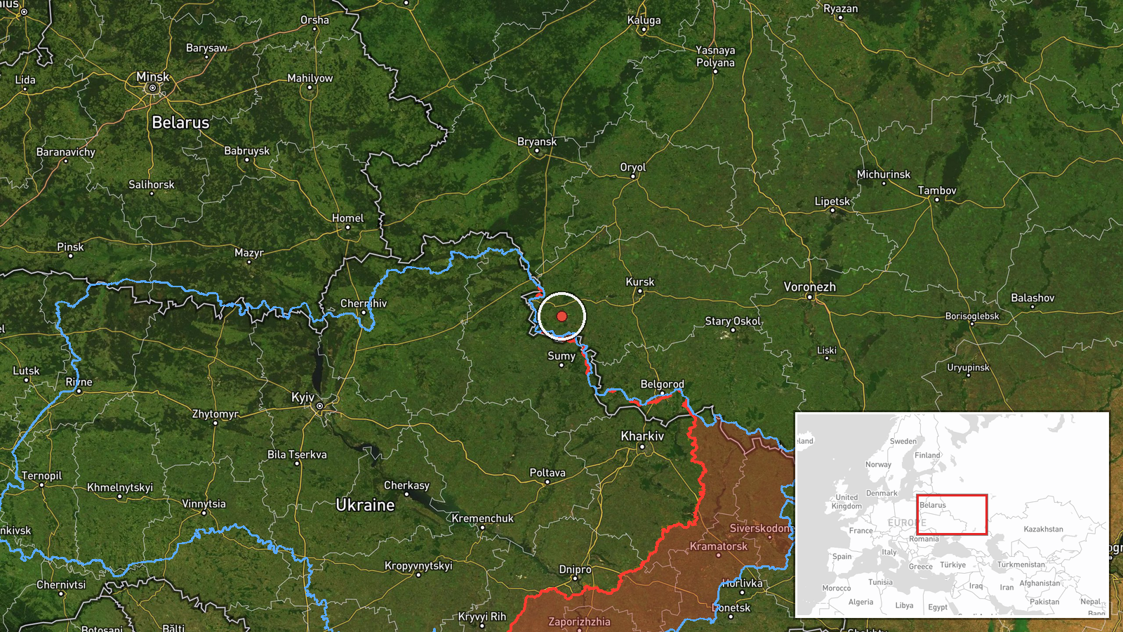
The location is recorded at region level, with approximate coordinates near 51.455 N, 34.800 E placed in northern Sumy Oblast. No settlement, facility, or flight-path waypoint was named, so the point should be read as a general area rather than a specific site. The northern part of Sumy Oblast borders the Russian Federation and lies close to Chernihiv Oblast, a geography that makes it a frequent transit zone for aerial movements. Because the pin is approximate, the coordinates should not be used to infer a precise track or target.
Related events nearby
- Russian shelling hit about 20 settlements in Sumy Oblast, and an airstrike hit Pustohorod; Chernihiv Oblast's 2026-10-21 05:03 UTC · Artillery · Bezsalivka, Sumy Oblast, Ukraine
- Russian forces conducted two airstrikes, five KAB glide bombs and 38 shellings against Ukrainian positions and2026-10-20 19:02 UTC · Airstrike · Near Kindrativka, Sumy, Ukraine (front line, estim
- Ukrainian air monitoring: 1 Russian Shahed-type drone heading toward Sumy.2026-10-21 09:37 UTC · Drone Transit · Sumy, Ukraine
- Ukrainian air monitoring: 1 Russian Banderol mini cruise missile from Sumy Oblast toward Krolevets.2026-10-21 04:53 UTC · Cruise Missile · Krolevets, Ukraine
- Ukrainian air monitoring: 1 Russian Shahed-type drone passing northern Kharkiv Oblast, heading southwest.2026-10-21 09:38 UTC · Drone Transit · northern Kharkiv Oblast, Ukraine
▶ View this event on the live map

Intel Mapper aggregates open-source reports from monitored Telegram and X channels, geolocates them, cross-checks duplicates across sources and assigns a confidence score. Entries are updated as new confirmations arrive. Read how we verify events.