Russian Geran-3 drone tracked northbound at Odesa-Mykolaiv border
What happened
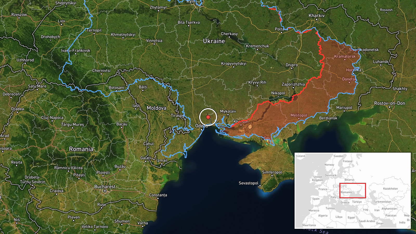
Ukrainian air monitoring detected one Russian jet-powered Shahed (Geran-3) drone travelling northbound at the border between Odesa and Mykolaiv oblasts on 13 October at 14:33 UTC. The drone was part of an active Russian air operation affecting southern Ukraine, following earlier detections of similar systems over Odesa Oblast and multiple drones heading toward Mykolaiv Oblast within the preceding hour. The report was issued by the Ukrainian air defence command via Telegram.
Context and assessment
The Geran-3 is Russia's jet-powered derivative of the Shahed loitering munition, capable of reaching inland targets at extended range. This northbound trajectory from the Black Sea region indicates a likely penetration of Ukrainian airspace toward rear-area objectives in Mykolaiv Oblast. The detection sequence—one drone over Odesa at 13:28, two drones toward Mykolaiv at 14:28, and this border-crossing report at 14:33—suggests a coordinated multi-drone sortie typical of Russian strike campaigns against southern Ukrainian cities and military infrastructure. Such operations have intensified throughout October 2026 despite air defence efforts.
Sources and confidence
Single source: Ukrainian air defence command (@kpszsu) via Telegram. No independent cross-confirmation reported. Confidence score of 8.0 reflects the reliability of the official source channel but the inherent limitations of single-source reporting and regional-level geolocation precision. Corroboration from Ukrainian or Western air tracking or subsequent damage reports would raise confidence.
Location
Border zone between Odesa and Mykolaiv oblasts, southern Ukraine, determined by regional designation rather than precise facility or settlement. The area lies inland from the Black Sea coast, approximately 50–80 kilometres from Odesa city, representing a transitional zone in the northbound drone approach corridor toward Mykolaiv's populated and industrial areas.
Related events nearby
- Ukrainian air monitoring: 1 Russian jet-powered Shahed (Geran-3) drone over Odesa.2026-10-13 15:27 UTC · Drone Transit · Odesa, Ukraine
- Ukrainian air monitoring: 1 Russian jet-powered Shahed (Geran-3) drone over Odesa Oblast.2026-10-13 13:28 UTC · Drone Transit · Odesa Oblast, Ukraine
- Ukrainian air monitoring: 2+ Russian jet-powered Shahed (Geran-3) drones from Black Sea toward Mykolaiv Oblast2026-10-13 14:28 UTC · Drone Transit · Mykolaiv Oblast, Ukraine
- Ukrainian air monitoring: 1 Russian jet-powered Shahed (Geran-3) drone heading toward Mykolaiv.2026-10-13 13:28 UTC · Drone Transit · Mykolaiv, Ukraine
- Ukrainian drone forces destroyed a large group of Russian Spetsnaz special forces attempting to cross the Dnip2026-10-13 09:15 UTC · UAS Strike · Kherson, Kherson Oblast, Ukraine
▶ View this event on the live map

Intel Mapper aggregates open-source reports from monitored Telegram and X channels, geolocates them, cross-checks duplicates across sources and assigns a confidence score. Entries are updated as new confirmations arrive. Read how we verify events.